Area Overview for RM8 2AG
Photos of RM8 2AG


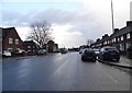


28 photos from this area
Area Information
Key information about the RM8 2AG including its size, population, and administrative classification.
- Area Type
- Postcode
- Area Size
- 7193 m²
- Population
- 1719
- Population Density
- 9891 people/km²
House Prices in RM8 2AG
27
Properties
£203,500
Average Sold Price
£45,000
Lowest Price
£390,000
Highest Price
Showing 27 properties
| Address | Type | Beds | Baths | Last Sale Price | Last Sale Date | |
|---|---|---|---|---|---|---|
| 36 Porters Avenue, Dagenham, RM8 2AG | house | - | - | £390,000 | Dec 2022 | |
| 50 Porters Avenue, Dagenham, RM8 2AG | house | - | - | £390,000 | Feb 2022 | |
| 38 Porters Avenue, Dagenham, RM8 2AG | Terraced | 3 | 1 | £315,000 | Aug 2019 | |
| 46 Porters Avenue, Dagenham, RM8 2AG | Terraced | 2 | - | £198,000 | Apr 2014 | |
| 28 Porters Avenue, Dagenham, RM8 2AG | Terraced | 2 | 1 | £148,000 | Nov 2011 | |
| 74 Porters Avenue, Dagenham, RM8 2AG | house | 2 | - | £165,000 | Jul 2010 | |
| 40 Porters Avenue, Dagenham, RM8 2AG | house | - | - | £173,000 | Feb 2010 | |
| 22 Porters Avenue, Dagenham, RM8 2AG | house | - | - | £241,000 | Mar 2008 | |
| 68 Porters Avenue, Dagenham, RM8 2AG | Terraced | 3 | 1 | £170,000 | Nov 2004 | |
| 58 Porters Avenue, Dagenham, RM8 2AG | Terraced | - | - | £147,000 | Dec 2003 |
Page 1 of 3
Energy Efficiency in RM8 2AG
Amenities
Schools
| Rank | School | Type | Entry gender | Ages |
|---|
Explore more schools in this area
Go to Schools tabDemographics
Household Size
Family (3-5 people)
most common
Accommodation Type
Houses
most common
Tenure
38
majority
Ethnic Group
White
most common
Religion
N/A
most common
Household Composition
N/A
most common
Age
47
median
Adults (30-64 years)
most common
Household Deprivation
N/A
with no deprivation
NS-SEC
19
in Lower managerial occupations
Explore more demographic insights in this area
Go to Demographics tabPlanning
Planning Constraints
- Flood RiskPremium
- Ramsar Wetland SitesPremium
- Area of Outstanding Natural BeautyPremium
- Protected Nature ReservePremium
- Protected WoodlandPremium