Area Overview for RM8 1UU
Photos of RM8 1UU
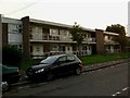
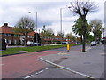
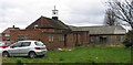


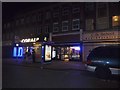
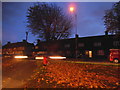


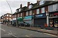
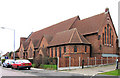

19 photos from this area
Area Information
Key information about the RM8 1UU including its size, population, and administrative classification.
- Area Type
- Postcode
- Area Size
- 5206 m²
- Population
- 1546
- Population Density
- 12088 people/km²
House Prices in RM8 1UU
20
Properties
£164,000
Average Sold Price
£95,000
Lowest Price
£233,000
Highest Price
Showing 20 properties
| Address | Type | Beds | Baths | Last Sale Price | Last Sale Date | |
|---|---|---|---|---|---|---|
| 693A Green Lane, Dagenham, RM8 1UU | Flat | - | - | £233,000 | Jun 2025 | |
| 695A Green Lane, Dagenham, RM8 1UU | Flat | 3 | 1 | £95,000 | Oct 2000 | |
| 709A Green Lane, Dagenham, RM8 1UU | Flat | 3 | - | - | - | |
| 691B Green Lane, Dagenham, RM8 1UU | Flat | - | - | - | - | |
| 691C Green Lane, Dagenham, RM8 1UU | Flat | - | - | - | - | |
| 689A Green Lane, Dagenham, RM8 1UU | Maisonette | - | - | - | - | |
| 709B Green Lane, Dagenham, RM8 1UU | Flat | - | - | - | - | |
| Nelsons Snooker Club, Accomodation Above, 667-671 Green Lane, Dagenham, RM8 1UU | assembly_leisure | - | - | - | - | |
| 711A Green Lane, Dagenham, RM8 1UU | Flat | - | - | - | - | |
| Numark Pharmacy, 705 Green Lane, Dagenham, RM8 1UU | commercial | - | - | - | - |
Page 1 of 2
Energy Efficiency in RM8 1UU
Amenities
Schools
| Rank | School | Type | Entry gender | Ages |
|---|
Explore more schools in this area
Go to Schools tabDemographics
Household Size
Family (3-5 people)
most common
Accommodation Type
Houses
most common
Tenure
38
majority
Ethnic Group
asian_total
most common
Religion
N/A
most common
Household Composition
N/A
most common
Age
47
median
Adults (30-64 years)
most common
Household Deprivation
N/A
with no deprivation
NS-SEC
18
in Lower managerial occupations
Explore more demographic insights in this area
Go to Demographics tabPlanning
Planning Constraints
- Flood RiskPremium
- Ramsar Wetland SitesPremium
- Area of Outstanding Natural BeautyPremium
- Protected Nature ReservePremium
- Protected WoodlandPremium