Area Overview for RM7 8QA
Photos of RM7 8QA
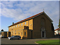
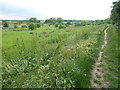
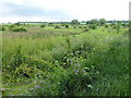
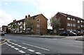

20 photos from this area
Area Information
Key information about the RM7 8QA including its size, population, and administrative classification.
- Area Type
- Postcode
- Area Size
- 1.5 hectares
- Population
- 1556
- Population Density
- 5535 people/km²
House Prices in RM7 8QA
34
Properties
£353,000
Average Sold Price
£89,000
Lowest Price
£855,001
Highest Price
Showing 34 properties
| Address | Type | Beds | Baths | Last Sale Price | Last Sale Date | |
|---|---|---|---|---|---|---|
| 461 Mawney Road, Romford, RM7 8QA | Terraced | 3 | 1 | £480,000 | Oct 2025 | |
| 497 Mawney Road, Romford, RM7 8QA | Terraced | 4 | 3 | £570,000 | Sep 2025 | |
| 521 Mawney Road, Romford, RM7 8QA | Detached | 4 | 2 | £855,001 | Mar 2025 | |
| 495 Mawney Road, Romford, RM7 8QA | house | - | - | £365,000 | Jun 2021 | |
| 511 Mawney Road, Romford, RM7 8QA | house | - | - | £490,000 | Mar 2021 | |
| 469 Mawney Road, Romford, RM7 8QA | house | - | - | £390,000 | Nov 2020 | |
| 515 Mawney Road, Romford, RM7 8QA | house | - | - | £590,000 | Jun 2020 | |
| 505 Mawney Road, Romford, RM7 8QA | Semi-detached | 2 | 1 | £330,000 | Mar 2020 | |
| 489 Mawney Road, Romford, RM7 8QA | Detached | 4 | 2 | £387,000 | Nov 2018 | |
| 501 Mawney Road, Romford, RM7 8QA | Terraced | - | - | £300,000 | Nov 2018 |
Page 1 of 4
Energy Efficiency in RM7 8QA
Amenities
Schools
| Rank | School | Type | Entry gender | Ages |
|---|
Explore more schools in this area
Go to Schools tabDemographics
Household Size
Family (3-5 people)
most common
Accommodation Type
Houses
most common
Tenure
83
majority
Ethnic Group
White
most common
Religion
N/A
most common
Household Composition
N/A
most common
Age
47
median
Adults (30-64 years)
most common
Household Deprivation
N/A
with no deprivation
NS-SEC
30
in Lower managerial occupations
Explore more demographic insights in this area
Go to Demographics tabPlanning
Planning Constraints
- Flood RiskPremium
- Ramsar Wetland SitesPremium
- Area of Outstanding Natural BeautyPremium
- Protected Nature ReservePremium
- Protected WoodlandPremium