Area Overview for RM7 0DB
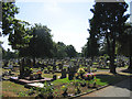
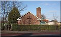
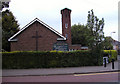
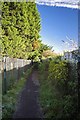
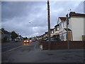
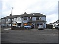
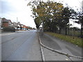
Photos of RM7 0DB

Area Information
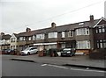
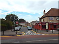
Living in RM7 0DB offers a distinct experience within the Thurrock and Havering boundary, defined by its small residential character. This postcode serves a specific cluster of homes with a total population of 1,754 residents. You will find a tightly knit community where daily life revolves around proximity to local transport hubs and retail parks rather than a sprawling urban centre. The area is almost exclusively composed of houses, creating a suburban feel that differs from the high-density flats found nearby in central London. With a median age of 47, the neighbourhood leans towards mature households rather than young professionals or empty nesters. Daily commutes rely heavily on the extensive rail and metro network surrounding Romford and Dagenham. Residents can access Elm Park Station, Gidea Park Station, and Dagenham East within a short drive or taxi ride. Your evenings and weekends will likely involve visits to major retailers like the Co-op in Romford or the Aldi and Lidl locations at the Rom Valley Retail Park. While the area lacks major green spaces or protected wetlands, it benefits from a completely flat flood risk profile. This makes it a straightforward choice for those seeking house ownership without environmental planning constraints, though you must weigh the high crime risk against the convenience of such direct access to London's suburbs.
- Area Type
- Postcode
- Area Size
- Not available
- Population
- 1754
- Population Density
- 3274 people/km²
The property market in RM7 0DB is characterised by a housing stock consisting entirely of houses. There are no flats listed for this specific postcode, meaning buyers are looking exclusively at detached, semi-detached, or terraced residential properties. With 53% of the population owning their homes, the area leans heavily towards owner-occupation. This stability often results in a slower turnover rate compared to high-demand rental zones. You are unlikely to find a dynamic buy-to-let market as the primary driver here. For prospective buyers, this environment suits those seeking a permanent home in a green belt or suburban setting. The population of 1,754 is small enough that every street likely has a distinct character, yet large enough to maintain some local identity. Because the accommodation type is restricted to houses, pricing will reflect house square footage and garden space rather than flat amenities. The area does not experience the rapid price speculation seen in central London due to its specific nature. You should expect a more traditional buying process rather than an auction-style competition.
House Prices in RM7 0DB
No properties found in this postcode.
Energy Efficiency in RM7 0DB
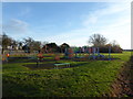
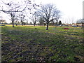
Your lifestyle in RM7 0DB centres on immediate access to major retail and transport nodes without entering the city. The Co-op Romford serves as a central hub for weekly groceries and essentials. You can also drive to the Aldi Rom Valley Retail Park or the Lidl Romford for larger bulk shopping trips. These venues are located within a short commute of the residential cluster. For commuting and quick trips, your choices include the Elm Park, Dagenham East, and Hornchurch metro stations. Alternatively, you might prefer the Gidea Park, Emerson Park, or Chadwell Heath rail stations for direct train lines to London. This variety gives you flexibility in travel times. You will not find local parks or nature reserves within the immediate postcode limits, as the area passes assessments with no protected wetland or nature reserve coverage. Your leisure activities will therefore depend heavily on what Romford town centre offers. You will rely on the retail park for weekend outings rather than local facilities.
Amenities
Schools
Families considering RM7 0DB have access to the Havering Motorvations Motor Project as the nearest educational facility. This institution is classified as an 'other' type school within the vicinity list. You will not find any standard primary, secondary, or grammar schools explicitly named in the immediate data for this postcode cluster. This gap in the school list suggests that residents rely on nearest provisions in Romford or Chadwell Heath for their children's education. The absence of listed schools on the immediate nearby list indicates that you must look beyond this specific postcode for daily schooling options. Parents living in RM7 0DB typically access schools in the wider Romford or Gidea Park area, which contain a mix of faith, grammar, and comprehensive institutions. Without specific Ofsted ratings or school types available for the immediate neighbourhood, planning must involve checking catchment boundaries for the broader Thurrock and Havering district. The available 'other' type facility hints at special education or vocational training options situated very close to the residential cluster.
| Rank | School | Type | Entry gender | Ages |
|---|
Explore more schools in this area
Go to Schools tabDemographics
The community profile in RM7 0DB is distinctly older, with a median age of 47 years. Adults constitute the most common age range, specifically those between 30 and 64 years old. This demographic skew suggests a neighbourhood dominated by established families and retirees rather than young singles. You will find that 53% of residents own their homes, indicating a strong baseline of owner-occupation alongside a renter population. This high ownership rate often correlates with areas where people have settled long-term. Ethnically, the predominant group in this postcode is White, reflecting a traditional suburban demographic common in Greater London's commuter belts. The housing stock is entirely focused on houses; there are no flats or apartments recorded within the immediate RM7 0DB cluster. This configuration supports single-family living arrangements and larger gardens. You should note that while specific deprivation indices are not included in the current data, the age profile and house ownership levels point towards a stable, mature community. The lack of younger households under 30 may mean fewer school-aged children living directly within this specific cluster compared to satellite postcodes.
Household Size
Accommodation Type
Tenure
Ethnic Group
Religion
Household Composition
Age
Household Deprivation
NS-SEC
Explore more demographic insights in this area
Go to Demographics tabPlanning
Planning Constraints
- Flood RiskPremium
- Ramsar Wetland SitesPremium
- Area of Outstanding Natural BeautyPremium
- Protected Nature ReservePremium
- Protected WoodlandPremium