Area Overview for RM6 6RB
Photos of RM6 6RB

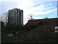
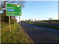
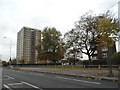
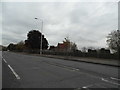
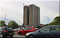
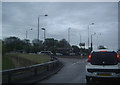
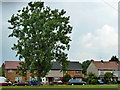
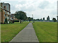
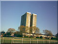
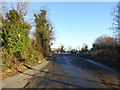
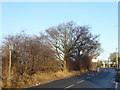
15 photos from this area
Area Information
Key information about the RM6 6RB including its size, population, and administrative classification.
- Area Type
- Postcode
- Area Size
- 39.9 hectares
- Population
- 1770
- Population Density
- 2099 people/km²
House Prices in RM6 6RB
18
Properties
£305,528
Average Sold Price
£235,000
Lowest Price
£500,000
Highest Price
Showing 18 properties
| Address | Type | Beds | Baths | Last Sale Price | Last Sale Date | |
|---|---|---|---|---|---|---|
| 459 Whalebone Lane North, Romford, RM6 6RB | Terraced | 3 | 1 | £450,000 | Nov 2024 | |
| 457 Whalebone Lane North, Romford, RM6 6RB | Terraced | 5 | 2 | £500,000 | Jan 2023 | |
| 5, Warren Farm Cottages, Whalebone Lane North, Chadwell Heath, RM6 6RB | Terraced | 3 | 1 | £250,000 | Dec 2015 | |
| 3, Warren Farm Cottages, Whalebone Lane North, Chadwell Heath, RM6 6RB | house | - | - | £285,000 | Dec 2015 | |
| 4, Warren Farm Cottages, Whalebone Lane North, Chadwell Heath, RM6 6RB | Terraced | 3 | 2 | £240,000 | Apr 2015 | |
| 6, Warren Farm Cottages, Whalebone Lane North, Chadwell Heath, RM6 6RB | Terraced | 2 | 1 | £277,000 | Mar 2015 | |
| 461 Whalebone Lane North, Romford, RM6 6RB | Terraced | 4 | 1 | £262,750 | Aug 2014 | |
| 463 Whalebone Lane North, Romford, RM6 6RB | Terraced | 3 | 1 | £250,000 | Sep 2013 | |
| 455 Whalebone Lane North, Romford, RM6 6RB | house | 3 | - | £235,000 | Jan 2012 | |
| Grs Bagging Limited, Mark Warren Quarry, Whalebone Lane North, Romford, RM6 6RB | Industrial | - | - | - | - |
Page 1 of 2
Energy Efficiency in RM6 6RB
Amenities
Schools
| Rank | School | Type | Entry gender | Ages |
|---|
Explore more schools in this area
Go to Schools tabDemographics
Household Size
Family (3-5 people)
most common
Accommodation Type
Houses
most common
Tenure
70
majority
Ethnic Group
asian_total
most common
Religion
N/A
most common
Household Composition
N/A
most common
Age
47
median
Adults (30-64 years)
most common
Household Deprivation
N/A
with no deprivation
NS-SEC
30
in Lower managerial occupations
Explore more demographic insights in this area
Go to Demographics tabPlanning
Planning Constraints
- Flood RiskPremium
- Ramsar Wetland SitesPremium
- Area of Outstanding Natural BeautyPremium
- Protected Nature ReservePremium
- Protected WoodlandPremium