Area Overview for RM6 5DS
Photos of RM6 5DS
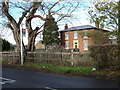
18 photos from this area
Area Information
Key information about the RM6 5DS including its size, population, and administrative classification.
- Area Type
- Postcode
- Area Size
- 1.0 hectares
- Population
- 1959
- Population Density
- 6207 people/km²
House Prices in RM6 5DS
33
Properties
£353,990
Average Sold Price
£110,500
Lowest Price
£740,000
Highest Price
Showing 33 properties
| Address | Type | Beds | Baths | Last Sale Price | Last Sale Date | |
|---|---|---|---|---|---|---|
| 3 Freshwell Avenue, Chadwell Heath, Romford, RM6 5DS | Semi-detached | 3 | 1 | £740,000 | Jun 2024 | |
| 43 Freshwell Avenue, Chadwell Heath, Romford, RM6 5DS | Semi-detached | 4 | 2 | £585,000 | Mar 2024 | |
| 17 Freshwell Avenue, Chadwell Heath, Romford, RM6 5DS | Semi-detached | 3 | 1 | £465,000 | Mar 2022 | |
| 65 Freshwell Avenue, Chadwell Heath, Romford, RM6 5DS | house | - | - | £600,000 | May 2021 | |
| 9 Freshwell Avenue, Chadwell Heath, Romford, RM6 5DS | house | - | - | £550,000 | Jan 2021 | |
| 1 Freshwell Avenue, Chadwell Heath, Romford, RM6 5DS | Terraced | 3 | - | £467,000 | Jan 2021 | |
| 49 Freshwell Avenue, Chadwell Heath, Romford, RM6 5DS | house | - | - | £243,000 | Jan 2020 | |
| 33 Freshwell Avenue, Chadwell Heath, Romford, RM6 5DS | house | - | - | £425,000 | Nov 2019 | |
| 35 Freshwell Avenue, Chadwell Heath, Romford, RM6 5DS | Semi-detached | 3 | 1 | £395,000 | Jun 2019 | |
| 27 Freshwell Avenue, Chadwell Heath, Romford, RM6 5DS | Semi-detached | 3 | 1 | £406,000 | Nov 2018 |
Page 1 of 4
Energy Efficiency in RM6 5DS
Amenities
Schools
| Rank | School | Type | Entry gender | Ages |
|---|
Explore more schools in this area
Go to Schools tabDemographics
Household Size
Family (3-5 people)
most common
Accommodation Type
Houses
most common
Tenure
80
majority
Ethnic Group
asian_total
most common
Religion
N/A
most common
Household Composition
N/A
most common
Age
47
median
Adults (30-64 years)
most common
Household Deprivation
N/A
with no deprivation
NS-SEC
30
in Lower managerial occupations
Explore more demographic insights in this area
Go to Demographics tabPlanning
Planning Constraints
- Flood RiskPremium
- Ramsar Wetland SitesPremium
- Area of Outstanding Natural BeautyPremium
- Protected Nature ReservePremium
- Protected WoodlandPremium