Area Overview for RM3 9YR
Photos of RM3 9YR
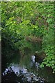
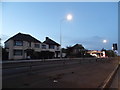
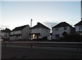
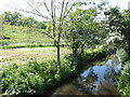
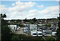
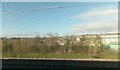
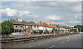
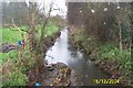
26 photos from this area
Area Information
Key information about the RM3 9YR including its size, population, and administrative classification.
- Area Type
- Postcode
- Area Size
- 1.6 hectares
- Population
- 1699
- Population Density
- 7491 people/km²
House Prices in RM3 9YR
29
Properties
£275,769
Average Sold Price
£75,000
Lowest Price
£435,000
Highest Price
Showing 29 properties
| Address | Type | Beds | Baths | Last Sale Price | Last Sale Date | |
|---|---|---|---|---|---|---|
| 5 Fairford Way, Romford, RM3 9YR | Terraced | 3 | 2 | £387,000 | Mar 2025 | |
| 16 Fairford Way, Romford, RM3 9YR | Terraced | 3 | 1 | £435,000 | Nov 2024 | |
| 25 Fairford Way, Romford, RM3 9YR | house | - | - | £382,000 | Jun 2021 | |
| 6 Fairford Way, Romford, RM3 9YR | house | - | - | £415,000 | Jan 2021 | |
| 33 Fairford Way, Romford, RM3 9YR | house | 3 | - | £325,000 | Mar 2020 | |
| 4 Fairford Way, Romford, RM3 9YR | Terraced | 3 | - | £317,000 | Nov 2018 | |
| 21 Fairford Way, Romford, RM3 9YR | house | 3 | - | £282,000 | Jan 2015 | |
| 18 Fairford Way, Romford, RM3 9YR | house | - | - | £165,000 | Aug 2012 | |
| 10 Fairford Way, Romford, RM3 9YR | house | 3 | - | £175,000 | Feb 2012 | |
| 15 Fairford Way, Romford, RM3 9YR | Terraced | - | - | £230,000 | Aug 2008 |
Page 1 of 3
Energy Efficiency in RM3 9YR
Amenities
Schools
| Rank | School | Type | Entry gender | Ages |
|---|
Explore more schools in this area
Go to Schools tabDemographics
Household Size
Family (3-5 people)
most common
Accommodation Type
Houses
most common
Tenure
58
majority
Ethnic Group
White
most common
Religion
N/A
most common
Household Composition
N/A
most common
Age
47
median
Adults (30-64 years)
most common
Household Deprivation
N/A
with no deprivation
NS-SEC
25
in Lower managerial occupations
Explore more demographic insights in this area
Go to Demographics tabPlanning
Planning Constraints
- Flood RiskPremium
- Ramsar Wetland SitesPremium
- Area of Outstanding Natural BeautyPremium
- Protected Nature ReservePremium
- Protected WoodlandPremium