Area Overview for RM3 9AU
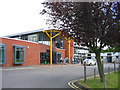
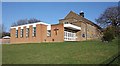
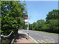
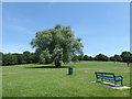
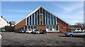
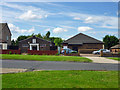
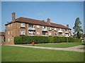
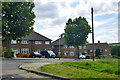
Photos of RM3 9AU


Area Information
RM3 9AU represents a specific residential cluster in England, characterised by a tightly defined footprint of 5,832 square metres. This small postcode area accommodates a population of 1,726 residents, creating a compact neighbourhood where daily life happens within close proximity to your home. The density here is high relative to its size, meaning services and neighbours are rarely far away. For those considering living in RM3 9AU, the location offers a distinct structure where homes form a cohesive community unit. The area functions as a self-contained residential zone, distinct from the wider borough beyond its immediate boundaries. Residents benefit from a neighbourhood scale that balances privacy with accessibility to essential facilities. This specific cluster does not sprawl; instead, it presents a focused living environment. If you are looking for homes in RM3 9AU, you are entering a space where local identity is strong and the community is closely knit. The area's small size ensures that local developments and changes are immediately visible to the people who call it home. Your daily routine will likely involve walking short distances to reach key destinations, making this postcode a practical choice for those who value a contained living environment over vast suburban expanses.
- Area Type
- Postcode
- Area Size
- 5832 m²
- Population
- 1726
- Population Density
- 7580 people/km²
The housing landscape in RM3 9AU is defined by its composition of houses, which stands as the predominant accommodation type. This structure dictates the character of the streets and dictates the kind of homes you will find available in the local market. With 49 per cent of properties owner-occupied, the area maintains a significant base of long-term residents who are directly invested in their homes. This figure contrasts with the 51 per cent of residents living in rental properties, creating a balanced market dynamic. The prevalence of houses suggests that families and professionals seeking detached or semi-detached living options will find the most suitable stock here. This postcode area, covering only 5,832 square metres, is too small to support a vast variety of property types, ensuring consistency in what is on offer. When viewing homes in RM3 9AU, expect to focus on standard residential properties suited to the local family demographic. The high percentage of owner-occupiers often correlates with a stable neighbourhood where turnover rates might be slower than in high-rental zones. Buyers entering the market must be prepared for a landscape dominated by traditional house layouts rather than modern flats or purpose-built developments.
House Prices in RM3 9AU
Showing 24 properties
| Address | Type | Beds | Baths | Last Sale Price | Last Sale Date | |
|---|---|---|---|---|---|---|
| 7 Chudleigh Road, Romford, RM3 9AU | house | 3 | - | £380,000 | Mar 2025 | |
| 17 Chudleigh Road, Romford, RM3 9AU | Semi-detached | 3 | 1 | £385,000 | Dec 2024 | |
| 19 Chudleigh Road, Romford, RM3 9AU | Semi-detached | 2 | 1 | £360,000 | Jul 2024 | |
| 33 Chudleigh Road, Romford, RM3 9AU | Semi-detached | 3 | 1 | £435,000 | Feb 2023 | |
| 11 Chudleigh Road, Romford, RM3 9AU | Terraced | 2 | 1 | £405,000 | May 2022 | |
| 39 Chudleigh Road, Romford, RM3 9AU | Semi-detached | 3 | 1 | £365,000 | May 2018 | |
| 43 Chudleigh Road, Romford, RM3 9AU | house | - | - | £282,000 | Feb 2017 | |
| 21 Chudleigh Road, Romford, RM3 9AU | house | 3 | 1 | £208,000 | Jun 2015 | |
| 35 Chudleigh Road, Romford, RM3 9AU | house | 3 | 1 | £249,000 | Aug 2014 | |
| 31 Chudleigh Road, Romford, RM3 9AU | house | 2 | - | £168,000 | Nov 2012 |
Energy Efficiency in RM3 9AU
Residents of RM3 9AU benefit from a convenient array of amenities located within practical reach of their homes. For daily shopping needs, five notable retail outlets are available, including Lidl Harold, Iceland Harold, and Sainsburys Harold. These supermarkets ensure you can stock up on groceries without travelling far from your property. Transport links are equally accessible, with five rail and metro stations situated nearby. Harold Wood Station, Gidea Park Station, and Emerson Park Station provide direct train access, while Upminster Bridge and Hornchurch stations offer additional metro connectivity for wider London travel. Having five distinct rail and metro options in your immediate vicinity enhances your flexibility and reduces reliance on private cars. Access to these transport hubs means your commute times remain predictable and your options for getting around are varied. The combination of immediate retail provision and multiple station choices makes living in RM3 9AU highly practical for daily life. You can attend work or leisure activities in central London with ease.
Amenities
Schools
Families residing in RM3 9AU have access to a range of educational facilities, including primary institutions and academy systems. Brookside Infant School and Brookside Junior School serve as the traditional primary education options within easy reach of the postcode. Further along the educational pathway, Drapers' Brookside Infant School and Drapers' Brookside Junior School operate as academies. Specifically, Drapers' Brookside Junior School holds a 'good' Ofsted rating, and Drapers' Brookside Infant School also carries a 'good' Ofsted rating. The presence of both stand-alone primary schools and academy-linked counterparts provides families with alternative educational philosophies. A 'good' rating indicates that the academy chain maintains high standards consistent with the overall sector expectations. The availability of two sets of primary schools, one infant and one junior pairing, means you can choose an educational setting that aligns with your specific learning preferences. All these schools are positioned to support the children in your household as they grow from early years through to key stage two education. Schools near RM3 9AU are thoroughly vetted, ensuring a baseline of educational quality for the community.
| Rank | School | Type | Entry gender | Ages |
|---|
Explore more schools in this area
Go to Schools tabDemographics
Community statistics reveal that adults between the ages of 30 and 64 years represent the most common age range in RM3 9AU. The median age for residents is 47 years, indicating a mature population compared to many younger-city centres. Nearly half of all households, specifically 49 per cent, consist of owners, while the remaining households reside in rented accommodation. This balance suggests a mixed community where stability meets transitional living arrangements. The primary type of accommodation found here is houses, which aligns with the needs of families and those seeking traditional UK housing rather than apartments. Over half of the residents identify as White, reflecting the predominant ethnic group in this specific cluster. With a density of 295,935 people per square kilometre, the social fabric is dense, fostering frequent interaction between neighbours. This demographic profile points to an area established well beyond the initial millennial boomerang rush. Families with older children or empty nesters are likely to find a home in this postcode, drawn by the house-heavy stock and an average household age. Life in RM3 9AU is shaped by this established demographic, offering a settled atmosphere rather than a transient student or young professional hub.
Household Size
Accommodation Type
Tenure
Ethnic Group
Religion
Household Composition
Age
Household Deprivation
NS-SEC
Explore more demographic insights in this area
Go to Demographics tabPlanning
Planning Constraints
- Flood RiskPremium
- Ramsar Wetland SitesPremium
- Area of Outstanding Natural BeautyPremium
- Protected Nature ReservePremium
- Protected WoodlandPremium