Area Overview for RM3 0TT
Photos of RM3 0TT

Area Information
Living in RM3 0TT means residing within a compact residential cluster spanning just 2.0 hectares. This specific postcode serves 1,540 residents, creating a tightly knit local community with a population density of 1,249 people per square kilometre. The area functions as a focused neighbourhood rather than a sprawling suburb, meaning you will interact with a defined group of neighbours in daily life. The scale of RM3 0TT ensures that services and local knowledge remain concentrated, avoiding the isolation sometimes found in larger districts. You are part of a small population group where the character of the place is defined by density and proximity. The geography is intentional and managed, offering a direct connection to the immediate surroundings without the vast distances of larger boroughs. When you choose this location, you select an environment where movement is short and community interactions are frequent. The limited footprint of the area distinguishes it from broader regions, offering a specific lifestyle choice centred on local familiarity.
- Area Type
- Postcode
- Area Size
- 2.0 hectares
- Population
- 1540
- Population Density
- 1249 people/km²
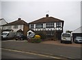
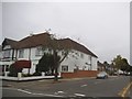
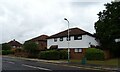
The housing stock in RM3 0TT is overwhelmingly defined by houses, which form the primary type of accommodation available in the sector. Ownership rates reach 76 per cent, making this an owner-occupied zone rather than a rental market. This high level of tenure suggests that properties in RM3 0TT are generally well-maintained by long-term residents who have purchased directly. Buyers looking at this area will find a market characterised by estate ownership rather than transient tenancy. The concentration of houses implies that terraced or flat living is not the standard offering within this specific postcode cluster. For those seeking permanent residence, the high ownership figure indicates a stable market where sellers often prioritize long-term value over quick turnover. The nature of the housing stock supports a community where people settle and stay, reducing vacancy rates and fostering local continuity.
House Prices in RM3 0TT
Showing 27 properties
| Address | Type | Beds | Baths | Last Sale Price | Last Sale Date | |
|---|---|---|---|---|---|---|
| 4 Upland Court Road, Romford, RM3 0TT | Semi-detached | 4 | 1 | £597,000 | Oct 2024 | |
| 25 Upland Court Road, Romford, RM3 0TT | Detached | - | - | £625,000 | Jul 2022 | |
| 19 Upland Court Road, Romford, RM3 0TT | house | - | - | £755,000 | Jun 2022 | |
| 7 Upland Court Road, Romford, RM3 0TT | Bungalow | 2 | - | £490,000 | Dec 2020 | |
| 10 Upland Court Road, Romford, RM3 0TT | Semi-detached | 4 | 2 | £600,000 | Oct 2019 | |
| 18 Upland Court Road, Romford, RM3 0TT | Bungalow | - | - | £480,000 | Feb 2018 | |
| 23 Upland Court Road, Romford, RM3 0TT | Semi-detached | 2 | 1 | £380,000 | Nov 2017 | |
| 3A Upland Court Road, Romford, RM3 0TT | Bungalow | 3 | - | £357,000 | Aug 2012 | |
| 22 Upland Court Road, Romford, RM3 0TT | Bungalow | 3 | - | £320,000 | Dec 2011 | |
| 11 Upland Court Road, Romford, RM3 0TT | Bungalow | 3 | - | £271,600 | Jul 2011 |
Energy Efficiency in RM3 0TT
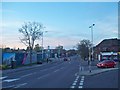
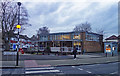
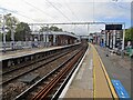
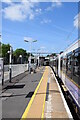
Your daily life in RM3 0TT benefits from a well-curated selection of nearby amenities within practical walking or short driving distances. Retail options include a Co-op located in Harold, Tesco Hornchurch, and M&S Hornchurch BP. These venues provide essentials and shopping variety without requiring long journeys. For rail access, five stations are located nearby, including Harold Wood Station, Gidea Park Station, and Emerson Park Station. These railway links connect you efficiently to wider travel networks. Additionally, three Metro stations operate close to the area, specifically Upminster Bridge, Hornchurch, and Elm Park Station. This density of transport and retail nodes ensures that you can access groceries, public transport, and daily necessities quickly. The presence of these named facilities directly outside your immediate vicinity means you do not need to travel far for routine needs.
Amenities
Schools
| Rank | School | Type | Entry gender | Ages |
|---|
Explore more schools in this area
Go to Schools tabDemographics
The community in RM3 0TT reflects a mature demographic profile with a median age of 47 years. Most residents fall into the adult age range between 30 and 64 years, indicating a population established in their careers and families. House ownership stands at 76 per cent, suggesting that the majority of households have purchased their properties and put down roots. The predominant form of accommodation within this postal sector consists of houses, catering to those seeking standalone living space. The most common ethnicity in RM3 0TT is White, aligning with broader trends in the surrounding housing estate. With such a high rate of ownership and a steady middle-aged population, the area maintains a stable social structure. This demographic stability typically supports consistent local investment and a predictable community atmosphere for long-term residents.
Household Size
Accommodation Type
Tenure
Ethnic Group
Religion
Household Composition
Age
Household Deprivation
NS-SEC
Explore more demographic insights in this area
Go to Demographics tabPlanning
Planning Constraints
- Flood RiskPremium
- Ramsar Wetland SitesPremium
- Area of Outstanding Natural BeautyPremium
- Protected Nature ReservePremium
- Protected WoodlandPremium