Area Overview for RM3 0EZ
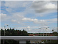
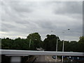
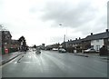
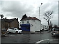
Photos of RM3 0EZ
Area Information
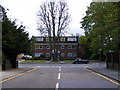
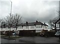
Living in RM3 0EZ offers a distinct residential experience within a small cluster covering 2,613 square metres. This tight-knit postcode serves 1,559 people, creating a dense environment where neighbours are often within easy reach. The population density stands at 596,625 people per square kilometre, which places this location among the most concentrated residential settlements in the country. Such density means opportunities for social interaction are frequent, yet it also defines the scale of the immediate neighbourhood. You will find that daily life here revolves around a compact footprint where space is efficient rather than expansive. The area functions as a self-contained block where residents can access essential services without travelling far. While the size is small, the location connects you directly to the wider transport network of East London and Essex. Homebuyers should understand that this postcode represents a specific slice of a larger urban fabric, characterised by its high volume of people relative to its physical space. This concentration supports a lively local rhythm without the sprawl of larger suburban complexes.
- Area Type
- Postcode
- Area Size
- 2613 m²
- Population
- 1559
- Population Density
- 2920 people/km²
The housing stock in RM3 0EZ is defined by its composition of houses, distinguishing it from areas dominated by purpose-built flats or terraced housing. A significant sixty-nine per cent of the population holds ownership of their property, confirming that this is primarily an owner-occupied zone rather than a rental hub. This high ownership rate typically results in a neighbourhood where residents have invested heavily in maintaining their individual homes, contributing to a consistent standard of housing presentation. You are looking at a market where sellers have a strong incentive to maintain value, and buyers often compete for established family homes. The scarcity of land within the total 2,613 square metre area of this specific postcode cluster limits the volume of inventory, which can influence price per square metre for the houses available. Potential homebuyers should note that the exclusive presence of houses means no consideration of block management fees or communal maintenance rules associated with apartment living. This market structure favours those seeking independent tenure and private gardens. The area functions as a stable part of the broader Romford and Hornchurch property chain, attracting buyers who prioritise ownership over renting.
House Prices in RM3 0EZ
Showing 1 properties
| Address | Type | Beds | Baths | Last Sale Price | Last Sale Date | |
|---|---|---|---|---|---|---|
| Renault, Southend Arterial Road, Hornchurch, RM3 0EZ | shop | - | - | - | - |
Energy Efficiency in RM3 0EZ
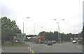
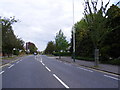
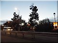
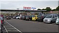
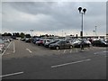
Your access to amenities in RM3 0EZ relies on travelling to nearby stations and retail clusters within practical reach. Five retail outlets serve the wider area, including major supermarkets such as Tesco Romford, Budgens MRH, and Tesco Hornchurch. These large stores provide comprehensive grocery shopping and general retail needs without requiring a long journey. For travel, five rail stations offer connections, notably Harold Wood Station, Gidea Park Station, and Emerson Park Station. Additionally, five metro stops are accessible, including Upminster Bridge, Hornchurch, and Elm Park Station. This variety of transport links allows you to commute easily to central London or reach other parts of Essex. The proximity to these namesake venues means that daily errands are manageable within a short drive or train ride. You can visit Harold Wood for local shopping or travel through Hornchurch for broader commercial options. The concentration of retail and transport hubs creates a convenient lifestyle where you can balance home life with outward movement efficiently. The presence of major chains like Tesco ensures that fresh produce and household goods are available close to your door.
Amenities
Schools
| Rank | School | Type | Entry gender | Ages |
|---|
Explore more schools in this area
Go to Schools tabDemographics
The community profile for RM3 0EZ is dominated by adults aged thirty to sixty-four years, reflecting a household dynamic that often includes families or established couples. The median age across the area is forty-seven years, indicating a population that is generally more mature than the national average. Sixty-nine per cent of residents own their homes, a figure that suggests long-term stability and well-established roots within the postcode. Accommodation types are exclusively houses, meaning the streetscape consists of detached or semi-detached dwellings rather than apartments or flats. White constitutes the predominant ethnic group, shaping the cultural fabric of the local community with specific traditions and community bonds. The high rate of homeownership correlates strongly with the availability of houses, reinforcing a market geared towards family settlement. This demographic picture paints a region where permanence is the norm. You can expect a community where local knowledge is deep and residents have很大程度上 settled their lives in one location for extended periods. The age structure implies that amenities likely cater more to adults and children than to young single professionals.
Household Size
Accommodation Type
Tenure
Ethnic Group
Religion
Household Composition
Age
Household Deprivation
NS-SEC
Explore more demographic insights in this area
Go to Demographics tabPlanning
Planning Constraints
- Flood RiskPremium
- Ramsar Wetland SitesPremium
- Area of Outstanding Natural BeautyPremium
- Protected Nature ReservePremium
- Protected WoodlandPremium