Area Overview for RM2 5UX
Photos of RM2 5UX
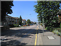
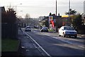
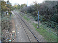
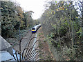
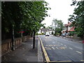
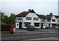
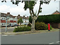
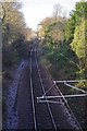
19 photos from this area
Area Information
Key information about the RM2 5UX including its size, population, and administrative classification.
- Area Type
- Postcode
- Area Size
- 1.8 hectares
- Population
- 1815
- Population Density
- 5771 people/km²
House Prices in RM2 5UX
30
Properties
£373,745
Average Sold Price
£75,300
Lowest Price
£698,000
Highest Price
Showing 30 properties
| Address | Type | Beds | Baths | Last Sale Price | Last Sale Date | |
|---|---|---|---|---|---|---|
| 84 Fairholme Avenue, Romford, RM2 5UX | Semi-detached | 4 | 1 | £698,000 | May 2025 | |
| 56A Fairholme Avenue, Romford, RM2 5UX | Bungalow | 2 | - | £430,000 | Feb 2025 | |
| 104 Fairholme Avenue, Romford, RM2 5UX | Bungalow | 2 | 1 | £520,000 | Oct 2024 | |
| 100 Fairholme Avenue, Romford, RM2 5UX | Bungalow | 3 | 1 | £535,000 | Feb 2024 | |
| 52 Fairholme Avenue, Romford, RM2 5UX | house | - | - | £640,000 | Jun 2021 | |
| 86 Fairholme Avenue, Romford, RM2 5UX | Semi-detached | 4 | 2 | £572,500 | Nov 2019 | |
| 88 Fairholme Avenue, Romford, RM2 5UX | house | - | - | £520,000 | Jun 2017 | |
| 90 Fairholme Avenue, Romford, RM2 5UX | Semi-detached | 3 | - | £650,000 | May 2017 | |
| 60 Fairholme Avenue, Romford, RM2 5UX | Terraced | 3 | - | £460,100 | Jan 2016 | |
| 56 Fairholme Avenue, Romford, RM2 5UX | Terraced | 3 | - | £400,000 | Apr 2013 |
Page 1 of 3
Energy Efficiency in RM2 5UX
Amenities
Schools
| Rank | School | Type | Entry gender | Ages |
|---|
Explore more schools in this area
Go to Schools tabDemographics
Household Size
Family (3-5 people)
most common
Accommodation Type
Houses
most common
Tenure
72
majority
Ethnic Group
White
most common
Religion
N/A
most common
Household Composition
N/A
most common
Age
47
median
Adults (30-64 years)
most common
Household Deprivation
N/A
with no deprivation
NS-SEC
43
in Lower managerial occupations
Explore more demographic insights in this area
Go to Demographics tabPlanning
Planning Constraints
- Flood RiskPremium
- Ramsar Wetland SitesPremium
- Area of Outstanding Natural BeautyPremium
- Protected Nature ReservePremium
- Protected WoodlandPremium