Area Overview for RM2 5PA
Photos of RM2 5PA
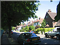
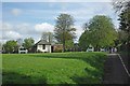
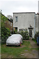
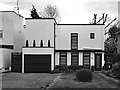
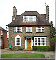
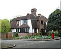
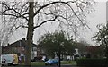
22 photos from this area
Area Information
Key information about the RM2 5PA including its size, population, and administrative classification.
- Area Type
- Postcode
- Area Size
- 8573 m²
- Population
- 1322
- Population Density
- 1177 people/km²
House Prices in RM2 5PA
14
Properties
£707,090
Average Sold Price
£205,000
Lowest Price
£1,350,000
Highest Price
Showing 14 properties
| Address | Type | Beds | Baths | Last Sale Price | Last Sale Date | |
|---|---|---|---|---|---|---|
| 56 Parkway, Romford, RM2 5PA | Detached | - | - | £1,350,000 | Jun 2023 | |
| 46 Parkway, Romford, RM2 5PA | Detached | 4 | 3 | £1,000,000 | Feb 2022 | |
| 52 Parkway, Romford, RM2 5PA | Detached | 4 | 1 | £755,000 | Nov 2018 | |
| 54 Parkway, Romford, RM2 5PA | house | - | - | £917,720 | Nov 2016 | |
| 58 Parkway, Romford, RM2 5PA | Detached | 4 | - | £619,000 | Nov 2009 | |
| 48 Parkway, Romford, RM2 5PA | house | 5 | - | £560,000 | Jan 2007 | |
| 62 Parkway, Romford, RM2 5PA | house | - | - | £250,000 | Nov 1998 | |
| 50 Parkway, Romford, RM2 5PA | Detached | - | - | £205,000 | Nov 1995 | |
| 60 Parkway, Romford, RM2 5PA | Detached | - | - | - | - | |
| 64 Parkway, Romford, RM2 5PA | Detached | - | - | - | - |
Page 1 of 2
Energy Efficiency in RM2 5PA
Amenities
Schools
| Rank | School | Type | Entry gender | Ages |
|---|
Explore more schools in this area
Go to Schools tabDemographics
Household Size
Two person
most common
Accommodation Type
Houses
most common
Tenure
85
majority
Ethnic Group
White
most common
Religion
N/A
most common
Household Composition
N/A
most common
Age
47
median
Adults (30-64 years)
most common
Household Deprivation
N/A
with no deprivation
NS-SEC
43
in Lower managerial occupations
Explore more demographic insights in this area
Go to Demographics tabPlanning
Planning Constraints
- Flood RiskPremium
- Ramsar Wetland SitesPremium
- Area of Outstanding Natural BeautyPremium
- Protected Nature ReservePremium
- Protected WoodlandPremium