Area Overview for RM14 3QH
Photos of RM14 3QH
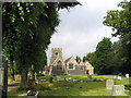
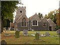


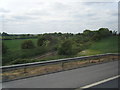
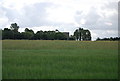
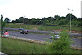
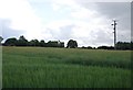
46 photos from this area
Area Information
Key information about the RM14 3QH including its size, population, and administrative classification.
- Area Type
- Postcode
- Area Size
- 61.6 hectares
- Population
- 1575
- Population Density
- 159 people/km²
House Prices in RM14 3QH
17
Properties
£764,667
Average Sold Price
£388,000
Lowest Price
£1,120,000
Highest Price
Showing 17 properties
| Address | Type | Beds | Baths | Last Sale Price | Last Sale Date | |
|---|---|---|---|---|---|---|
| Church Barn, Church Lane, North Ockendon, Upminster, RM14 3QH | office_workshop | 3 | 1 | £790,000 | Jul 2022 | |
| Moat Barn, Church Lane, North Ockendon, Upminster, RM14 3QH | Detached | 3 | - | £665,000 | Oct 2015 | |
| Swallow Barn, Church Lane, North Ockendon, Upminster, RM14 3QH | Semi-detached | 2 | - | £388,000 | Mar 2014 | |
| The Coach House, Church Lane, North Ockendon, Upminster, RM14 3QH | Detached | 5 | 4 | £1,000,000 | Jun 2011 | |
| The Old Forge, Church Lane, North Ockendon, Upminster, RM14 3QH | house | 4 | - | £625,000 | Aug 2010 | |
| The Rectory, Church Lane, North Ockendon, Upminster, RM14 3QH | Detached | - | - | £1,120,000 | Jun 2007 | |
| Hall Farm, Church Lane, North Ockendon, Upminster, RM14 3QH | Farm | - | - | - | - | |
| 2, Hall Farm Bungalows, Church Lane, North Ockendon, Upminster, RM14 3QH | Bungalow | - | - | - | - | |
| Cedar 1, Hall Farm Bungalows, Church Lane, North Ockendon, Upminster, RM14 3QH | Detached | - | - | - | - | |
| Flat, The Rectory, Church Lane, North Ockendon, Upminster, RM14 3QH | Flat | - | - | - | - |
Page 1 of 2
Energy Efficiency in RM14 3QH
Amenities
Schools
| Rank | School | Type | Entry gender | Ages |
|---|
Explore more schools in this area
Go to Schools tabDemographics
Household Size
Family (3-5 people)
most common
Accommodation Type
Houses
most common
Tenure
88
majority
Ethnic Group
White
most common
Religion
N/A
most common
Household Composition
N/A
most common
Age
47
median
Adults (30-64 years)
most common
Household Deprivation
N/A
with no deprivation
NS-SEC
41
in Lower managerial occupations
Explore more demographic insights in this area
Go to Demographics tabPlanning
Planning Constraints
- Flood RiskPremium
- Ramsar Wetland SitesPremium
- Area of Outstanding Natural BeautyPremium
- Protected Nature ReservePremium
- Protected WoodlandPremium