Area Overview for RM14 3EX
Photos of RM14 3EX
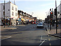
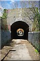
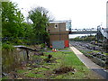
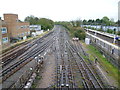
99 photos from this area
Area Information
Key information about the RM14 3EX including its size, population, and administrative classification.
- Area Type
- Postcode
- Area Size
- 6.5 hectares
- Population
- 1607
- Population Density
- 1175 people/km²
House Prices in RM14 3EX
41
Properties
£463,600
Average Sold Price
£95,000
Lowest Price
£750,000
Highest Price
Showing 41 properties
| Address | Type | Beds | Baths | Last Sale Price | Last Sale Date | |
|---|---|---|---|---|---|---|
| 87 Argyle Gardens, Upminster, RM14 3EX | house | - | - | £630,000 | Jul 2024 | |
| 111 Argyle Gardens, Upminster, RM14 3EX | Semi-detached | 4 | 1 | £725,000 | Mar 2024 | |
| 121 Argyle Gardens, Upminster, RM14 3EX | Detached | 4 | 1 | £750,000 | Mar 2024 | |
| 83 Argyle Gardens, Upminster, RM14 3EX | Semi-detached | 3 | 1 | £560,000 | Jun 2021 | |
| 91 Argyle Gardens, Upminster, RM14 3EX | house | - | - | £502,600 | Jun 2021 | |
| 89 Argyle Gardens, Upminster, RM14 3EX | Semi-detached | 4 | 1 | £645,000 | Dec 2020 | |
| 76 Argyle Gardens, Upminster, RM14 3EX | Semi-detached | 3 | 1 | £575,000 | Jan 2020 | |
| 105 Argyle Gardens, Upminster, RM14 3EX | house | - | - | £585,000 | Jul 2019 | |
| 70A Argyle Gardens, Upminster, RM14 3EX | Detached | 3 | - | £540,000 | Nov 2017 | |
| 123 Argyle Gardens, Upminster, RM14 3EX | house | - | - | £580,000 | Jul 2016 |
Page 1 of 5
Energy Efficiency in RM14 3EX
Amenities
Schools
| Rank | School | Type | Entry gender | Ages |
|---|
Explore more schools in this area
Go to Schools tabDemographics
Household Size
Family (3-5 people)
most common
Accommodation Type
Houses
most common
Tenure
94
majority
Ethnic Group
White
most common
Religion
N/A
most common
Household Composition
N/A
most common
Age
47
median
Adults (30-64 years)
most common
Household Deprivation
N/A
with no deprivation
NS-SEC
46
in Lower managerial occupations
Explore more demographic insights in this area
Go to Demographics tabPlanning
Planning Constraints
- Flood RiskPremium
- Ramsar Wetland SitesPremium
- Area of Outstanding Natural BeautyPremium
- Protected Nature ReservePremium
- Protected WoodlandPremium