Area Overview for RM14 2HB
Photos of RM14 2HB


Area Information
Living in RM14 2HB means choosing a distinct residential cluster situated in the RM14 postcode area of England. This specific location accommodates a population of 1649 residents, creating a close-knit community environment rather than a sprawling suburb. The area functions as a focused housing zone where daily life revolves around proximity to local services and transport links. You will find yourself in a setting defined by its residential nature, away from the density of larger city centres. The small size of the cluster offers a sense of insulation from the wider urban noise, yet it remains tightly connected to the broader Upminster region. Your lives here are supported by the immediate availability of key infrastructure, meaning you do not need to travel far for everyday necessities. The character of this postcode is practical and established, reflecting the needs of the people who inhabit these specific homes. When you consider what living in RM14 2HB entails, you are selecting a stable environment where the focus remains on quality of life within a defined boundary. The area presents a clear picture of what you can expect without the uncertainty found in newer developments or rapidly changing zones.
- Area Type
- Postcode
- Area Size
- Not available
- Population
- 1649
- Population Density
- 4498 people/km²
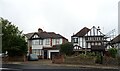
Your expectations for the property market in RM14 2HB should be set by the fact that 94% of homes are owner-occupied. This statistic defines the character of the housing stock as a secure, long-term residence rather than a transient rental product. The area predominantly features houses, meaning you will look for free-standing or terraced properties rather than apartments or flats. This accommodation type suits families and individuals seeking space and privacy. Because home ownership is so high, the market here is driven by those trading up, moving down, or staying due to affordability and attachment. You are unlikely to find a high volume of rental properties competing for tenants in this immediate cluster. Instead, the focus is on owners maintaining their homes and moving only when their circumstances change significantly. If you are looking at homes in RM14 2HB, you will encounter a stock that reflects stability and established value. The nature of the area discourages the rapid turnover typical of new developments or holiday lets. Your purchase would place you in a slice of the market where residents have a permanent stake in the locality. The high ownership rate also suggests fewer vacant properties, meaning the streets are consistently populated year-round.
House Prices in RM14 2HB
No properties found in this postcode.
Energy Efficiency in RM14 2HB
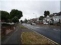
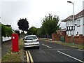
Your daily lifestyle in RM14 2HB benefits from a ring of practical amenities located within easy reach. For your weekly shopping, Iceland Upminster, Aldi Upminster, and Waitrose Upminster provide a comprehensive selection of groceries and household goods without a long commute. If you need a vehicle for travel, five railway stations are nearby, including Upminster Station, Emerson Park Station, and Ockendon Railway Station. These rail links offer straightforward access to Greater London and surrounding towns. You also have access to five Metro routes, with Upminster Bridge, Hornchurch, and Elm Park Station serving your mobility needs. These transport hubs work in tandem to get you where you need to go efficiently. The presence of these major retailers and transport nodes means your daily life is characterised by convenience and choice. You do not need to drive frequently to access essential services. The integration of retail and transport ensures that the convenience of urban living merges with the quiet of your home environment.
Amenities
Schools
| Rank | School | Type | Entry gender | Ages |
|---|
Explore more schools in this area
Go to Schools tabDemographics
The community in RM14 2HB reflects an established demographic profile dominated by adults aged between 30 and 64 years. With a median age of 47, the area is populated primarily by householders in their middle years rather than young professionals or retirees. This age distribution underpins a setting where stability is the norm. Home ownership stands at a remarkable 94% within this postcode, indicating that the vast majority of residents are mortgage-free or in the final stages of paying off their loans. Almost all accommodation consists of detached, semi-detached or terraced houses, aligning with the life stage and financial position of the inhabitants. The predominant ethnic group is White, which mirrors the long-standing historical settlement patterns of the area. You can expect a neighbourhood where you will see familiar faces and established families. The high rate of home ownership suggests a population that has taken root in the location and is unlikely to churn frequently. This demographic consistency creates a predictable environment where lifestyle choices and community values have remained relatively consistent over many decades.
Household Size
Accommodation Type
Tenure
Ethnic Group
Religion
Household Composition
Age
Household Deprivation
NS-SEC
Explore more demographic insights in this area
Go to Demographics tabPlanning
Planning Constraints
- Flood RiskPremium
- Ramsar Wetland SitesPremium
- Area of Outstanding Natural BeautyPremium
- Protected Nature ReservePremium
- Protected WoodlandPremium