Area Overview for RM14 2ER
Photos of RM14 2ER
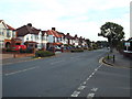
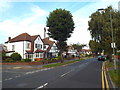
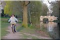
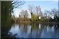
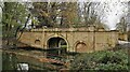
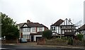
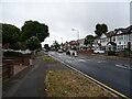
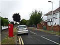
31 photos from this area
Area Information
Key information about the RM14 2ER including its size, population, and administrative classification.
- Area Type
- Postcode
- Area Size
- 2.0 hectares
- Population
- 1593
- Population Density
- 1824 people/km²
House Prices in RM14 2ER
29
Properties
£450,709
Average Sold Price
£109,000
Lowest Price
£880,000
Highest Price
Showing 29 properties
| Address | Type | Beds | Baths | Last Sale Price | Last Sale Date | |
|---|---|---|---|---|---|---|
| 9A The Grove, Upminster, RM14 2ER | Detached | 4 | 2 | £880,000 | Sep 2025 | |
| 16 The Grove, Upminster, RM14 2ER | Bungalow | 2 | 1 | £760,000 | May 2025 | |
| 17 The Grove, Upminster, RM14 2ER | Semi-detached | 3 | 2 | £750,000 | Mar 2025 | |
| 27 The Grove, Upminster, RM14 2ER | Bungalow | - | - | £610,000 | Jul 2023 | |
| 6A The Grove, Upminster, RM14 2ER | Detached | 4 | - | £575,000 | Nov 2019 | |
| 22 The Grove, Upminster, RM14 2ER | house | - | - | £595,000 | Sep 2013 | |
| 18 The Grove, Upminster, RM14 2ER | Detached | 4 | 2 | £389,500 | Mar 2013 | |
| 23 The Grove, Upminster, RM14 2ER | Bungalow | - | - | £385,000 | May 2012 | |
| 7 The Grove, Upminster, RM14 2ER | Bungalow | 3 | - | £425,000 | Aug 2011 | |
| 10 The Grove, Upminster, RM14 2ER | Bungalow | 4 | - | £380,000 | Dec 2010 |
Page 1 of 3
Energy Efficiency in RM14 2ER
Amenities
Schools
| Rank | School | Type | Entry gender | Ages |
|---|
Explore more schools in this area
Go to Schools tabDemographics
Household Size
Family (3-5 people)
most common
Accommodation Type
Houses
most common
Tenure
94
majority
Ethnic Group
White
most common
Religion
N/A
most common
Household Composition
N/A
most common
Age
47
median
Adults (30-64 years)
most common
Household Deprivation
N/A
with no deprivation
NS-SEC
44
in Lower managerial occupations
Explore more demographic insights in this area
Go to Demographics tabPlanning
Planning Constraints
- Flood RiskPremium
- Ramsar Wetland SitesPremium
- Area of Outstanding Natural BeautyPremium
- Protected Nature ReservePremium
- Protected WoodlandPremium