Area Overview for RM14 1UU
Photos of RM14 1UU
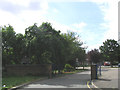
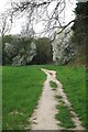
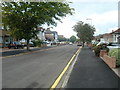
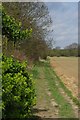
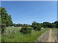
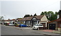
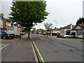
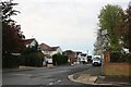
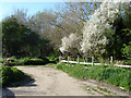
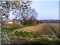
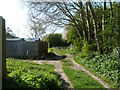
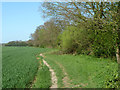
16 photos from this area
Area Information
Key information about the RM14 1UU including its size, population, and administrative classification.
- Area Type
- Postcode
- Area Size
- 3.9 hectares
- Population
- 1543
- Population Density
- 2614 people/km²
House Prices in RM14 1UU
24
Properties
£264,249
Average Sold Price
£82,000
Lowest Price
£410,000
Highest Price
Showing 24 properties
| Address | Type | Beds | Baths | Last Sale Price | Last Sale Date | |
|---|---|---|---|---|---|---|
| 10A, Waldegrave Court, Waldegrave Gardens, Upminster, RM14 1UU | Maisonette | 2 | 1 | £378,500 | Mar 2025 | |
| 12, Waldegrave Court, Waldegrave Gardens, Upminster, RM14 1UU | Maisonette | 2 | 1 | £375,000 | Jan 2025 | |
| 9, Waldegrave Court, Waldegrave Gardens, Upminster, RM14 1UU | Maisonette | 2 | 1 | £377,500 | Dec 2023 | |
| 7, Waldegrave Court, Waldegrave Gardens, Upminster, RM14 1UU | Flat | 2 | 1 | £370,000 | Sep 2023 | |
| 11, Waldegrave Court, Waldegrave Gardens, Upminster, RM14 1UU | Maisonette | 2 | 1 | £380,000 | Sep 2022 | |
| 12A, Waldegrave Court, Waldegrave Gardens, Upminster, RM14 1UU | Flat | - | - | £410,000 | Jun 2021 | |
| 1A, Waldegrave Court, Waldegrave Gardens, Upminster, RM14 1UU | Maisonette | - | - | £350,000 | Jun 2021 | |
| 5, Waldegrave Court, Waldegrave Gardens, Upminster, RM14 1UU | Flat | - | - | £85,000 | Oct 2019 | |
| 10, Waldegrave Court, Waldegrave Gardens, Upminster, RM14 1UU | Flat | 2 | 1 | £355,000 | Sep 2018 | |
| 3A, Waldegrave Court, Waldegrave Gardens, Upminster, RM14 1UU | Maisonette | - | - | £320,000 | Mar 2016 |
Page 1 of 3
Energy Efficiency in RM14 1UU
Amenities
Schools
| Rank | School | Type | Entry gender | Ages |
|---|
Explore more schools in this area
Go to Schools tabDemographics
Household Size
Family (3-5 people)
most common
Accommodation Type
Houses
most common
Tenure
85
majority
Ethnic Group
White
most common
Religion
N/A
most common
Household Composition
N/A
most common
Age
47
median
Adults (30-64 years)
most common
Household Deprivation
N/A
with no deprivation
NS-SEC
42
in Lower managerial occupations
Explore more demographic insights in this area
Go to Demographics tabPlanning
Planning Constraints
- Flood RiskPremium
- Ramsar Wetland SitesPremium
- Area of Outstanding Natural BeautyPremium
- Protected Nature ReservePremium
- Protected WoodlandPremium