Area Overview for RM14 1JX
Photos of RM14 1JX
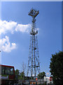
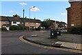
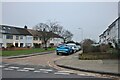
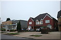
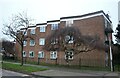
64 photos from this area
Area Information
Key information about the RM14 1JX including its size, population, and administrative classification.
- Area Type
- Postcode
- Area Size
- 7658 m²
- Population
- 1518
- Population Density
- 5431 people/km²
House Prices in RM14 1JX
15
Properties
£409,322
Average Sold Price
£153,000
Lowest Price
£665,000
Highest Price
Showing 15 properties
| Address | Type | Beds | Baths | Last Sale Price | Last Sale Date | |
|---|---|---|---|---|---|---|
| 41 Kings Gardens, Upminster, RM14 1JX | Bungalow | - | - | £400,000 | Aug 2023 | |
| 33 Kings Gardens, Upminster, RM14 1JX | Bungalow | 5 | 2 | £665,000 | Jun 2021 | |
| 38 Kings Gardens, Upminster, RM14 1JX | Semi-detached | 4 | 3 | £565,000 | Sep 2020 | |
| 32 Kings Gardens, Upminster, RM14 1JX | house | - | - | £480,000 | Sep 2018 | |
| 26 Kings Gardens, Upminster, RM14 1JX | Bungalow | - | - | £590,900 | Apr 2016 | |
| 27 Kings Gardens, Upminster, RM14 1JX | Bungalow | 3 | - | £415,000 | Oct 2014 | |
| 36 Kings Gardens, Upminster, RM14 1JX | house | - | - | £235,000 | Oct 2009 | |
| 34 Kings Gardens, Upminster, RM14 1JX | house | - | - | £153,000 | Jun 2001 | |
| 28 Kings Gardens, Upminster, RM14 1JX | Bungalow | 3 | 1 | £179,995 | Feb 2001 | |
| 37 Kings Gardens, Upminster, RM14 1JX | Bungalow | 3 | 1 | - | - |
Page 1 of 2
Energy Efficiency in RM14 1JX
Amenities
Schools
| Rank | School | Type | Entry gender | Ages |
|---|
Explore more schools in this area
Go to Schools tabDemographics
Household Size
Family (3-5 people)
most common
Accommodation Type
Houses
most common
Tenure
88
majority
Ethnic Group
White
most common
Religion
N/A
most common
Household Composition
N/A
most common
Age
47
median
Adults (30-64 years)
most common
Household Deprivation
N/A
with no deprivation
NS-SEC
37
in Lower managerial occupations
Explore more demographic insights in this area
Go to Demographics tabPlanning
Planning Constraints
- Flood RiskPremium
- Ramsar Wetland SitesPremium
- Area of Outstanding Natural BeautyPremium
- Protected Nature ReservePremium
- Protected WoodlandPremium