Area Overview for RM14 1BG
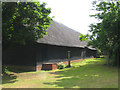
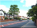
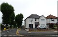
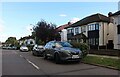
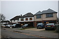
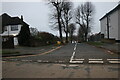
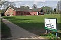
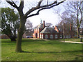
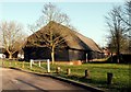
Photos of RM14 1BG


Area Information
Living in RM14 1BG is an experience defined by a compact residential cluster covering just 2.0 hectares. This specific postcode area houses 1,736 people, creating a tight-knit environment where neighbours often know one another. You will find this location sits within a highly populated setting, with a density of 86,301 people per square kilometre. Despite the small physical footprint, the community feels substantial due to the concentration of households in this specific stretch of England. The area prioritises local convenience, ensuring that daily needs are met without requiring long journeys into neighbouring towns. For those seeking a settled pace of life, the limited size of this postcode boundary offers a sense of enclosure and stability. Residents here enjoy proximity to wider networks while maintaining a distinct local identity. The sheer density means you are close to transport hubs and retail outlets, yet the specific nature of this 2-hectare zone provides a degree of focus that sprawling districts lack. When you visit, the sense of a defined neighbourhood becomes apparent immediately.
- Area Type
- Postcode
- Area Size
- 2.0 hectares
- Population
- 1736
- Population Density
- 2287 people/km²
The property market in RM14 1BG reflects a region where established homeowners dominate the landscape. With 91 per cent of residents owning their homes, the area functions primarily as an owner-occupied zone rather than a rental market. This statistic means you will encounter a high concentration of families who have likely been living in the same properties for many years. The predominant accommodation type consists of houses, which supports the high ownership figure as detached or semi-detached stock usually appeals more to buyers than flats. Living in this postcode means entering a market where sellers often take pride in their long-term residence. The small 2.0-hectare boundary further constrains supply, potentially making transactions in this specific cluster competitive for those looking to buy. Buyers should expect to engage with owners who know the area intimately. The lack of significant rental inventory suggests that short-term letting or investment properties are rare here. Instead, the housing stock serves local families and professionals looking for stability.
House Prices in RM14 1BG
Showing 18 properties
| Address | Type | Beds | Baths | Last Sale Price | Last Sale Date | |
|---|---|---|---|---|---|---|
| 5 Ingrebourne Gardens, Upminster, RM14 1BG | Detached | 6 | 1 | £1,275,000 | Feb 2023 | |
| 2 Ingrebourne Gardens, Upminster, RM14 1BG | house | - | - | £1,250,000 | May 2022 | |
| 6 Ingrebourne Gardens, Upminster, RM14 1BG | house | - | - | £865,000 | Nov 2020 | |
| 8 Ingrebourne Gardens, Upminster, RM14 1BG | Semi-detached | 3 | - | £780,000 | Oct 2020 | |
| 10 Ingrebourne Gardens, Upminster, RM14 1BG | house | - | - | £775,000 | Feb 2017 | |
| 1 Ingrebourne Gardens, Upminster, RM14 1BG | house | - | - | £975,000 | Jan 2017 | |
| 11 Ingrebourne Gardens, Upminster, RM14 1BG | house | - | - | £857,000 | Jul 2015 | |
| 3 Ingrebourne Gardens, Upminster, RM14 1BG | Detached | 6 | - | £820,000 | Feb 2014 | |
| 15 Ingrebourne Gardens, Upminster, RM14 1BG | Bungalow | 5 | - | £733,000 | Oct 2010 | |
| 7 Ingrebourne Gardens, Upminster, RM14 1BG | house | - | - | £763,000 | May 2009 |
Energy Efficiency in RM14 1BG
Your daily life in RM14 1BG benefits from a well-supported network of essential amenities within practical reach. You have access to five railway stations including Upminster Station, Emerson Park Station, and Harold Wood Station, making surface travel straightforward. Shopping options include M&S Upminster SF, The Southern Co-operative Co, and Waitrose Upminster, ensuring high-quality grocery supplies are never far away. Local infrastructure extends to five metro points such as Upminster Bridge, Hornchurch, and Elm Park Station, integrating this postcode into the broader transport grid. These stations connect you seamlessly to wider London and surrounding areas without a long commute. The presence of major retailers like Waitrose suggests a well-serviced environment where you can find specific brands and dietary requirements easily. You can walk to these facilities or use the nearby transit to extend your reach. This combination of rail and retail access means essential errands and leisure trips require minimal planning.
Amenities
Schools
| Rank | School | Type | Entry gender | Ages |
|---|
Explore more schools in this area
Go to Schools tabDemographics
The community in RM14 1BG is characterised by a mature population with a median age of 47 years. Most residents fall into the adult age range between 30 and 64 years, suggesting a demographic dominated by professionals and established families rather than students or young retirees. This age profile indicates a neighbourhood where life goals are settled and long-term investments are common. Home ownership stands at an impressive 91 per cent, highlighting that this area is overwhelmingly owned rather than rented. This high level of ownership suggests residents view the location as a place to root down for the foreseeable future. The predominant ethnic group in this postcode is White, and the territory generally consists of houses rather than flats. This accommodation type aligns with the ownership statistics, as houses typically attract buyers seeking to establish a permanent home. With such a high rate of ownership and a consistent adult population, the area maintains a stable social fabric where long-standing community ties are likely strong.
Household Size
Accommodation Type
Tenure
Ethnic Group
Religion
Household Composition
Age
Household Deprivation
NS-SEC
Explore more demographic insights in this area
Go to Demographics tabPlanning
Planning Constraints
- Flood RiskPremium
- Ramsar Wetland SitesPremium
- Area of Outstanding Natural BeautyPremium
- Protected Nature ReservePremium
- Protected WoodlandPremium