Area Overview for RM13 9DB
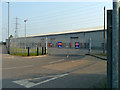
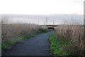
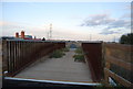
Photos of RM13 9DB

Area Information
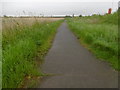
Living in RM13 9DB means residing within a small, defined residential cluster covering just 2.1 hectares. This postcode represents a concentrated community of 1,968 people, creating an intimate environment where neighbours likely know one another. The area occupies a specific slice of the broader Rainham and Dagenham corridor, functioning as a quiet pocket amidst larger urban sprawl. You are part of a town with a median age of 47, meaning the bustle of younger families is often tempered by a more settled demographic. Daily life here is characterised by proximity rather than grandeur; the community is physically compact enough that local streets form the core of social interaction. While the area lacks the vastness of some surrounding suburbs, this small footprint ensures that amenities and transport links remaining within practical reach. The residential nature of this specific cluster distinguishes it from mixed-use zones, offering a quieter domestic setting. If you seek a home in this postcode, you are entering a neighbourhood where the focus remains on stable living rather than commercial activity. This compact size means noise travel distances are short and the overall atmosphere feels manageable for those who prioritise a tight-knit local environment over expansive green spaces.
- Area Type
- Postcode
- Area Size
- 2.1 hectares
- Population
- 1968
- Population Density
- 193 people/km²
The property market in RM13 9DB is characterised by a packed housing stock dominated by houses. Because the postcode covers only 2.1 hectares, the variety of property types available is naturally limited compared to larger districts. The sheer volume of owner-occupied homes is evidenced by the 73% home ownership rate, which dwarfs the rental sector. You will find that most homes in this specific cluster are occupied by buyers rather than landlords. The predominance of houses means that apartments or flats are virtually absent from this immediate postcode. This structure appeals to those seeking detached or semi-detached homes rather than dense urban living. Since the area is so small, the concentration of tenures is high, meaning price per square metre may fluctuate less dramatically than in hyper-diverse neighbourhoods. When searching for homes in RM13 9DB, you are entering a market where supply is fixed by physical space. The lack of new build opportunities within this tiny footprint means transformation and replacement are unlikely. Buyers should expect a secondary market dominated by existing stock that has changed hands over decades. The high ownership rate also implies lower turnover, which can extend time on market for individual properties. Understanding that this is an owner-led enclave helps you gauge competition levels before making an offer.
House Prices in RM13 9DB
Showing 1 properties
| Address | Type | Beds | Baths | Last Sale Price | Last Sale Date | |
|---|---|---|---|---|---|---|
| Paper Recycling Centre, Ferry Lane, Rainham, RM13 9DB | office_workshop | - | - | - | - |
Energy Efficiency in RM13 9DB
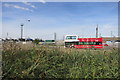
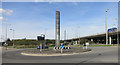
Daily life in RM13 9DB revolves around accessing specific amenities within a short distance, given the postcode's compact size. Rail transport is a major priority, with five stations nearby including Rainham Station, Belvedere, and Dagenham Dock Station. These links provide regular services connecting you to London and other key destinations. You also have access to five metro stations, such as Dagenham East and Dagenham Heathway, offering additional travel flexibility. Shopping needs are met by five major retail locations, including Tesco Rainham, Sainsburys Dagenham, and Lidl Clydesdale Way. These supermarkets provide fresh food and daily essentials without requiring a long journey. Commuters benefit from three ferry options, notably Woolwich Arsenal Pier and Woolwich Ferry North Pier, though these serve the wider region more than the immediate cluster. One airport, London City Airport, sits relatively close, offering international connections for frequent travellers. While the postcode itself is small, the surrounding network of transport and retail hubs ensures convenience. You will not need to drive far to stock your pantry or catch a train. This density of services makes the small physical area of RM13 9DB feel larger in terms of opportunity and accessibility.
Amenities
Schools
Families considering RM13 9DB have access to specific educational institutions nearby, though options are geographically constrained by the small size of the postcode. The Chafford School, A Specialist Business and Enterprise College serves as a key educational facility here, operating in both primary and academy capacities. This single institution handles both early years and secondary education under one roof, offering continuity for children growing up in the area. Additionally, Harris Academy Rainham is located in close proximity and holds a good Ofsted rating. This designation signals that the school meets expected standards and delivers solid educational outcomes for its student body. The mix of school types is simplified due to the local geography; you are unlikely to find separate, distinct primary and secondary institutions within a short walking distance. The presence of Harris Academy Rainham as a special school provides specialist support, which may appeal to families with specific educational needs. While the immediate vicinity may not offer a wide selection of independent or religious schools, these state-funded options fulfill the core requirement for education. Parents in RM13 9DB rely heavily on these two main venues for their children's schooling. Transport links mentioned earlier will aid attendance at these sites, ensuring that distance is rarely a barrier to regular schooling.
| Rank | School | Type | Entry gender | Ages |
|---|
Explore more schools in this area
Go to Schools tabDemographics
The community in RM13 9DB is defined by a clear demographic profile centred on adults between 30 and 64 years old. With a median age of 47, this area does not cater to students or young families seeking their first mover homes. Instead, the population consists largely of established households looking for stability and proximity. Home ownership stands at 73%, indicating a strong majority of residents have secured their housing through purchase rather than renting. This high rate suggests long-term settlement and investment in the local property market. Accommodation types are predominantly houses, ensuring that terraced living is rare and families or individuals enjoy more space within their boundaries. The predominant ethnic group is White, reflecting a historically settled community structure that has remained consistent over time. There is little evidence of recent rapid demographic shifts or high transient populations. Deprivation data is not available in the provided dataset, so any claims about social inequality must be treated as unknown. However, the high home ownership rate often correlates with financial security within a household. You are looking at an area where people have put down roots and maintained residency for significant periods. This stability creates a predictable social environment for buyers entering the market.
Household Size
Accommodation Type
Tenure
Ethnic Group
Religion
Household Composition
Age
Household Deprivation
NS-SEC
Explore more demographic insights in this area
Go to Demographics tabPlanning
Planning Constraints
- Flood RiskPremium
- Ramsar Wetland SitesPremium
- Area of Outstanding Natural BeautyPremium
- Protected Nature ReservePremium
- Protected WoodlandPremium