Area Overview for RM13 8LU
Photos of RM13 8LU
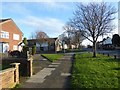
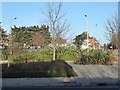
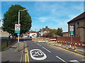
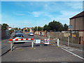
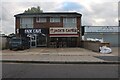
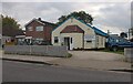
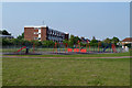
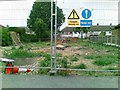
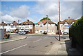
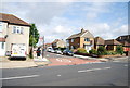
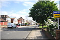
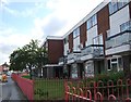
20 photos from this area
Area Information
Key information about the RM13 8LU including its size, population, and administrative classification.
- Area Type
- Postcode
- Area Size
- 2.2 hectares
- Population
- 1707
- Population Density
- 6049 people/km²
House Prices in RM13 8LU
55
Properties
£280,981
Average Sold Price
£72,000
Lowest Price
£613,800
Highest Price
Showing 55 properties
| Address | Type | Beds | Baths | Last Sale Price | Last Sale Date | |
|---|---|---|---|---|---|---|
| 31 Philip Road, Rainham, RM13 8LU | Detached | 4 | 2 | £613,800 | Nov 2024 | |
| 52 Philip Road, Rainham, RM13 8LU | house | 3 | 1 | £375,000 | Nov 2024 | |
| 50 Philip Road, Rainham, RM13 8LU | house | - | - | £355,000 | Dec 2023 | |
| 65 Philip Road, Rainham, RM13 8LU | Bungalow | 3 | 1 | £380,000 | Aug 2023 | |
| 76 Philip Road, Rainham, RM13 8LU | house | - | - | £550,000 | Aug 2023 | |
| 49 Philip Road, Rainham, RM13 8LU | Bungalow | 3 | 2 | £500,000 | Jul 2023 | |
| 41 Philip Road, Rainham, RM13 8LU | Detached | 3 | 2 | £580,000 | Jul 2023 | |
| 48 Philip Road, Rainham, RM13 8LU | Terraced | - | - | £232,000 | Jan 2023 | |
| 67 Philip Road, Rainham, RM13 8LU | Bungalow | - | - | £438,000 | Dec 2021 | |
| 34 Philip Road, Rainham, RM13 8LU | house | - | - | £345,000 | Sep 2021 |
Page 1 of 6
Energy Efficiency in RM13 8LU
Amenities
Schools
| Rank | School | Type | Entry gender | Ages |
|---|
Explore more schools in this area
Go to Schools tabDemographics
Household Size
Family (3-5 people)
most common
Accommodation Type
Houses
most common
Tenure
81
majority
Ethnic Group
White
most common
Religion
N/A
most common
Household Composition
N/A
most common
Age
47
median
Adults (30-64 years)
most common
Household Deprivation
N/A
with no deprivation
NS-SEC
28
in Lower managerial occupations
Explore more demographic insights in this area
Go to Demographics tabPlanning
Planning Constraints
- Flood RiskPremium
- Ramsar Wetland SitesPremium
- Area of Outstanding Natural BeautyPremium
- Protected Nature ReservePremium
- Protected WoodlandPremium