Area Overview for RM13 8JU
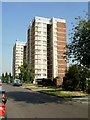
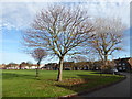
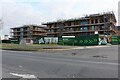
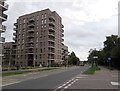
Photos of RM13 8JU


Area Information
Living in RM13 8JU defines a specific postcode area covering a small residential cluster in England. You are looking at a pocket community comprising 2469 people across just 4900 square metres of land. This results in a population density of 1001 people per square kilometre, creating a tightly knit neighbourhood where proximity is central to daily life. The location is not a vast suburb but a concentrated residential patch where neighbours are likely just yards apart. This specific cluster serves as a functional living space for thousands within a very defined geographic boundary. Your day-to-day existence here relies on the compact nature of this postcode. Because the area size is so limited, you will find that amenities and transport hubs are within immediate practical reach without the need for long commutes to reach basic services. The area functions as a distinct residential enclave rather than a sprawling district. You walk through an environment designed for high density living where the community footprint is clear and boundaries are well understood. Understanding that you are purchasing a home in a specific cluster rather than a generalised borough changes how you view the property. The small scale ensures that local characteristics and community dynamics remain visible and tangible to every resident.
- Area Type
- Postcode
- Area Size
- 4900 m²
- Population
- 2469
- Population Density
- 1001 people/km²
The property market in RM13 8JU reflects a stable environment defined by the accommodation type and tenure structure of the homes here. With 60% home ownership, you are looking at an area where residents have chosen to buy rather than rent. This high figure of owner-occupied properties means that decision-making regarding local improvements and sales often comes from existing homeowners. The sales activity is likely driven by life events such as up-sizing or down-sizing within the adult population you identified earlier. Houses are the predominant form of accommodation in your postcode area. You will find that the housing stock is tailored towards family living or individual household needs rather than high-density apartment blocks. This focus on houses suggests that buyers value private grounds and traditional layouts within the small residential cluster. When you view properties near RM13 8JU, you are evaluating stock that fits this established pattern of house ownership. The market dynamics here favour owners who look for solid, permanent residences. Understanding this mix helps you gauge whether buying here aligns with your long-term plans for living in a house-centric environment.
House Prices in RM13 8JU
Showing 12 properties
| Address | Type | Beds | Baths | Last Sale Price | Last Sale Date | |
|---|---|---|---|---|---|---|
| 10 Auckland Avenue, Rainham, RM13 8JU | Semi-detached | 3 | 2 | £425,000 | Jul 2022 | |
| 3 Auckland Avenue, Rainham, RM13 8JU | Maisonette | 2 | 1 | £272,000 | May 2022 | |
| 2 Auckland Avenue, Rainham, RM13 8JU | house | - | - | £382,000 | Jan 2022 | |
| 6 Auckland Avenue, Rainham, RM13 8JU | Semi-detached | 3 | - | £250,000 | Oct 2014 | |
| 14 Auckland Avenue, Rainham, RM13 8JU | Semi-detached | 3 | 2 | £275,000 | Jun 2005 | |
| 8 Auckland Avenue, Rainham, RM13 8JU | Semi-detached | - | - | £160,000 | Oct 2003 | |
| 12 Auckland Avenue, Rainham, RM13 8JU | house | - | - | £71,000 | Jun 1997 | |
| 4 Auckland Avenue, Rainham, RM13 8JU | Semi-detached | - | - | - | - | |
| 7 Auckland Avenue, Rainham, RM13 8JU | Flat | - | - | - | - | |
| 5 Auckland Avenue, Rainham, RM13 8JU | Flat | - | - | - | - |
Energy Efficiency in RM13 8JU
Residents of RM13 8JU enjoy convenient access to essential amenities within practical reach. Supermarkets include Tesco Rainham, listed twice in the data, and Sainsburys Dagenham, providing choice for your daily grocery needs. Retail options are backed by five facilities nearby, ensuring you do not need to travel far for essentials. For commuting, you have rail connections at Rainham Station and Dagenham Dock Station, alongside the Belvedere station which serves the area well. Transport diversity is further enhanced by metro stations at Dagenham East, Elm Park, and Dagenham Heathway. Leisure and travel options extend beyond buses and trains. You can access the Woolwich Arsenal Pier and Woolwich Ferry North Pier for river crossings if required. The proximity to London City Airport adds a unique travel dimension to your lifestyle, potentially reducing travel time for business meetings or holidays. Five rail stations and five metro stations demonstrate a heavy emphasis on public transport integration for this postcode. This infrastructure supports a lifestyle that balances local convenience with rapid access to major employment and leisure centres further away.
Amenities
Schools
You have access to quality education within your vicinity, specifically through nearby schools listed for the area. La Salette Catholic Primary School is located near RM13 8JU and offers primary education. The school holds a good Ofsted rating, which provides a clear benchmark for educational quality in this neighbourhood. For families with younger children, this establishment represents a straightforward local option for schooling requirements. The provision of schools near RM13 8JU focuses on the primary level. You do not have data indicating secondary schools in the immediate listing, which means you should investigate further for older children. The presence of a single primary school with a positive rating suggests a functional educational route for early years. If you are considering buying homes in RM13 8JU, this school is a key factor in your daily routine. Parents in the area rely on this rating to confirm that their children will receive a standard education compliant with national expectations. The local school offering is simple but effective for the specific age group served.
| Rank | School | Type | Entry gender | Ages |
|---|
Explore more schools in this area
Go to Schools tabDemographics
The community in RM13 8JU consists primarily of adults aged 30 to 64 years, who form the most common age range within the population. The median age for residents is 47, indicating a mature demographic that has likely settled in the area for a significant period. This age profile suggests stability and a workforce that is past the initial career-building phase but not approaching retirement. You will find that the neighbourhood caters to established families and professionals rather than young university students or empty nesters. Home ownership stands at 60%, meaning a clear majority of households own their properties outright or with a mortgage. This high rate indicates a buyer’s market element where long-term residents have invested in the local housing stock. The predominant accommodation type consists of houses, which aligns with the needs of families and adults seeking private space. You will encounter very few apartments or flats, which reinforces the character of a traditional residential area. The predominant ethnic group is White, reflecting the historical settlement patterns of this specific postcode sector. These figures paint a picture of a stable, owner-occupied community with a settled demographic structure.
Household Size
Accommodation Type
Tenure
Ethnic Group
Religion
Household Composition
Age
Household Deprivation
NS-SEC
Explore more demographic insights in this area
Go to Demographics tabPlanning
Planning Constraints
- Flood RiskPremium
- Ramsar Wetland SitesPremium
- Area of Outstanding Natural BeautyPremium
- Protected Nature ReservePremium
- Protected WoodlandPremium