Area Overview for RM13 7TA
Photos of RM13 7TA
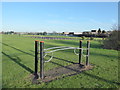
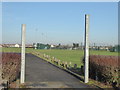
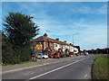
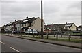
17 photos from this area
Area Information
Key information about the RM13 7TA including its size, population, and administrative classification.
- Area Type
- Postcode
- Area Size
- 2.7 hectares
- Population
- 1932
- Population Density
- 7365 people/km²
House Prices in RM13 7TA
19
Properties
£222,818
Average Sold Price
£56,995
Lowest Price
£355,000
Highest Price
Showing 19 properties
| Address | Type | Beds | Baths | Last Sale Price | Last Sale Date | |
|---|---|---|---|---|---|---|
| 118 Dagenham Road, Rainham, RM13 7TA | Terraced | 3 | 1 | £328,000 | Nov 2019 | |
| 114 Dagenham Road, Rainham, RM13 7TA | Terraced | 4 | 2 | £355,000 | Jul 2019 | |
| 106 Dagenham Road, Rainham, RM13 7TA | Terraced | 3 | 1 | £295,000 | Feb 2017 | |
| 130 Dagenham Road, Rainham, RM13 7TA | Terraced | 3 | - | £298,000 | Aug 2016 | |
| 128 Dagenham Road, Rainham, RM13 7TA | house | - | - | £262,000 | Nov 2015 | |
| 132 Dagenham Road, Rainham, RM13 7TA | Terraced | 3 | - | £212,000 | Apr 2014 | |
| 108 Dagenham Road, Rainham, RM13 7TA | house | - | - | £162,000 | Aug 2012 | |
| 112 Dagenham Road, Rainham, RM13 7TA | house | 3 | - | £185,000 | Jan 2012 | |
| 120 Dagenham Road, Rainham, RM13 7TA | Terraced | - | - | £175,000 | Oct 2006 | |
| 116 Dagenham Road, Rainham, RM13 7TA | Terraced | - | - | £122,000 | Jul 2002 |
Page 1 of 2
Energy Efficiency in RM13 7TA
Amenities
Schools
| Rank | School | Type | Entry gender | Ages |
|---|
Explore more schools in this area
Go to Schools tabDemographics
Household Size
Family (3-5 people)
most common
Accommodation Type
Houses
most common
Tenure
60
majority
Ethnic Group
White
most common
Religion
N/A
most common
Household Composition
N/A
most common
Age
47
median
Adults (30-64 years)
most common
Household Deprivation
N/A
with no deprivation
NS-SEC
21
in Lower managerial occupations
Explore more demographic insights in this area
Go to Demographics tabPlanning
Planning Constraints
- Flood RiskPremium
- Ramsar Wetland SitesPremium
- Area of Outstanding Natural BeautyPremium
- Protected Nature ReservePremium
- Protected WoodlandPremium