Area Overview for RM13 7LD
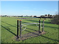
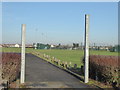
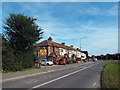
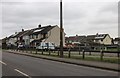
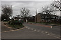
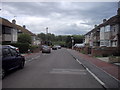
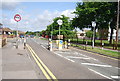
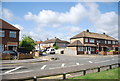
Photos of RM13 7LD
Area Information
RM13 7LD represents a very specific cluster of residences within a 1.5-hectare footprint. This postcode covers a small residential cluster rather than a sprawling neighbourhood, creating a tightly knit environment where neighbours are likely to know each other. The location sits within the greater Rainham and Dagenham corridor, balancing proximity to urban centres with a degree of contained scale. There are 1,543 registered people living in this space, resulting in a measured density of 101,016 people per square kilometre. Despite the high density figure, the physical area remains modest, suggesting a focus on compact living rather than expansive plots. Daily life here revolves around efficient access to nearby transport hubs and essential services. You will find yourself just minutes from the C2C railway line and the DLR, making this a practical base for commuters heading into London or central Essex. The area functions as a distinct postcode unit with its own statistical identity, differing from the broader town names often used in general conversation. If you are considering homes in RM13 7LD, you are looking at a compact, highly defined residential zone where convenience and location are the primary drivers of living standards.
- Area Type
- Postcode
- Area Size
- 1.5 hectares
- Population
- 1543
- Population Density
- 4482 people/km²
Homes in RM13 7LD consist almost exclusively of houses. This specification reflects the accommodation type data and distinguishes the area from zones dominated by flats or apartments. The 81% home ownership rate further cements the character of this market as an owner-occupied stronghold rather than a rental estate. Buyers looking at this postcode should expect a stock of detached, semi-detached, or terraced properties suited to established families or empty nesters. The low density of 1.5 hectares reinforces that this is not a high-rise urban habitat but a setting defined by individual dwellings. This lack of social housing or rental blocks creates a homogeneous market where competition between private owners is the primary driver of house prices. If you are interested in buying a home here, you are entering a market with limited rental pressure, potentially leading to different price elasticity compared to flashier, high-rental zones. The consistency of the housing stock offers a predictable environment for investors and homeowners alike who value traditional property types.
House Prices in RM13 7LD
Showing 12 properties
| Address | Type | Beds | Baths | Last Sale Price | Last Sale Date | |
|---|---|---|---|---|---|---|
| 2 Locke Close, Rainham, RM13 7LD | Semi-detached | 4 | 2 | £600,000 | Dec 2024 | |
| 8 Locke Close, Rainham, RM13 7LD | Semi-detached | 3 | 1 | £460,000 | Mar 2024 | |
| 7 Locke Close, Rainham, RM13 7LD | Semi-detached | 3 | 1 | £408,000 | Oct 2019 | |
| 6 Locke Close, Rainham, RM13 7LD | Semi-detached | 3 | - | £240,000 | Oct 2014 | |
| 3 Locke Close, Rainham, RM13 7LD | Semi-detached | 3 | 1 | £250,000 | Jun 2014 | |
| 5 Locke Close, Rainham, RM13 7LD | house | - | - | £185,000 | Aug 2005 | |
| 12 Locke Close, Rainham, RM13 7LD | Semi-detached | - | - | £230,000 | Oct 2004 | |
| 9 Locke Close, Rainham, RM13 7LD | Semi-detached | - | - | - | - | |
| 1 Locke Close, Rainham, RM13 7LD | Semi-detached | - | - | - | - | |
| 11 Locke Close, Rainham, RM13 7LD | Semi-detached | - | - | - | - |
Energy Efficiency in RM13 7LD
Living in RM13 7LD places you within easy reach of a variety of retail and transport amenities. There are five notable retail options nearby, including the Chelmsford Star Co-operative Society Co, the Tesco Rainham, and the Co-op Elm. These shops provide everyday essentials without the need for long trips into central urban centres. Transport access is robust, with five key metro locations such as Elm Park Station, Dagenham East, and Hornchurch all within practical reach. Rail travel is supported by stations like Rainham Station, Dagenham Dock Station, and Emerson Park Station, offering flexible options for daily commutes. Transport links extend further still with access to the Woolwich Arsenal Pier, providing ferry connectivity to other regions of the UK. The variety of stations allows you to choose the route that best fits your morning schedule. Daily life involves convenient access to groceries, public transit, and inter-city travel links. This network of amenities supports a self-sufficient lifestyle where the majority of commercial needs can be met locally.
Amenities
Schools
Schooling options for families in RM13 7LD are concentrated around Scargill Junior School and Scargill Infant School. Both institutions serve different stages of early education, offering continuity for children from reception through to the end of primary education. Scargill Infant School holds an Ofsted rating of good as an academy, providing verified quality assurance for the younger years. As an academy, it operates independently of the local authority while still adhering to national standards. Scargill Junior School serves as the feeder for upper primary years, completing the phase-specific education model in the immediate vicinity. This setup ensures that you have access to state-funded education without needing to travel further for the early years of your child's schooling. The presence of both infant and junior schools in the same operational cluster simplifies the daily routine for parents. While secondary education requires a trip further afield, the primary provision is solid and accessible. These schools form a critical part of the services available to residents of RM13 7LD.
| Rank | School | Type | Entry gender | Ages |
|---|
Explore more schools in this area
Go to Schools tabDemographics
The community within RM13 7LD is defined by a mature population profile. The median age is 47 years, indicating that the most common age range comprises adults between 30 and 64 years. This demographic structure suggests the area attracts long-term residents rather than young transients. Additionally, there is a strong emphasis on homeownership, with an 81% home ownership rate. This figure points to a stable community where families and professionals have put down roots rather than renting temporarily. The predominant ethnic group is White, which aligns with the broader demographic trends of many parts of East London and the surrounding boroughs. Affordable institutions dominate the landscape, fitting the profile of a area where stability and ownership are key priorities. For a home buyer, this means entering a neighbourhood where tenure is long-standing and the residents are likely invested in the local infrastructure. The high ownership rate also implies that selling or purchasing a property may face different market dynamics compared to areas with large rental populations.
Household Size
Accommodation Type
Tenure
Ethnic Group
Religion
Household Composition
Age
Household Deprivation
NS-SEC
Explore more demographic insights in this area
Go to Demographics tabPlanning
Planning Constraints
- Flood RiskPremium
- Ramsar Wetland SitesPremium
- Area of Outstanding Natural BeautyPremium
- Protected Nature ReservePremium
- Protected WoodlandPremium