Area Overview for RM13 7HT
Photos of RM13 7HT


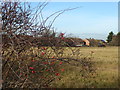


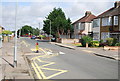
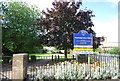

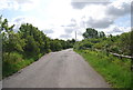

23 photos from this area
Area Information
Key information about the RM13 7HT including its size, population, and administrative classification.
- Area Type
- Postcode
- Area Size
- 8521 m²
- Population
- 1798
- Population Density
- 8611 people/km²
House Prices in RM13 7HT
36
Properties
£256,269
Average Sold Price
£140,000
Lowest Price
£320,000
Highest Price
Showing 36 properties
| Address | Type | Beds | Baths | Last Sale Price | Last Sale Date | |
|---|---|---|---|---|---|---|
| 80 Bader Way, Rainham, RM13 7HT | Flat | 2 | 1 | £310,000 | Jul 2025 | |
| 31 Bader Way, Rainham, RM13 7HT | Maisonette | 2 | 1 | £280,000 | Jan 2024 | |
| 15 Bader Way, Rainham, RM13 7HT | Maisonette | 2 | 1 | £277,000 | Aug 2023 | |
| 88 Bader Way, Rainham, RM13 7HT | Maisonette | 2 | 1 | £265,000 | May 2023 | |
| 94 Bader Way, Rainham, RM13 7HT | Flat | - | - | £295,000 | Jun 2022 | |
| 84 Bader Way, Rainham, RM13 7HT | Retail | 2 | 1 | £320,000 | May 2022 | |
| 92 Bader Way, Rainham, RM13 7HT | Maisonette | 2 | 1 | £280,000 | Jun 2021 | |
| 33 Bader Way, Rainham, RM13 7HT | Flat | - | - | £283,000 | Mar 2021 | |
| 27 Bader Way, Rainham, RM13 7HT | Maisonette | - | - | £270,000 | Jan 2021 | |
| 96 Bader Way, Rainham, RM13 7HT | Flat | - | - | £258,000 | Aug 2018 |
Page 1 of 4
Energy Efficiency in RM13 7HT
Amenities
Schools
| Rank | School | Type | Entry gender | Ages |
|---|
Explore more schools in this area
Go to Schools tabDemographics
Household Size
Family (3-5 people)
most common
Accommodation Type
Houses
most common
Tenure
58
majority
Ethnic Group
White
most common
Religion
N/A
most common
Household Composition
N/A
most common
Age
47
median
Adults (30-64 years)
most common
Household Deprivation
N/A
with no deprivation
NS-SEC
26
in Lower managerial occupations
Explore more demographic insights in this area
Go to Demographics tabPlanning
Planning Constraints
- Flood RiskPremium
- Ramsar Wetland SitesPremium
- Area of Outstanding Natural BeautyPremium
- Protected Nature ReservePremium
- Protected WoodlandPremium