Area Overview for RM13 7BS
Photos of RM13 7BS


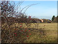


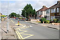
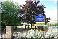

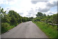
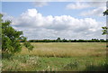

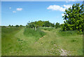
23 photos from this area
Area Information
Key information about the RM13 7BS including its size, population, and administrative classification.
- Area Type
- Postcode
- Area Size
- 2.2 hectares
- Population
- 1695
- Population Density
- 7715 people/km²
House Prices in RM13 7BS
48
Properties
£292,616
Average Sold Price
£55,000
Lowest Price
£487,500
Highest Price
Showing 48 properties
| Address | Type | Beds | Baths | Last Sale Price | Last Sale Date | |
|---|---|---|---|---|---|---|
| 18 Elmer Gardens, Rainham, RM13 7BS | Detached | 3 | 2 | £454,000 | Feb 2025 | |
| 19 Elmer Gardens, Rainham, RM13 7BS | Bungalow | 3 | 1 | £455,000 | May 2024 | |
| 7 Elmer Gardens, Rainham, RM13 7BS | Semi-detached | 3 | 1 | £420,000 | May 2024 | |
| 11 Elmer Gardens, Rainham, RM13 7BS | Semi-detached | 3 | 2 | £475,000 | Sep 2023 | |
| 1 Elmer Gardens, Rainham, RM13 7BS | Semi-detached | 3 | 1 | £465,000 | Jul 2023 | |
| 33A Elmer Gardens, Rainham, RM13 7BS | Bungalow | 2 | 1 | £406,000 | Apr 2023 | |
| 42 Elmer Gardens, Rainham, RM13 7BS | Retail | 3 | 1 | £460,000 | Sep 2022 | |
| 25 Elmer Gardens, Rainham, RM13 7BS | Bungalow | 2 | 1 | £475,000 | Apr 2022 | |
| 58 Elmer Gardens, Rainham, RM13 7BS | Terraced | 3 | 1 | £350,000 | Jan 2020 | |
| 27 Elmer Gardens, Rainham, RM13 7BS | Detached | 5 | 3 | £487,500 | Apr 2017 |
Page 1 of 5
Energy Efficiency in RM13 7BS
Amenities
Schools
| Rank | School | Type | Entry gender | Ages |
|---|
Explore more schools in this area
Go to Schools tabDemographics
Household Size
Family (3-5 people)
most common
Accommodation Type
Houses
most common
Tenure
80
majority
Ethnic Group
White
most common
Religion
N/A
most common
Household Composition
N/A
most common
Age
47
median
Adults (30-64 years)
most common
Household Deprivation
N/A
with no deprivation
NS-SEC
28
in Lower managerial occupations
Explore more demographic insights in this area
Go to Demographics tabPlanning
Planning Constraints
- Flood RiskPremium
- Ramsar Wetland SitesPremium
- Area of Outstanding Natural BeautyPremium
- Protected Nature ReservePremium
- Protected WoodlandPremium