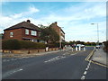
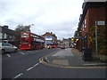
Area Overview for RM12 6HR
Photos of RM12 6HR


Area Information
Living in RM12 6HR offers a highly insulated residential experience within a compact footprint. This specific postcode cluster covers just 5948 square metres, creating an intensely intimate environment where neighbours are immediately adjacent. The population sits at 1492 people, resulting in a population density of 250821 people per square kilometre. Such staggering density indicates a built-up locality where private space is at a premium and the immediate surroundings are fully developed. This area functions as a defined residential pocket within the wider Hornchurch and Upminster corridor. Daily life here is characterised by close proximity to residential clusters rather than sprawling estates. You live in an environment where every house is likely near another, fostering a community where residents know one another through constant interaction. The small geographic size means local services and transport hubs are within a short travel time. While the area lacks expansive green spaces due to its compact nature, the sheer concentration of homes creates a distinct identity separate from larger, more dispersed settlements in the Borough of Havering.
- Area Type
- Postcode
- Area Size
- 5948 m²
- Population
- 1492
- Population Density
- 5350 people/km²
The property market in RM12 6HR is almost exclusively owner-occupied, with 90% of residents owning their homes. This statistic signals a market driven by residential need rather than speculative rental demand. Houses form the core of the accommodation type, meaning buyers should expect to find detached, semi-detached, or terraced family homes rather than flats or grow-up apartments. Given the postcode covers only 5948 square metres, the inventory is limited and competitive. Prospective buyers targeting RM12 6HR must act quickly, as the small geographic area restricts the total supply of available stock. The high homeownership rate suggests that homes here provide stability and are not heavily exposed to the volatility of the private rental sector. Families looking for traditional house living will find this area aligns perfectly with their requirements. The lack of significant rental stock means the local furniture agents and landlords operating nationally will have minimal presence.
House Prices in RM12 6HR
Showing 12 properties
| Address | Type | Beds | Baths | Last Sale Price | Last Sale Date | |
|---|---|---|---|---|---|---|
| 5 Ravenscourt Close, Hornchurch, RM12 6HR | Semi-detached | 4 | 2 | £550,100 | Mar 2021 | |
| 8 Ravenscourt Close, Hornchurch, RM12 6HR | Semi-detached | 4 | 3 | £485,000 | Dec 2019 | |
| 3 Ravenscourt Close, Hornchurch, RM12 6HR | Semi-detached | 4 | 1 | £515,000 | May 2019 | |
| 2 Ravenscourt Close, Hornchurch, RM12 6HR | Terraced | 5 | 2 | £315,000 | Sep 2009 | |
| 7 Ravenscourt Close, Hornchurch, RM12 6HR | Semi-detached | 4 | 2 | £275,000 | Apr 2005 | |
| 4 Ravenscourt Close, Hornchurch, RM12 6HR | Semi-detached | - | - | £185,000 | Sep 2002 | |
| 10 Ravenscourt Close, Hornchurch, RM12 6HR | Semi-detached | - | - | £103,000 | May 1998 | |
| 6 Ravenscourt Close, Hornchurch, RM12 6HR | Semi-detached | 5 | 2 | £129,995 | Aug 1997 | |
| 11 Ravenscourt Close, Hornchurch, RM12 6HR | Semi-detached | - | - | - | - | |
| 9 Ravenscourt Close, Hornchurch, RM12 6HR | Semi-detached | - | - | - | - |
Energy Efficiency in RM12 6HR
Residents of RM12 6HR have convenient access to a range of amenities within practical reach. Local retail needs are met by Sainsburys Hornchurch and Iceland Hornchurch, both located nearby. For those seeking a wider variety of goods, Elm Park Station and Upminster Bridge offer further retail options. Transport is a key feature of daily life, with Emerson Park Station, Upminster Station, and Gidea Park Station all situated close by. If you plan to commute via rail networks, these five stations provide multiple daily connections to London and beyond. Hornchurch serves as a major hub, offering additional shopping and dining choices just outside the immediate postcode boundary. The area boasts five nearby railway stations, ensuring you rarely wait long for a train. This combination of local supermarkets and major transport interchanges means you can run errands locally or travel to the city centre in under an hour. Your morning commute involves reasonable planning flexibility.
Amenities
Schools
| Rank | School | Type | Entry gender | Ages |
|---|
Explore more schools in this area
Go to Schools tabDemographics
The community in RM12 6HR is defined by a mature demographic with a median age of 47 years. The majority of residents fall into the adult bracket spanning 30 to 64 years, suggesting a population prioritising stability and family life over student housing or retirement settlements. Homeownership is the dominant housing tenure, with 90% of households owning their property outright or with a mortgage. This high level of ownership indicates long-term residents who view their homes as a permanent anchor rather than a short-term investment. Houses are the primary accommodation type, confirming the absence of large apartment blocks or purpose-built rental complexes within this cluster. The predominant ethnic group is White, reflecting the historical development patterns of the area. With such a high ownership rate and a middle-aged population, deprivation levels tend to remain moderate as wealth accumulation stabilises the local economy. This demographic profile supports local schools that cater primarily to children of working parents and professionals.
Household Size
Accommodation Type
Tenure
Ethnic Group
Religion
Household Composition
Age
Household Deprivation
NS-SEC
Explore more demographic insights in this area
Go to Demographics tabPlanning
Planning Constraints
- Flood RiskPremium
- Ramsar Wetland SitesPremium
- Area of Outstanding Natural BeautyPremium
- Protected Nature ReservePremium
- Protected WoodlandPremium