Area Overview for RM12 6HA
Photos of RM12 6HA


Area Information
Living in RM12 6HA offers a quiet residential experience within a compact cluster measuring 2.1 hectares. This specific postcode serves as a small, contained community where daily life revolves around close proximity to Hornchurch and Embridge Park. The area shelters 1,484 residents, creating an intimate neighbourhood feel distinct from the broader sprawl of Greater London. Despite its modest footprint, the population density reaches 69,505 people per square kilometre, indicating a tightly packed settlement typical of this eastern London postcode. Residents enjoy a suburban pace of life while remaining steps away from major transport links and local retail hubs. The character of RM12 6HA is defined by its residential focus rather than commercial activity. Homes here cater primarily to families and long-term occupants who value stability. The surrounding landscape avoids significant planning constraints such as protected woodlands or wetlands, meaning the immediate environment is free from the restrictions that often accompany conservation areas. You can expect a straightforward living environment where noise levels and development risks remain manageable. This area represents a practical choice for those seeking a slice of suburban England just minutes from the Dartford Crossing and central credit.
- Area Type
- Postcode
- Area Size
- 2.1 hectares
- Population
- 1484
- Population Density
- 3853 people/km²
The property market in RM12 6HA is heavily skewed towards owner-occupied homes, with 65% of all housing stock held by residents. This high ownership rate defines the area as a mature residential zone rather than a transient rental hub. Most properties in this postcode are houses, reflecting a preference for single-family accommodation over flats or apartments. You will find fewer shared interests or communal living arrangements than in denser urban fragments. Because the area contains only 2.1 hectares of land, the supply of homes is naturally limited, which often supports steady property values. The concentration of houses means that any new developments would face strict limits regarding scale and character. Buyers looking at RM12 6HA are likely targeting family homes or properties requiring modernisation. The lack of rental properties implies a lower demand for buy-to-let investments within these specific boundaries. If you are purchasing here, you are joining an established community of long-term residents who have benefited from years of equity growth. The market here rewards patience and knowledge of local reading rather than speculative flips.
House Prices in RM12 6HA
Showing 22 properties
| Address | Type | Beds | Baths | Last Sale Price | Last Sale Date | |
|---|---|---|---|---|---|---|
| 4 Mill Park Avenue, Hornchurch, RM12 6HA | Detached | 2 | 2 | £530,000 | Jul 2025 | |
| 1 Mill Park Avenue, Hornchurch, RM12 6HA | house | - | - | £915,000 | Apr 2024 | |
| 5A Mill Park Avenue, Hornchurch, RM12 6HA | Retail | 5 | 3 | £1,025,000 | Aug 2022 | |
| 20 Mill Park Avenue, Hornchurch, RM12 6HA | Retail | 3 | 1 | £720,000 | Mar 2022 | |
| 3 Mill Park Avenue, Hornchurch, RM12 6HA | Detached | 4 | 2 | £650,000 | Apr 2015 | |
| Mill House, 13 Mill Park Avenue, Hornchurch, RM12 6HA | Detached | - | - | £240,000 | Feb 2013 | |
| 17 Mill Park Avenue, Hornchurch, RM12 6HA | house | 4 | - | £485,000 | Aug 2010 | |
| 6 Mill Park Avenue, Hornchurch, RM12 6HA | Semi-detached | - | - | £330,000 | Jul 2009 | |
| 22 Mill Park Avenue, Hornchurch, RM12 6HA | Detached | - | - | £483,000 | Aug 2006 | |
| 16 Mill Park Avenue, Hornchurch, RM12 6HA | Semi-detached | - | - | £415,000 | Jan 2003 |
Energy Efficiency in RM12 6HA
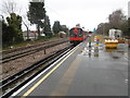
Residents of RM12 6HA benefit from immediate access to local shops and transport hubs that define daily convenience. Within a short walk, you can find Iceland Hornchurch, Sainsburys Hornchurch, and Lidl Hornchurch, offering a comprehensive range of groceries and daily essentials without the need for a long drive. Retail availability ensures that even late-night shopping or specific dietary requirements are easy to meet. These three major supermarkets anchor the commercial landscape for the local population. Transport accessibility further enhances lifestyle choices, with five metro and rail stations located nearby. You can reach Hornchurch, Upminster Bridge, Elm Park Station, Emerson Park Station, and both Upminster Station and Gidea Park Station with ease. This connectivity allows weekend trips to nearby attractions or quick commutes to London without relying solely on personal vehicles. The proximity of these facilities means you can enjoy a suburban quiet while maintaining urban access. Daily routines involve short walks to the supermarket or the railway line, creating a balanced life between home and work.
Amenities
Schools
Families considering RM12 6HA will find several educational institutions within practical reach, though the local options differ from traditional primary and secondary schools. The nearest educational facilities are Birnam Wood Pupil Referral Unit, The Tuition Centre, and Olive AP Academy - Havering. All three institutions operate as other types of specialities rather than standard mainstream schools. This mix suggests that while mainstream education may reside slightly further away, the area supports alternative and special needs learning pathways. If you require a pupil referral unit or a tuition centre for your child, these locations provide direct access without needing to travel to distant towns. Olive AP Academy - Havering represents a broader academic option in the vicinity. The presence of these specific providers indicates a focus on specialised education tailored to individual student needs. Prospective parents should note that these are not comprehensive schools but rather targeted facilities. For general primary or secondary education, you would likely need to look at institutions just outside the immediate RM12 6HA perimeter.
| Rank | School | Type | Entry gender | Ages |
|---|
Explore more schools in this area
Go to Schools tabDemographics
The community in RM12 6HA reflects a mature household structure dominated by adults aged between 30 and 64 years. The median age for residents sits at 47, confirming that families with older children or empty nesters form the core of the population. A significant 65% of households own their homes outright or with a mortgage, suggesting a stable, settled neighbourhood where residents are likely to stay long term. Less than one in three homes is subject to a rental tenancy agreement compared to the high ownership rate. The local population is predominantly White, aligning with broader trends in this part of Havering. Most accommodation consists of detached or semi-detached houses, providing ample space for the average household size. Unlike denser urban clusters, this area does not feature high-rise blocks or purpose-built estates. Instead, the housing stock relies on traditional property types that command higher capital values. If you are considering moving to RM12 6HA, you are entering a market where homeownership is the norm rather than the exception. This demographic profile indicates a low turnover community where neighbours often know each other by name and local institutions have deep roots in the area.
Household Size
Accommodation Type
Tenure
Ethnic Group
Religion
Household Composition
Age
Household Deprivation
NS-SEC
Explore more demographic insights in this area
Go to Demographics tabPlanning
Planning Constraints
- Flood RiskPremium
- Ramsar Wetland SitesPremium
- Area of Outstanding Natural BeautyPremium
- Protected Nature ReservePremium
- Protected WoodlandPremium