Area Overview for RM12 6AR
Photos of RM12 6AR
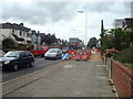
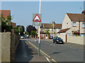
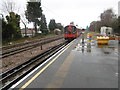
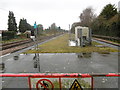
48 photos from this area
Area Information
Key information about the RM12 6AR including its size, population, and administrative classification.
- Area Type
- Postcode
- Area Size
- 7909 m²
- Population
- 1492
- Population Density
- 5350 people/km²
House Prices in RM12 6AR
19
Properties
£312,893
Average Sold Price
£114,995
Lowest Price
£505,000
Highest Price
Showing 19 properties
| Address | Type | Beds | Baths | Last Sale Price | Last Sale Date | |
|---|---|---|---|---|---|---|
| 19 Central Drive, Hornchurch, RM12 6AR | Bungalow | 3 | 1 | £420,000 | Jan 2024 | |
| 34 Central Drive, Hornchurch, RM12 6AR | Bungalow | 2 | 1 | £365,000 | Mar 2021 | |
| 23 Central Drive, Hornchurch, RM12 6AR | Bungalow | - | - | £375,000 | Oct 2019 | |
| 38 Central Drive, Hornchurch, RM12 6AR | Bungalow | - | - | £400,000 | Mar 2018 | |
| 36 Central Drive, Hornchurch, RM12 6AR | Bungalow | 2 | - | £372,500 | Oct 2017 | |
| 17 Central Drive, Hornchurch, RM12 6AR | Semi-detached | 2 | 1 | £375,000 | Jan 2017 | |
| 31 Central Drive, Hornchurch, RM12 6AR | Semi-detached | 3 | - | £505,000 | Dec 2016 | |
| 20 Central Drive, Hornchurch, RM12 6AR | Semi-detached | 3 | 1 | £355,000 | Dec 2015 | |
| 26 Central Drive, Hornchurch, RM12 6AR | Semi-detached | 3 | 2 | £285,000 | Sep 2013 | |
| 32 Central Drive, Hornchurch, RM12 6AR | Semi-detached | 2 | - | £218,000 | Apr 2011 |
Page 1 of 2
Energy Efficiency in RM12 6AR
Amenities
Schools
| Rank | School | Type | Entry gender | Ages |
|---|
Explore more schools in this area
Go to Schools tabDemographics
Household Size
Family (3-5 people)
most common
Accommodation Type
Houses
most common
Tenure
90
majority
Ethnic Group
White
most common
Religion
N/A
most common
Household Composition
N/A
most common
Age
47
median
Adults (30-64 years)
most common
Household Deprivation
N/A
with no deprivation
NS-SEC
35
in Lower managerial occupations
Explore more demographic insights in this area
Go to Demographics tabPlanning
Planning Constraints
- Flood RiskPremium
- Ramsar Wetland SitesPremium
- Area of Outstanding Natural BeautyPremium
- Protected Nature ReservePremium
- Protected WoodlandPremium