Area Overview for RM12 5SH
Photos of RM12 5SH

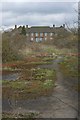
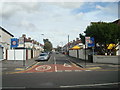
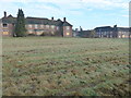
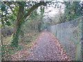


21 photos from this area
Area Information
Key information about the RM12 5SH including its size, population, and administrative classification.
- Area Type
- Postcode
- Area Size
- 1.8 hectares
- Population
- 1598
- Population Density
- 4700 people/km²
House Prices in RM12 5SH
39
Properties
£292,731
Average Sold Price
£81,000
Lowest Price
£525,000
Highest Price
Showing 39 properties
| Address | Type | Beds | Baths | Last Sale Price | Last Sale Date | |
|---|---|---|---|---|---|---|
| 94 Maybank Avenue, Hornchurch, RM12 5SH | Terraced | 3 | 1 | £475,000 | Oct 2024 | |
| 82 Maybank Avenue, Hornchurch, RM12 5SH | Terraced | 3 | 1 | £422,000 | Jul 2023 | |
| 146 Maybank Avenue, Hornchurch, RM12 5SH | house | - | - | £525,000 | Nov 2021 | |
| 102 Maybank Avenue, Hornchurch, RM12 5SH | Detached | 3 | 2 | £340,000 | Jul 2021 | |
| 88 Maybank Avenue, Hornchurch, RM12 5SH | house | - | - | £342,000 | Jun 2021 | |
| 108 Maybank Avenue, Hornchurch, RM12 5SH | house | - | - | £407,500 | May 2021 | |
| 148 Maybank Avenue, Hornchurch, RM12 5SH | house | 3 | - | £475,000 | Aug 2020 | |
| 104 Maybank Avenue, Hornchurch, RM12 5SH | Terraced | 3 | 1 | £348,500 | Dec 2018 | |
| 96 Maybank Avenue, Hornchurch, RM12 5SH | Terraced | 3 | 1 | £325,000 | Oct 2018 | |
| 132 Maybank Avenue, Hornchurch, RM12 5SH | house | - | - | £470,000 | Jul 2018 |
Page 1 of 4
Energy Efficiency in RM12 5SH
Amenities
Schools
| Rank | School | Type | Entry gender | Ages |
|---|
Explore more schools in this area
Go to Schools tabDemographics
Household Size
Family (3-5 people)
most common
Accommodation Type
Houses
most common
Tenure
86
majority
Ethnic Group
White
most common
Religion
N/A
most common
Household Composition
N/A
most common
Age
47
median
Adults (30-64 years)
most common
Household Deprivation
N/A
with no deprivation
NS-SEC
39
in Lower managerial occupations
Explore more demographic insights in this area
Go to Demographics tabPlanning
Planning Constraints
- Flood RiskPremium
- Ramsar Wetland SitesPremium
- Area of Outstanding Natural BeautyPremium
- Protected Nature ReservePremium
- Protected WoodlandPremium