Area Overview for RM12 5PP
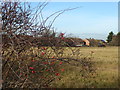
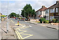
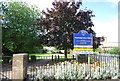
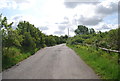
Photos of RM12 5PP


Area Information
RM12 5PP occupies a compact residential cluster covering only 1.2 hectares in England. This small footprint houses 1,508 people, creating a close-knit environment where neighbours are likely to know one another. The high population density of 125,021 people per square kilometre reflects a tightly packed layout typical of established suburban estates. Living in RM12 5PP means navigating a neighbourhood defined by its scale rather than vast open spaces. You will find a community that values stability, evidenced by the fact that the majority of residents have been established here for some time. Daily life revolves around a dedicated network of homes that serve a specific, well-defined group of residents. The area functions as a self-contained residential pocket rather than a sprawling district. Homebuyers seeking a specific postcode with a clear identity will find ample space to walk around without moving far from their doorstep. This concentration of households creates a sense of place that larger municipalities often struggle to replicate.
- Area Type
- Postcode
- Area Size
- 1.2 hectares
- Population
- 1508
- Population Density
- 2928 people/km²
Homes in RM12 5PP reflect a market dominated by private investment rather than private renting. The 83% home ownership rate indicates that the vast majority of properties are occupied by their owners. This statistic places the area firmly in the owner-occupied bracket, which often correlates with lower crime rates and more attentive maintenance. Houses are the standard accommodation type, meaning buyers should expect detached, semi-detached, or terraced family homes rather than high-rise apartments or student lets. This housing mix suggests the area is not a hub for transient professionals or students. Prospective buyers looking at this specific postcode will find a market where sellers often seek replacement homes rather than landlords seeking yield. The density of 125,021 people per square kilometre implies limited opportunity for new large-scale developments within the immediate boundaries. Property values here likely reflect the cost of acquiring a home in a consolidated, owner-stable environment. This structure offers predictability for those entering the market as lifelong residents.
House Prices in RM12 5PP
Showing 20 properties
| Address | Type | Beds | Baths | Last Sale Price | Last Sale Date | |
|---|---|---|---|---|---|---|
| 31 Tangmere Crescent, Hornchurch, RM12 5PP | house | - | - | £477,500 | Dec 2024 | |
| 38 Tangmere Crescent, Hornchurch, RM12 5PP | Terraced | 3 | 1 | £400,000 | Aug 2024 | |
| 40 Tangmere Crescent, Hornchurch, RM12 5PP | Terraced | 4 | 2 | £448,500 | Jan 2024 | |
| 36 Tangmere Crescent, Hornchurch, RM12 5PP | house | - | - | £420,000 | Dec 2022 | |
| 29 Tangmere Crescent, Hornchurch, RM12 5PP | Terraced | 3 | 1 | £218,000 | Dec 2012 | |
| 32 Tangmere Crescent, Hornchurch, RM12 5PP | Terraced | 5 | 3 | - | - | |
| 21 Tangmere Crescent, Hornchurch, RM12 5PP | Terraced | 3 | 1 | - | - | |
| School House, Tangmere Crescent, Hornchurch, RM12 5PP | Detached | - | - | - | - | |
| 23 Tangmere Crescent, Hornchurch, RM12 5PP | Terraced | - | - | - | - | |
| 25 Tangmere Crescent, Hornchurch, RM12 5PP | Terraced | - | - | - | - |
Energy Efficiency in RM12 5PP
Residents of RM12 5PP benefit from immediate access to five retail outlets within practical reach. Notable shopping options include Tesco Hornchurch, Chelmsford Star Co-operative Society Co, and Co-op Elm. These venues provide essential groceries and general store requirements without requiring long journeys. Transport connectivity is robust with five metro stations nearby, including Elm Park Station, Hornchurch, and Dagenham East. Additionally, five rail stations such as Rainham Station, Emerson Park Station, and Upminster Station facilitate travel beyond the immediate borough. This network allows commuters to reach Central London and surrounding areas efficiently. The proximity of these amenities ensures that residents do not need to travel far for daily necessities. Shopping and commuting are integrated into the daily routine with minimal travel time. This level of accessibility defines the convenience life in RM12 5PP.
Amenities
Schools
Families living in RM12 5PP have access to two primary schools within practical reach. Mitchell Junior School serves the local primary education needs. R J Mitchell Primary School also operates in the vicinity and holds a satisfactory Ofsted rating. The presence of these institutions caters specifically to younger children, as the nearby school list does not include secondary or special educational needs colleges. This configuration means that once children complete primary education, they will need to travel to other locations for secondary schooling. The distance to these schools aligns with the residential nature of RM12 5PP, ensuring that children can attend classes without long commutes. Parents will find that local education facilities are integrated into the neighbourhood fabric rather than being distant fixtures. The satisfactory rating of R J Mitchell provides a clear benchmark for quality assurance in the local educational provision.
| Rank | School | Type | Entry gender | Ages |
|---|
Explore more schools in this area
Go to Schools tabDemographics
The community within RM12 5PP is defined by an adult population with a median age of 47 years. Adults between 30 and 64 years old make up the most common age range, indicating a neighbourhood dominated by working families and empty nesters. You will encounter a demographic where stability is key, supported by an impressive 83% home ownership rate. This high figure suggests that the majority of households have established roots in the locality rather than treating it as a short-term rental arrangement. Houses form the predominant accommodation type, meaning you are unlikely to find purpose-built flats or terraced rows in this specific cluster. The resident population is largely white, reflecting a homogeneous community structure. This demographic profile points towards a family-oriented environment where long-term investment in the property is common. The age distribution implies a quiet atmosphere during school holidays and a settled rhythm throughout the week. Younger generations may find a slower pace of life compared to other districts while older residents appreciate the established character.
Household Size
Accommodation Type
Tenure
Ethnic Group
Religion
Household Composition
Age
Household Deprivation
NS-SEC
Explore more demographic insights in this area
Go to Demographics tabPlanning
Planning Constraints
- Flood RiskPremium
- Ramsar Wetland SitesPremium
- Area of Outstanding Natural BeautyPremium
- Protected Nature ReservePremium
- Protected WoodlandPremium