Area Overview for RM12 5PH
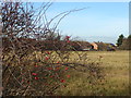
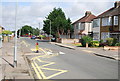
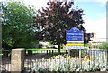
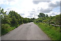
Photos of RM12 5PH


Area Information
RM12 5PH represents a very specific residential cluster within the Hornchurch and Upminster postcode districts. This small area covers just 5,613 square metres, a footprint that accommodates a population of 1,608 people. The density here is exceptionally high at 286,482 people per square kilometre, implying a compact neighbourhood where houses stand close together. Residents of this postcode experience daily life within a concentrated block of homes rather than sprawling across larger properties. The space is limited by definition, making every square metre of living area valuable for families and individuals alike. Living in RM12 5PH means navigating a tight-knit environment where local geography dictates the pace of daily routines. You will find that the immediate surroundings are defined by this specific postcode boundary, which serves as a microcosm of the wider commuter towns nearby. The scale of the area ensures that development and maintenance decisions impact a distinct group of neighbours. Prospective buyers looking at homes in RM12 5PH should recognise that they are entering a defined residential pocket with its own unique demographic character and spatial constraints.
- Area Type
- Postcode
- Area Size
- 5613 m²
- Population
- 1608
- Population Density
- 1888 people/km²
The housing market in RM12 5PH is defined by a nearly exclusive ownership model, as evidenced by the 90% home ownership rate. This statistic indicates that the vast majority of the local housing stock is held by individuals who intend to remain in their property for the foreseeable future. Accommodation types are primarily houses, rather than flats or high-density apartments, which shapes the character of the streets and the internal layout of the homes available. For buyers considering homes in RM12 5PH, this environment means negotiating with owners who are likely well-acquainted with the local market values and the specific nuances of their properties. The small geographic size of 5,613 square metres limits the sheer volume of available stock, meaning transactions may involve a smaller number of listings than found in larger districts. This concentration can create a tight local market where specific properties command attention from a defined group of potential purchasers. When evaluating the area, you will find that the primary competition comes from local families looking to trade up between similar houses nearby. The predominance of owner-occupiers suggests that the area is established and appeals to those seeking root stability rather than rental flexibility.
House Prices in RM12 5PH
Showing 20 properties
| Address | Type | Beds | Baths | Last Sale Price | Last Sale Date | |
|---|---|---|---|---|---|---|
| 8 Fairlop Close, Hornchurch, RM12 5PH | Terraced | 3 | 1 | £443,000 | Mar 2025 | |
| 7 Fairlop Close, Hornchurch, RM12 5PH | Semi-detached | 3 | 1 | £450,000 | Aug 2023 | |
| 22 Fairlop Close, Hornchurch, RM12 5PH | Retail | 3 | 1 | £430,000 | Jul 2022 | |
| 32 Fairlop Close, Hornchurch, RM12 5PH | house | - | - | £350,000 | Dec 2020 | |
| 12 Fairlop Close, Hornchurch, RM12 5PH | Terraced | 3 | 1 | £358,500 | Aug 2020 | |
| 16 Fairlop Close, Hornchurch, RM12 5PH | Terraced | 3 | 1 | £352,500 | Jun 2018 | |
| 14 Fairlop Close, Hornchurch, RM12 5PH | Terraced | 4 | - | £480,000 | Dec 2017 | |
| 20 Fairlop Close, Hornchurch, RM12 5PH | house | - | - | £195,000 | Sep 2009 | |
| 26 Fairlop Close, Hornchurch, RM12 5PH | Terraced | - | - | £197,000 | Nov 2005 | |
| 3 Fairlop Close, Hornchurch, RM12 5PH | Terraced | - | - | £175,000 | Jan 2003 |
Energy Efficiency in RM12 5PH
Amenities within practical reach provide all essential shopping and transport links needed for daily living in RM12 5PH. Retail options include Tesco Hornchurch, Chelmsford Star Co-operative Society Co, and Co-op Elm, offering a straightforward selection of groceries and general merchandise without the need to travel far. Transport connectivity is strong, with five nearby metro stops including Elm Park Station, Hornchurch, and Dagenham East ensuring access to the national rail network. Additionally, five rail stations such as Rainham Station, Emerson Park Station, and Upminster Station provide further flexibility for commuters heading into central London or surrounding counties. You do not need to drive frequently for your weekly shop or your daily commute, as these facilities sit within a short walking distance for many residents. This concentration of services supports the lifestyle of the 90% owner-occupier demographic who value convenience and established neighbourhood infrastructures. The presence of major retailers like Tesco and Co-op ensures that household bills and food requirements are met locally, reducing reliance on online delivery for bulk items.
Amenities
Schools
| Rank | School | Type | Entry gender | Ages |
|---|
Explore more schools in this area
Go to Schools tabDemographics
The community profile for RM12 5PH skews significantly towards older adults, with a median age of 47 years. The most common age range for residents falls between 30 and 64 years, indicating a population that has largely settled into stable family units or retirement phases. Homeownership is the dominant accommodation choice, with 90% of residents owning their properties outright or with a mortgage. This high level of ownership suggests a very stable resident base with little transient population turnover. The predominant ethnic group in this area is White, reflecting the traditional demographic makeup of many South East London and Essex commuter belts. The diversity of the neighbourhood is presented by the fact that the majority of occupants are long-term homeowners rather than renters or students. You can expect a quiet domestic atmosphere where the streets are primarily populated by established families and older couples. The accommodaton type consists mainly of houses, which aligns with the higher age profile and ownership rates. This demographic stability offers a consistent community feel, though the lack of younger age groups might mean fewer children playing on the streets during school hours compared to larger suburban districts.
Household Size
Accommodation Type
Tenure
Ethnic Group
Religion
Household Composition
Age
Household Deprivation
NS-SEC
Explore more demographic insights in this area
Go to Demographics tabPlanning
Planning Constraints
- Flood RiskPremium
- Ramsar Wetland SitesPremium
- Area of Outstanding Natural BeautyPremium
- Protected Nature ReservePremium
- Protected WoodlandPremium