Area Overview for RM12 5ED
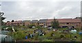
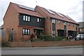
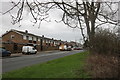
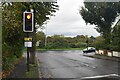
Photos of RM12 5ED


Area Information
Living in RM12 5ED offers a defined residential experience within a compact 7,554 m² cluster. This small postcode serves approximately 1,758 residents, creating a neighbourhood with a noticeable presence despite its modest scale. The density of 232,714 people per km² indicates a tightly packed community where daily interactions remain frequent. You will find yourself in a specific rural or suburban setting where proximity defines the local atmosphere. The area functions as a self-contained unit where neighbours are closer than average. This concentration of households establishes a distinct character compared to sprawling urban developments across Greater London. The small footprint means that local routes are well understood by both residents and visitors. Daily life revolves around the immediate vicinity of the postcode boundary. You do not need to travel far to reach the core of the area. The environment supports a stable population that has settled deeply within these boundaries. The area is recognised as a specific residential cluster rather than a large district. Your daily routine will reflect the compact nature of this settlement.
- Area Type
- Postcode
- Area Size
- 7554 m²
- Population
- 1758
- Population Density
- 7876 people/km²
The property market in RM12 5ED is defined by a 71% home ownership rate, which classifies this area as predominantly owner-occupied. Houses are the main accommodation type, meaning you will rarely find purpose-built flats or terraced flats within this specific boundary. This profile indicates that the housing stock consists of individual detached or semi-detached properties managed by long-term owners. Buying homes here offers the security of dealing with owners who have a vested interest in the area's stability. The low density of rental accommodation suggests that the market does not cater primarily to young professionals or expatriate tenants. Instead, it serves families seeking to put down roots or retired individuals looking for permanence. The 71% ownership figure is a strong indicator that property values are driven by local maintenance and ownership culture rather than rental yield expectations. If you are a first-time buyer targeting this postcode, you face a competitive market with limited inventory. Most transactions involve resale between established homeowners rather than land banking or flipping. The prevalence of houses means that extensions and garden works play a larger role in property appeal. You should expect higher energy bills associated with detached homes compared to flats in central zones. The market reflects a desire for space and privacy over urban convenience. Local agents will report slower turnover rates in this specific sector. The high ownership rate also means that estate management fees are less relevant than they might be in high-rise buildings.
House Prices in RM12 5ED
Showing 23 properties
| Address | Type | Beds | Baths | Last Sale Price | Last Sale Date | |
|---|---|---|---|---|---|---|
| 159 St Andrews Avenue, Hornchurch, RM12 5ED | Semi-detached | 3 | 1 | £440,000 | Apr 2025 | |
| 147 St Andrews Avenue, Hornchurch, RM12 5ED | Terraced | 3 | 1 | £457,000 | Mar 2025 | |
| 145 St Andrews Avenue, Hornchurch, RM12 5ED | Terraced | 4 | 2 | £550,000 | Aug 2022 | |
| 151 St Andrews Avenue, Hornchurch, RM12 5ED | Terraced | 3 | 2 | £380,000 | Apr 2022 | |
| 165 St Andrews Avenue, Hornchurch, RM12 5ED | Terraced | 3 | 1 | £405,000 | Dec 2019 | |
| 155 St Andrews Avenue, Hornchurch, RM12 5ED | house | - | - | £365,000 | Apr 2019 | |
| 161 St Andrews Avenue, Hornchurch, RM12 5ED | Semi-detached | 3 | - | £250,000 | Jul 2013 | |
| 187 St Andrews Avenue, Hornchurch, RM12 5ED | Semi-detached | 5 | 2 | £282,500 | Mar 2006 | |
| 157 St Andrews Avenue, Hornchurch, RM12 5ED | Semi-detached | - | - | £150,000 | Nov 2003 | |
| 179 St Andrews Avenue, Hornchurch, RM12 5ED | Terraced | - | - | £186,995 | Aug 2003 |
Energy Efficiency in RM12 5ED
Daily life in RM12 5ED benefits from accessible amenities including Co-op Elm, Sainsburys Hornchurch Elm, and Tesco Elm within practical reach for shopping. Residents rely on these five local retail outlets for groceries and household essentials. Your errands remain close to home without requiring a long commute to town centres. The area is supported by five metro and rail connection points. You can reach Elm Park Station, Rainham Station, and Emerson Park Station for regional travel. These five stations provide multiple options for daily commuting to London or surrounding counties. Dagenham East and Dagenham Dock Station are also nearby, offering direct links to central employment hubs. The presence of five railway or metro stations significantly reduces travel time compared to areas with fewer transport nodes. You will find dining opportunities and leisure facilities in the wider Hornchurch and Rainham spheres if needed. The proximity of Sainsburys and Tesco means you do not need to shop during peak inbound traffic hours. Co-op Elm serves the immediate neighbourhood with convenience goods. The transport network integrates seamlessly with local bus routes, though specific bus numbers are not listed in the current data. Your lifestyle revolves around the convenience of having major retail chains and rail hubs nearby. The five stations create redundancy in your travel plans if one line experiences delays. You appreciate the choice of destinations available within a short train ride. The retail parks provide essential services without leaving the local authority boundary.
Amenities
Schools
| Rank | School | Type | Entry gender | Ages |
|---|
Explore more schools in this area
Go to Schools tabDemographics
The community in RM12 5ED reflects a mature household profile with a median age of 47 years. Adults between 30 and 64 years constitute the most common age range, suggesting families and established professionals dominate the population. Seventy-one per cent of residents own their homes, indicating high stability and long-term residency rates. Houses form the primary accommodation type, meaning terraced or flat living is rare in this specific postcode. The predominant ethnic group is White, which aligns with the broader demographic trends of East London. You will encounter a neighbourhood where long-standing residents have built deep roots. The high home ownership rate suggests that many properties are passed down or purchased for inheritance purposes. This demographic structure supports a quiet atmosphere rather than a transient student or young professional hub. The age profile implies that local schools serve a secondary age group, while primary education likely draws from neighbouring areas. Families with older children find a suitable environment here. The consistent age range creates social continuity within the streets. You can expect a community where neighbours know each other through generations. The lack of significant young adult presence under thirty suggests a shift away from first-time buyer markets. Residents here prioritise stability over rapid turnover. The household composition supports a demand for larger properties rather than micro-apartments.
Household Size
Accommodation Type
Tenure
Ethnic Group
Religion
Household Composition
Age
Household Deprivation
NS-SEC
Explore more demographic insights in this area
Go to Demographics tabPlanning
Planning Constraints
- Flood RiskPremium
- Ramsar Wetland SitesPremium
- Area of Outstanding Natural BeautyPremium
- Protected Nature ReservePremium
- Protected WoodlandPremium