Area Overview for RM12 5DP
Photos of RM12 5DP
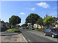
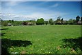
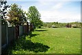
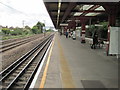
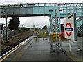
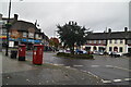
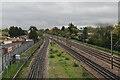
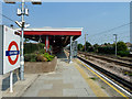
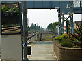
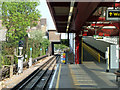
27 photos from this area
Area Information
Key information about the RM12 5DP including its size, population, and administrative classification.
- Area Type
- Postcode
- Area Size
- 6654 m²
- Population
- 1758
- Population Density
- 7876 people/km²
House Prices in RM12 5DP
26
Properties
£254,326
Average Sold Price
£60,000
Lowest Price
£468,000
Highest Price
Showing 26 properties
| Address | Type | Beds | Baths | Last Sale Price | Last Sale Date | |
|---|---|---|---|---|---|---|
| 82 Carnforth Gardens, Hornchurch, RM12 5DP | Terraced | 3 | 1 | £405,000 | Feb 2025 | |
| 122 Carnforth Gardens, Hornchurch, RM12 5DP | Semi-detached | 3 | 2 | £468,000 | May 2023 | |
| 124 Carnforth Gardens, Hornchurch, RM12 5DP | Terraced | - | - | £375,000 | Mar 2022 | |
| 78 Carnforth Gardens, Hornchurch, RM12 5DP | house | - | - | £340,000 | Jan 2017 | |
| 114 Carnforth Gardens, Hornchurch, RM12 5DP | Terraced | 3 | 1 | £292,000 | Oct 2015 | |
| 84 Carnforth Gardens, Hornchurch, RM12 5DP | Terraced | 3 | 1 | £290,000 | Aug 2015 | |
| 118 Carnforth Gardens, Hornchurch, RM12 5DP | house | - | - | £210,000 | Sep 2014 | |
| 120 Carnforth Gardens, Hornchurch, RM12 5DP | Terraced | 3 | - | £290,000 | Jun 2014 | |
| 100 Carnforth Gardens, Hornchurch, RM12 5DP | Terraced | - | - | £169,945 | Mar 2008 | |
| 90 Carnforth Gardens, Hornchurch, RM12 5DP | Terraced | - | - | £232,950 | Jun 2007 |
Page 1 of 3
Energy Efficiency in RM12 5DP
Amenities
Schools
| Rank | School | Type | Entry gender | Ages |
|---|
Explore more schools in this area
Go to Schools tabDemographics
Household Size
Family (3-5 people)
most common
Accommodation Type
Houses
most common
Tenure
71
majority
Ethnic Group
White
most common
Religion
N/A
most common
Household Composition
N/A
most common
Age
47
median
Adults (30-64 years)
most common
Household Deprivation
N/A
with no deprivation
NS-SEC
32
in Lower managerial occupations
Explore more demographic insights in this area
Go to Demographics tabPlanning
Planning Constraints
- Flood RiskPremium
- Ramsar Wetland SitesPremium
- Area of Outstanding Natural BeautyPremium
- Protected Nature ReservePremium
- Protected WoodlandPremium