Area Overview for RM12 4TE
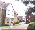
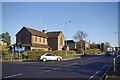
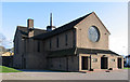
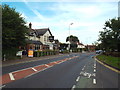
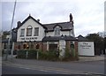
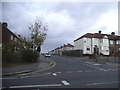
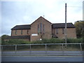
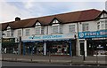
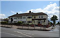
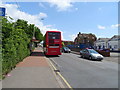
Photos of RM12 4TE


Area Information
RM12 4TE represents a specific residential cluster within the Greater London postcode area, covering a compact 7929 square metres. With a population of 1796 people, this small neighbourhood functions as a dense residential pocket where daily life revolves around immediate community ties rather than sprawling suburbs. The area is entirely defined by its residential character, creating a setting where residents interact frequently within a tightly knit environment. Living in RM12 4TE means navigating a space where every street corner contributes to the overall fabric of the locality. The small physical footprint contrasts sharply with the high concentration of residents, resulting in a neighbourhood that feels more like a village extension than a typical urban district. Prospective buyers should understand that they are entering an established residential zone where the scale of the environment is intimate. This specific postcode serves as a gateway to larger towns while maintaining its own distinct identity as a self-contained living unit. The area does not boast extensive green space or large commercial zones within its immediate boundaries, focusing instead on housing and local convenience. Understanding the true size of this postcode is crucial for managing expectations about walkability and the distance to major facilities.
- Area Type
- Postcode
- Area Size
- 7929 m²
- Population
- 1796
- Population Density
- 3953 people/km²
The property market in RM12 4TE is characterised by established ownership, with 82% of households owning their homes. This figure clearly identifies the area as a long-term settlement rather than a transient rental zone. Houses serve as the predominant accommodation type, suggesting that buyers will look for single-family residences rather than flats or conversions. The high rate of home ownership typically indicates a mature housing stock where properties have been inhabited for extended periods. When searching for homes in RM12 4TE, you should expect to find traditional family homes that have stood the test of time. The small total area of 7929 square metres limits the overall volume of available properties, which can increase competition for specific listings. Potential buyers must act decisively when viewing houses in this postcode, as the market does not cater to high-volume turnover. The absence of significant rental activity means that the local estate market focuses almost exclusively on owner-purchasers exchanging properties at their own pace. This dynamic supports a stable valuation environment where property prices reflect long-term worth rather than short-term rental yields.
House Prices in RM12 4TE
Showing 35 properties
Energy Efficiency in RM12 4TE
Lifestyle convenience in RM12 4TE relies heavily on a well-connected network of retail and transport hubs located in the immediate vicinity. You have access to five retail options including The Southern Co-operative Co-op, Tesco Romford, and Lidl Hornchurch, allowing you to cover most shopping needs without extensive travel. Transport links are robust, with five railway stations nearby including Emerson Park Station, Gidea Park Station, and Upminster Station. Additionally, five metro options are within reach, such as Elm Park Station, Hornchurch, and Upminster Bridge. This density of transport nodes means daily commutes to London or other business districts are practical and time-efficient. Residents do not need a private vehicle to access major shopping centres or employment zones, as the nearby stations provide frequent service. The presence of multiple supermarkets creates a competitive local market where you can choose between different pricing structures and product ranges. Daily errands remain simple, requiring minimal travel time to complete essential shopping and transit activities.
Amenities
Schools
| Rank | School | Type | Entry gender | Ages |
|---|
Explore more schools in this area
Go to Schools tabDemographics
The community in RM12 4TE reflects a mature population with a median age of 47 years. Adults aged between 30 and 64 years form the most common age range, indicating that the area attracts professionals and families in their mid-life years rather than young students or retirees. Home ownership stands at a striking 82%, which confirms that this is fundamentally an owner-occupied neighbourhood. Houses dominate the accommodation type profile, meaning you will find standalone properties rather than apartments or flat conversions. The predominant ethnic group is White, shaping the cultural character of the local shops and community activities. This demographic profile suggests stability, as high home ownership rates often correlate with long-term residents who are invested in their local streets. With two-thirds of the population in the prime working age bracket, there is significant demand for amenities that suit active adults. The housing stock supports families who have moved beyond the early renting stages of life into permanent settlement. The lack of significant young adult or elderly populations creates a balanced environment without the extremes of a university town or a retirement village.
Household Size
Accommodation Type
Tenure
Ethnic Group
Religion
Household Composition
Age
Household Deprivation
NS-SEC
Explore more demographic insights in this area
Go to Demographics tabPlanning
Planning Constraints
- Flood RiskPremium
- Ramsar Wetland SitesPremium
- Area of Outstanding Natural BeautyPremium
- Protected Nature ReservePremium
- Protected WoodlandPremium