Area Overview for RM12 4SP
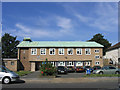
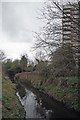
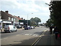
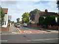
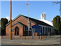
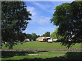
Photos of RM12 4SP


Area Information
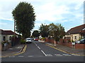
Living in RM12 4SP means residing in a compact residential cluster covering just 1.2 hectares. This specific postcode serves exactly 1,548 people, creating a neighbourhood where residents know one another. The high population density of 133,430 people per square kilometre suggests a tightly knit community rather than a sprawling suburb. You will find homes here are predominantly houses, forming a traditional street pattern typical of this small estate. The area stands apart from larger commercial centres, focusing solely on residential needs within a defined boundary. Daily life revolves around walking to nearby stations and local shops, as the area is designed for convenience rather than expansion. There are no sprawling parks or large green spaces within the immediate cluster; instead, the value lies in its proximity to the wider network. You enter a setting where the built environment is already fully realised, eliminating the uncertainty of undeveloped land. This established footprint provides a sense of stability that appeals to those seeking a quiet address away from traffic chaos.
- Area Type
- Postcode
- Area Size
- 1.2 hectares
- Population
- 1548
- Population Density
- 5480 people/km²
The property market in RM12 4SP is defined by a consistent stock of houses and exceptionally high ownership rates. With 82% of households owning their homes, you will find a landscape where buyers have already settled into the area with permanence. This figure contrasts sharply with areas dominated by private rentals, suggesting stable tenancy and lower turnover. The accommodation type confirms that this postcode is almost exclusively residential, consisting of houses rather than flats or modern conversions. When you look at homes in this cluster, you are viewing properties that have formed part of the permanent fabric of the neighbourhood. The small area size of 1.2 hectares means supply is finite, creating a distinct market dynamic within this specific cluster. Buyers should expect to face competition, as the number of available properties in such a tight space is inherently limited. The high ownership score also implies that buying in this specific area often requires entering a chain or purchasing directly from other current owners.
House Prices in RM12 4SP
Showing 37 properties
| Address | Type | Beds | Baths | Last Sale Price | Last Sale Date | |
|---|---|---|---|---|---|---|
| 31 Elm Park Avenue, Hornchurch, RM12 4SP | Terraced | 3 | 1 | £400,000 | Jul 2024 | |
| 53 Elm Park Avenue, Hornchurch, RM12 4SP | Terraced | 2 | 1 | £365,000 | Jul 2023 | |
| 51 Elm Park Avenue, Hornchurch, RM12 4SP | Retail | 2 | 1 | £325,000 | Aug 2022 | |
| 36 Elm Park Avenue, Hornchurch, RM12 4SP | Terraced | 3 | 1 | £450,000 | Jun 2022 | |
| 14 Elm Park Avenue, Hornchurch, RM12 4SP | Terraced | 3 | 1 | £330,000 | Feb 2021 | |
| 29 Elm Park Avenue, Hornchurch, RM12 4SP | Terraced | 3 | 1 | £375,000 | Sep 2020 | |
| 3 Elm Park Avenue, Hornchurch, RM12 4SP | Detached | 2 | 1 | £369,000 | Jul 2019 | |
| 35 Elm Park Avenue, Hornchurch, RM12 4SP | Terraced | 3 | 2 | £315,000 | Jan 2018 | |
| 28 Elm Park Avenue, Hornchurch, RM12 4SP | Terraced | 2 | 1 | £320,000 | Oct 2017 | |
| 11 Elm Park Avenue, Hornchurch, RM12 4SP | house | 3 | - | £285,000 | Aug 2016 |
Energy Efficiency in RM12 4SP
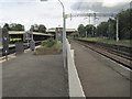
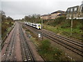
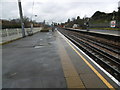
Your daily routine in RM12 4SP benefits from five major retail outlets located within practical reach. You can shop at Tesco Elm, Sainsburys Hornchurch Elm, and Co-op Elm for your weekly groceries and household needs. These supermarkets provide a full range of shopping options without requiring a long drive. Public transport is equally well served, with five metro stations and five railway stations accessible from the area. You can catch trains at Elm Park Station, Gidea Park Station, Emerson Park Station, Upminster Station, and Hornchurch for connections to central London and other destinations. Traveling to Upminster Bridge also offers useful interchange options. This density of transport hubs means you have multiple choices depending on your destination or train times. The proximity of these stations ensures that commuting does not consume a significant portion of your day, giving you more time for home and leisure.
Amenities
Schools
Families living in RM12 4SP have access to a mix of primary and secondary education options nearby. Two primary schools serve the immediate vicinity: Benhurst Primary School and Abbs Cross School and Arts College. Both institutions hold a good Ofsted rating, assuring parents of quality early education. For older children, Abbs Cross Academy and Arts College operates as an academy and also holds a good rating. This cluster of good-rated schools means you do not need to travel far for reputable education. The presence of both primary and academy options provides flexibility for children as they advance through their schooling years. You can expect the local schools to maintain high standards given their recent inspections and ratings. The concentration of good-rated institutions near RM12 4SP makes this a practical choice for parents prioritising educational quality without long commutes.
| Rank | School | Type | Entry gender | Ages |
|---|
Explore more schools in this area
Go to Schools tabDemographics
The community in RM12 4SP reflects an older demographic profile suited to established families or downsizers. The median age stands at 47 years, placing the area squarely within the adult bracket of 30 to 64 years. This age distribution indicates a stable population likely focused on long-term settlement rather than transient living. Home ownership is markedly high at 82%, confirming that most residents have bought into the area permanently. You will encounter fewer landlords and more people living in properties they own outright or have a significant stake in. The predominant ethnic group is White, mirroring the broader demographic trends of the surrounding wards. Accommodation consists entirely of houses, reinforcing the character of a family-oriented or senior-led neighbourhood. The high rate of ownership correlates with the older age group, suggesting many residents have lived here for decades. There is minimal data on income deprivation, but the combination of high ownership and mature age points toward a settled, traditional community structure without the volatility of a high-turnover rental market.
Household Size
Accommodation Type
Tenure
Ethnic Group
Religion
Household Composition
Age
Household Deprivation
NS-SEC
Explore more demographic insights in this area
Go to Demographics tabPlanning
Planning Constraints
- Flood RiskPremium
- Ramsar Wetland SitesPremium
- Area of Outstanding Natural BeautyPremium
- Protected Nature ReservePremium
- Protected WoodlandPremium