Area Overview for RM12 4SA
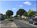
Photos of RM12 4SA
Area Information
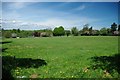
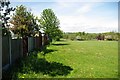
RM12 4SA stands as a specific residential cluster within the London postcodes, covering a total area of 2311 square metres. This small geographical footprint supports a population of 1343 people, creating a community where neighbours are likely to know one another. You can expect a neighbourhood defined by high density, with 581021 people per square kilometre, suggesting a compact living environment. Although the location covers a limited physical space, it functions as a stable residential zone where long-term residents have established roots. Living in this postcode means engaging with a settled community rather than a developing or transient district. The area is situated in England, and its size indicates that local resources are proximate to individual homes. You should approach this location with the understanding that it is a distinct, small-scale residential unit rather than a vast suburb.
- Area Type
- Postcode
- Area Size
- 2311 m²
- Population
- 1343
- Population Density
- 5896 people/km²
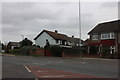
Homes in RM12 4SA reflect a market dominated by owner-occupiers rather than landlords or temporary rentals. A staggering 76% of the housing stock is owner-occupied, which points to a stable and established property market. The accommodation type consists entirely of houses, indicating that this specific postcode does not include flats or apartments. This means you are looking at a traditional housing environment rather than a modern high-density build. For buyers, this translates to a distinctively residential feel without the noise or crowds associated with apartment blocks. The low rental proportion suggests a community where families have purchased their homes and settled down. When considering this location, remember that the market is driven by people who own their bricks and mortar. This creates a neighbourhood where long-term investment and family stability are the norm.
House Prices in RM12 4SA
Showing 12 properties
| Address | Type | Beds | Baths | Last Sale Price | Last Sale Date | |
|---|---|---|---|---|---|---|
| 16, Flat 1, Elm Parade, Elm Park Avenue, Hornchurch, RM12 4SA | Retail | 1 | 1 | - | - | |
| The Fat Pizza, 18, Elm Parade Shops, Elm Park Avenue, Hornchurch, RM12 4SA | shop | - | - | - | - | |
| Your Vape Store, 14, Elm Parade Shops, Elm Park Avenue, Hornchurch, RM12 4SA | restaurant_cafe | - | - | - | - | |
| The Carpet Gallery, 22, Elm Parade Shops, Elm Park Avenue, Hornchurch, RM12 4SA | retail_financial | - | - | - | - | |
| Omar's, 25-26, Elm Parade Shops, Elm Park Avenue, Hornchurch, RM12 4SA | retail_financial | - | - | - | - | |
| Cancer Research Uk, 15, Elm Parade Shops, Elm Park Avenue, Hornchurch, RM12 4SA | retail_financial | - | - | - | - | |
| Happy Family, 23, Elm Parade Shops, Elm Park Avenue, Hornchurch, RM12 4SA | shop | - | - | - | - | |
| 17, Elm Parade Shops, Elm Park Avenue, Hornchurch, RM12 4SA | retail_financial | - | - | - | - | |
| Nemo's Plaice, 24, Elm Parade Shops, Elm Park Avenue, Hornchurch, RM12 4SA | restaurant_cafe | - | - | - | - | |
| Alluring Nail Bar Limited, 16, Elm Parade, Elm Park Avenue, Hornchurch, RM12 4SA | shop | - | - | - | - |
Energy Efficiency in RM12 4SA
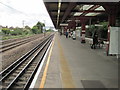
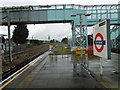
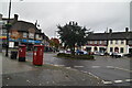
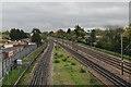
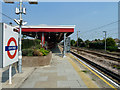
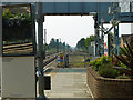
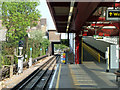
Your daily life in RM12 4SA benefits from a variety of amenities within practical reach. For your grocery shopping needs, Tesco Elm, Sainsburys Hornchurch Elm, and Co-op Elm are available as nearby retail options. These stores provide essential goods without requiring a long journey elsewhere. Your commute options are extensive, featuring five nearby metro stations including Elm Park Station, Hornchurch, and Dagenham East. You also have access to five rail stations such as Emerson Park Station, Gidea Park Station, and Upminster Station. This transport network provides flexibility for travel across London and surrounding areas. The concentration of shops near Elm and the abundance of train and tube stations mean you can access work and leisure destinations quickly. Living in this area gives you the convenience of urban transport links while residing in a compact residential cluster.
Amenities
Schools
| Rank | School | Type | Entry gender | Ages |
|---|
Explore more schools in this area
Go to Schools tabDemographics
The community within RM12 4SA is characterised by stability, with a median age of 47 years. Most residents fall into the adult age range of 30 to 64 years, indicating a population of mature households and families. Home ownership is the dominant housing tenure, standing at 76% of all dwellings. This high rate suggests a neighbourhood where people buy their properties rather than rent them. Accodmmodation types are exclusively houses, meaning you will not find flats or apartments in this specific postcode. The predominant ethnic group is White, reflecting the demographic composition of the area. With such a high percentage of owner-occupied homes and a specific age profile, the area likely fosters a quiet, established atmosphere. You can expect a community where residents have invested heavily in their local surroundings and intend to remain for the long term.
Household Size
Accommodation Type
Tenure
Ethnic Group
Religion
Household Composition
Age
Household Deprivation
NS-SEC
Explore more demographic insights in this area
Go to Demographics tabPlanning
Planning Constraints
- Flood RiskPremium
- Ramsar Wetland SitesPremium
- Area of Outstanding Natural BeautyPremium
- Protected Nature ReservePremium
- Protected WoodlandPremium