Area Overview for RM12 4PA
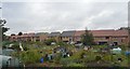
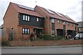
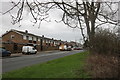
Photos of RM12 4PA


Area Information
Living in RM12 4PA offers a quiet residential experience within a compact community. This specific postcode covers a small cluster spanning 8,968 square metres. The area accommodates a population of 1,810 residents across densely arranged housing. With a population density of 1,624 people per square kilometre, this section of East London feels intimate yet connected. You will find a neighbourhood where daily routines are shaped by close proximity to local facilities and frequent rail access. The physical size of this postcode area ensures that distances between homes and amenities remain short. Residents move through streets that serve a defined group of over one thousand eight hundred souls. The character of RM12 4PA is defined by its status as a residential pocket rather than a sprawling suburb. This concentration creates a strong sense of locality while maintaining easy access to wider transport networks in Hornchurch, Rainham, and the surrounding regions.
- Area Type
- Postcode
- Area Size
- 8968 m²
- Population
- 1810
- Population Density
- 1624 people/km²
The property market in RM12 4PA is dominated by owner-occupied homes rather than rental developments. Data confirms that 81% of households are owner-occupied, creating a distinct seller's market dynamic. The majority of accommodation types consist of houses, meaning buyers looking for flats or purpose-built apartments will face limited options within this postcode. This housing stock typically appeals to families and established professionals seeking space and permanence. Purchase transactions within RM12 4PA usually involve existing homes rather than planned new builds or speculative investment projects. The sheer number of homeowners means that price fluctuations often reflect longer-term investment trends rather than short-term rental yields. You will findёл estate where price history is determined by individual house sales rather than block-wide valuation updates. This structure provides security for buyers but may require patience when searching for specific house types or price points within the local cluster.
House Prices in RM12 4PA
Showing 12 properties
Energy Efficiency in RM12 4PA
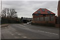
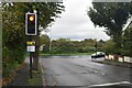
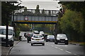
Daily life in RM12 4PA benefits from a concentrated array of nearby amenities within practical reach. Five metro stations serve the immediate region, including Elm Park Station, Dagenham East, and Hornchurch, facilitating easy travel into central London and beyond. Retail options include three major supermarkets: Sainsburys Hornchurch Elm, Co-op Elm, and Tesco Elm ensure groceries are easily accessible. Beyond groceries, the area is a rail hub with connections to Emerson Park Station, Rainham Station, and Dagenham Dock Station. These five rail stations provide robust frequency and variety for commuters. You can walk to essentials like fresh produce, household goods, and daily perishables without needing a vehicle for short runs. The presence of multiple transport terminals means you can switch between rail and metro lines depending on your destination. This network supports both local convenience and regional travel, making RM12 4PA well connected despite its residential focus.
Amenities
Schools
Families living in RM12 4PA have access to specific educational institutions nearby. Dunningford Primary School is the only primary school listed in the immediate vicinity for this postcode. This single primary option shapes the school catchment dynamics for local families. For secondary education, no additional schools are listed within the provided data for RM12 4PA. This absence indicates that secondary school choices likely extend beyond the immediate neighbourhood boundaries. Parents must look further afield for comprehensive or high schools outside this specific postcode cluster. Having one named primary option means less competition for local spots compared to areas with multiple institutions. The simplicity of the options means straightforward choices for parents moving into the area. You should verify catchment areas for any school located in nearby postcodes, as this small residential cluster relies on external networks for older children's education.
| Rank | School | Type | Entry gender | Ages |
|---|
Explore more schools in this area
Go to Schools tabDemographics
The community in RM12 4PA is defined by a mature and stable resident base. The median age stands at 47 years, with adults aged between 30 and 64 years being the most common age range. This demographic profile suggests an area settled by families, professionals, or retirees rather than young students or transient workers. Home ownership is exceptionally prevalent, accounting for 81% of all households. This high figure indicates that most residents have long-term investment in their properties rather than living as tenants. Primary accommodation consists of houses, reflecting a preference for detached or semi-detached living over high-density flats. The predominant ethnic group is White, mirroring the traditional housing stock found across much of East London. With such a high ownership rate and an older population, the neighbourhood prioritises stability over rapid change. You can expect a environment where neighbours often know one another through shared property investment and long-term residence.
Household Size
Accommodation Type
Tenure
Ethnic Group
Religion
Household Composition
Age
Household Deprivation
NS-SEC
Explore more demographic insights in this area
Go to Demographics tabPlanning
Planning Constraints
- Flood RiskPremium
- Ramsar Wetland SitesPremium
- Area of Outstanding Natural BeautyPremium
- Protected Nature ReservePremium
- Protected WoodlandPremium