Area Overview for RM12 4NF
Photos of RM12 4NF
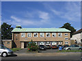
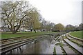
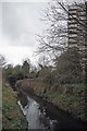
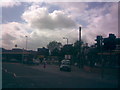
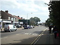
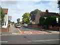
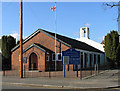
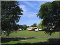
48 photos from this area
Area Information
Key information about the RM12 4NF including its size, population, and administrative classification.
- Area Type
- Postcode
- Area Size
- 8189 m²
- Population
- 1512
- Population Density
- 4992 people/km²
House Prices in RM12 4NF
23
Properties
£309,984
Average Sold Price
£97,750
Lowest Price
£550,000
Highest Price
Showing 23 properties
| Address | Type | Beds | Baths | Last Sale Price | Last Sale Date | |
|---|---|---|---|---|---|---|
| 65 Suttons Avenue, Hornchurch, RM12 4NF | Semi-detached | 3 | 1 | £550,000 | Dec 2025 | |
| 57 Suttons Avenue, Hornchurch, RM12 4NF | Semi-detached | 3 | 2 | £540,000 | Jun 2022 | |
| 92 Suttons Avenue, Hornchurch, RM12 4NF | Semi-detached | 3 | 1 | £420,000 | Mar 2021 | |
| 94 Suttons Avenue, Hornchurch, RM12 4NF | Semi-detached | 3 | 1 | £445,000 | Dec 2019 | |
| 45 Suttons Avenue, Hornchurch, RM12 4NF | Semi-detached | 3 | - | £545,000 | Dec 2019 | |
| 61 Suttons Avenue, Hornchurch, RM12 4NF | Semi-detached | 4 | 1 | £425,000 | Nov 2018 | |
| 51 Suttons Avenue, Hornchurch, RM12 4NF | Semi-detached | 3 | - | £360,000 | Oct 2014 | |
| 63 Suttons Avenue, Hornchurch, RM12 4NF | house | - | - | £237,000 | Dec 2012 | |
| 98 Suttons Avenue, Hornchurch, RM12 4NF | Detached | - | - | £295,000 | Jun 2006 | |
| 78 Suttons Avenue, Hornchurch, RM12 4NF | Semi-detached | 3 | 1 | £244,500 | Mar 2006 |
Page 1 of 3
Energy Efficiency in RM12 4NF
Amenities
Schools
| Rank | School | Type | Entry gender | Ages |
|---|
Explore more schools in this area
Go to Schools tabDemographics
Household Size
One person
most common
Accommodation Type
Houses
most common
Tenure
74
majority
Ethnic Group
White
most common
Religion
N/A
most common
Household Composition
N/A
most common
Age
47
median
Adults (30-64 years)
most common
Household Deprivation
N/A
with no deprivation
NS-SEC
34
in Lower managerial occupations
Explore more demographic insights in this area
Go to Demographics tabPlanning
Planning Constraints
- Flood RiskPremium
- Ramsar Wetland SitesPremium
- Area of Outstanding Natural BeautyPremium
- Protected Nature ReservePremium
- Protected WoodlandPremium