Area Overview for RM12 4LT
Photos of RM12 4LT
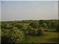
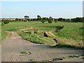
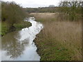
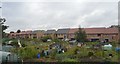
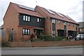
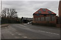
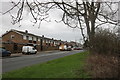
41 photos from this area
Area Information
Key information about the RM12 4LT including its size, population, and administrative classification.
- Area Type
- Postcode
- Area Size
- 1.1 hectares
- Population
- 1810
- Population Density
- 1624 people/km²
House Prices in RM12 4LT
15
Properties
£271,273
Average Sold Price
£92,000
Lowest Price
£380,000
Highest Price
Showing 15 properties
| Address | Type | Beds | Baths | Last Sale Price | Last Sale Date | |
|---|---|---|---|---|---|---|
| 5 Singleton Close, Hornchurch, RM12 4LT | Terraced | 4 | 2 | £375,000 | Sep 2021 | |
| 9 Singleton Close, Hornchurch, RM12 4LT | house | - | - | £355,000 | Jun 2021 | |
| 8 Singleton Close, Hornchurch, RM12 4LT | house | - | - | £380,000 | Oct 2018 | |
| 11 Singleton Close, Hornchurch, RM12 4LT | Semi-detached | 4 | - | £365,000 | Sep 2018 | |
| 13 Singleton Close, Hornchurch, RM12 4LT | house | - | - | £295,000 | Jul 2015 | |
| 12 Singleton Close, Hornchurch, RM12 4LT | house | - | - | £235,000 | Jan 2013 | |
| 4 Singleton Close, Hornchurch, RM12 4LT | Semi-detached | 4 | 2 | £250,000 | Jul 2010 | |
| 10 Singleton Close, Hornchurch, RM12 4LT | house | 4 | - | £215,000 | Sep 2007 | |
| 1 Singleton Close, Hornchurch, RM12 4LT | house | - | - | £227,000 | Jul 2006 | |
| 2 Singleton Close, Hornchurch, RM12 4LT | Semi-detached | - | - | £195,000 | Sep 2003 |
Page 1 of 2
Energy Efficiency in RM12 4LT
Amenities
Schools
| Rank | School | Type | Entry gender | Ages |
|---|
Explore more schools in this area
Go to Schools tabDemographics
Household Size
Family (3-5 people)
most common
Accommodation Type
Houses
most common
Tenure
81
majority
Ethnic Group
White
most common
Religion
N/A
most common
Household Composition
N/A
most common
Age
47
median
Adults (30-64 years)
most common
Household Deprivation
N/A
with no deprivation
NS-SEC
35
in Lower managerial occupations
Explore more demographic insights in this area
Go to Demographics tabPlanning
Planning Constraints
- Flood RiskPremium
- Ramsar Wetland SitesPremium
- Area of Outstanding Natural BeautyPremium
- Protected Nature ReservePremium
- Protected WoodlandPremium