Area Overview for RM12 4HJ
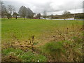
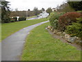
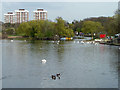
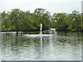
Photos of RM12 4HJ


Area Information
RM12 4HJ occupies a compact residential cluster covering just over one hectare. This small footprint defines a tightly knit environment where neighbours are likely to know one another. The population stands at 1,931 people, creating a distinct pocket within the wider Romford and Hornchurch corridor. Daily life here moves at a deliberate pace compared to sprawling metropolitan developments. Residents enjoy the space of a residential zone without the isolation found in more remote locations. The area functions as a self-contained community within the borough of Havering. Living in RM12 4HJ means accessing big-town amenities while remaining in a quiet, settled environment. The postcode serves a specific cluster of homes that benefits from established infrastructure. You will find yourself part of a group where individual households often own their properties outright. This stability contributes to the overall character of the area. It is a place where practicality meets community, offering a slice of suburban life that is both accessible and secure. The scale of the area allows for strong local cohesion while still integrating seamlessly with surrounding transport networks and services.
- Area Type
- Postcode
- Area Size
- 1.1 hectares
- Population
- 1931
- Population Density
- 4523 people/km²
Homes in RM12 4HJ are characterised by a market where ownership is the default position. With 86% of residents owning their homes, the area operates as a classic owner-occupied community. This high rate of ownership typically stabilises property values and reduces the churn of short-term tenancies. The accommodation type is overwhelmingly houses, meaning you will find detached, semi-detached, or terraced homes rather than flats or blocks of purpose-built apartments. This housing mix appeals to those seeking privacy and traditional suburban living. Buyers looking at this small area will find a stock designed for individual families rather than generational living or rental investment. The presence of such a high ownership rate often indicates a neighbourhood where buy-to-let investors have a minimal presence. Consequently, tenants in the area are likely to be long-term residents rather than transient occupants. For a buyer entering this market, competition may be higher as properties tend to stay with the same families for extended periods. The housing stock offers a reliable foundation for building equity.
House Prices in RM12 4HJ
Showing 34 properties
| Address | Type | Beds | Baths | Last Sale Price | Last Sale Date | |
|---|---|---|---|---|---|---|
| 51 Chestnut Avenue, Hornchurch, RM12 4HJ | Terraced | 2 | 1 | £400,000 | Aug 2025 | |
| 49 Chestnut Avenue, Hornchurch, RM12 4HJ | Terraced | 3 | 1 | £435,000 | Dec 2024 | |
| 76A Chestnut Avenue, Hornchurch, RM12 4HJ | Terraced | 3 | 2 | £500,000 | Jan 2024 | |
| 57 Chestnut Avenue, Hornchurch, RM12 4HJ | Terraced | 2 | 1 | £370,000 | Jul 2023 | |
| 50 Chestnut Avenue, Hornchurch, RM12 4HJ | Terraced | 3 | - | £400,000 | Jan 2021 | |
| 64 Chestnut Avenue, Hornchurch, RM12 4HJ | Terraced | 4 | 2 | £480,000 | Jan 2018 | |
| 46 Chestnut Avenue, Hornchurch, RM12 4HJ | house | - | - | £525,000 | Mar 2017 | |
| 67 Chestnut Avenue, Hornchurch, RM12 4HJ | Terraced | 3 | - | £361,000 | Oct 2016 | |
| 70 Chestnut Avenue, Hornchurch, RM12 4HJ | house | - | - | £335,000 | Jul 2016 | |
| 73 Chestnut Avenue, Hornchurch, RM12 4HJ | Terraced | 3 | - | £267,000 | Oct 2013 |
Energy Efficiency in RM12 4HJ
Your daily routine in RM12 4HJ is supported by a range of amenities within practical walking or short driving distance. You have access to five retail locations including Tesco Romford, The Southern Co-operative Co-op, and Tesco Elm. These supermarkets stock your weekly essentials and offer wider product ranges than typical local corner shops. For travel, five metro stations hang close by, specifically Elm Park Station, Hornchurch, and Dagenham East. Additionally, five rail stations such as Emerson Park and Gidea Park provide direct train connections. This density of services means you rarely need to venture far for groceries or travel. The proximity of Tesco Romford in particular offers convenience for large households. Dining and leisure options are accessible through these retail parks and station areas. You gain the benefits of a larger town's offerings without being overwhelmed by city centre traffic. The listed amenities ensure that your practical needs are met efficiently. Residents can easily reach these points of interest for quick errands or planned shopping trips.
Amenities
Schools
| Rank | School | Type | Entry gender | Ages |
|---|
Explore more schools in this area
Go to Schools tabDemographics
The community in RM12 4HJ reflects a settled population with a median age of 47 years. This figure indicates a neighbourhood dominated by adults between the ages of 30 and 64. Families with children and established professionals form the core of this demographic profile. Home ownership stands at an exceptionally high level of 86%, suggesting long-term residents who have put down roots. This percentage far exceeds national averages for owner-occupation. The housing stock consists primarily of houses, which aligns with the preference for private gardens and separate living spaces common in this age group. The predominant ethnic group is white, mirroring broader patterns in certain sectors of east London. This demographic consistency fosters a shared cultural understanding among neighbours. You can expect a community where stability and continuity are the norm. The combination of older residents and working-age professionals creates a balanced environment. There are few young families or transient populations recorded in the primary data for this postcode. This demographic structure supports local businesses that cater to mature households and established workers.
Household Size
Accommodation Type
Tenure
Ethnic Group
Religion
Household Composition
Age
Household Deprivation
NS-SEC
Explore more demographic insights in this area
Go to Demographics tabPlanning
Planning Constraints
- Flood RiskPremium
- Ramsar Wetland SitesPremium
- Area of Outstanding Natural BeautyPremium
- Protected Nature ReservePremium
- Protected WoodlandPremium