Area Overview for RM12 4BT
Photos of RM12 4BT
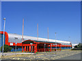
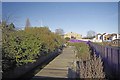
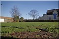
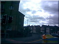
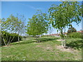
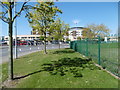

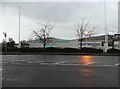
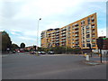
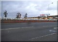
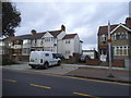
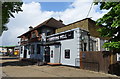
36 photos from this area
Area Information
Key information about the RM12 4BT including its size, population, and administrative classification.
- Area Type
- Postcode
- Area Size
- 1.7 hectares
- Population
- 1725
- Population Density
- 5859 people/km²
House Prices in RM12 4BT
39
Properties
£361,945
Average Sold Price
£80,000
Lowest Price
£615,000
Highest Price
Showing 39 properties
| Address | Type | Beds | Baths | Last Sale Price | Last Sale Date | |
|---|---|---|---|---|---|---|
| 25 Shelley Avenue, Hornchurch, RM12 4BT | Terraced | 3 | 2 | £465,000 | Jul 2024 | |
| 28 Shelley Avenue, Hornchurch, RM12 4BT | Terraced | 3 | 1 | £405,000 | May 2024 | |
| 16 Shelley Avenue, Hornchurch, RM12 4BT | Retail | 3 | 1 | £527,000 | Sep 2022 | |
| 15 Shelley Avenue, Hornchurch, RM12 4BT | Retail | 4 | 1 | £615,000 | Jun 2022 | |
| 10 Shelley Avenue, Hornchurch, RM12 4BT | house | - | - | £430,000 | Feb 2022 | |
| 14 Shelley Avenue, Hornchurch, RM12 4BT | Retail | 4 | 1 | £545,000 | Dec 2021 | |
| 31 Shelley Avenue, Hornchurch, RM12 4BT | Semi-detached | 5 | 2 | £468,000 | Nov 2021 | |
| 42 Shelley Avenue, Hornchurch, RM12 4BT | Semi-detached | 3 | 2 | £550,000 | Oct 2021 | |
| 20 Shelley Avenue, Hornchurch, RM12 4BT | Semi-detached | 4 | - | £550,000 | Aug 2021 | |
| 30 Shelley Avenue, Hornchurch, RM12 4BT | house | - | - | £350,000 | Feb 2021 |
Page 1 of 4
Energy Efficiency in RM12 4BT
Amenities
Schools
| Rank | School | Type | Entry gender | Ages |
|---|
Explore more schools in this area
Go to Schools tabDemographics
Household Size
Family (3-5 people)
most common
Accommodation Type
Houses
most common
Tenure
88
majority
Ethnic Group
White
most common
Religion
N/A
most common
Household Composition
N/A
most common
Age
47
median
Adults (30-64 years)
most common
Household Deprivation
N/A
with no deprivation
NS-SEC
36
in Lower managerial occupations
Explore more demographic insights in this area
Go to Demographics tabPlanning
Planning Constraints
- Flood RiskPremium
- Ramsar Wetland SitesPremium
- Area of Outstanding Natural BeautyPremium
- Protected Nature ReservePremium
- Protected WoodlandPremium