Area Overview for RM11 3TS
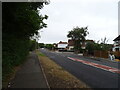
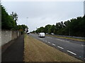
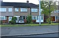
Photos of RM11 3TS

Area Information
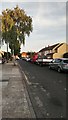
RM11 3TS represents a specific residential cluster within the Greater London area, characterised by its distinct campus footprint. This small postcode covers exactly 6,657 square metres and houses a defined population of 1,488 people. You are looking at a compact environment with very high density, as the figure of 223,518 people per square kilometre indicates close proximity between homes in RM11 3TS. While the area size is modest, it functions as a practical living space where daily life revolves around immediate proximity to key local services and transport links. Living in RM11 3TS means you settle into a neighbourhood where the built environment is tightly packed around essential amenities. This concentration allows for easy access to shops, stations, and schools without needing long commutes to reach the basics. The area is situated in England, serving as a functional part of the broader housing market that prioritises accessibility and integration with surrounding districts. Residents find their daily routine centred on the convenience of having fundamental services within immediate reach.
- Area Type
- Postcode
- Area Size
- 6657 m²
- Population
- 1488
- Population Density
- 1758 people/km²
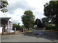
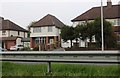
This postcode area functions almost entirely as an established residential zone where houses make up the accommodation type. With 83% of residents being owner-occupiers, the housing stock in RM11 3TS is defined by long-term stability rather than short-term tenancies. This high ownership percentage typically implies fewer landlord-tenant interactions and a community where people have put down roots. You will find that homes in RM11 3TS are primarily single-family properties rather than purpose-built flats. The fact that the area covers a small footprint of 6,657 square metres yet accommodates 1,488 people suggests that the built environment is dense despite the house-based accommodation type. For buyers considering this location, the market is characterised by independent detached or semi-detached homes. The low rate of rental properties here means you are more likely to purchase a property where the previous owner has lived for many years. This dynamic often results in well-maintained properties and a lack of speculative buying activity.
House Prices in RM11 3TS
Showing 22 properties
| Address | Type | Beds | Baths | Last Sale Price | Last Sale Date | |
|---|---|---|---|---|---|---|
| 2 Owlets Hall Close, Hornchurch, RM11 3TS | Flat | - | - | £280,000 | Nov 2022 | |
| 22 Owlets Hall Close, Hornchurch, RM11 3TS | Terraced | 3 | - | £437,500 | Oct 2022 | |
| 17 Owlets Hall Close, Hornchurch, RM11 3TS | Terraced | 3 | - | £440,000 | May 2022 | |
| 18 Owlets Hall Close, Hornchurch, RM11 3TS | Terraced | 3 | 1 | £405,000 | Mar 2022 | |
| 6 Owlets Hall Close, Hornchurch, RM11 3TS | Flat | - | - | £260,000 | Dec 2021 | |
| 16 Owlets Hall Close, Hornchurch, RM11 3TS | Terraced | 3 | - | £360,000 | Aug 2020 | |
| 11 Owlets Hall Close, Hornchurch, RM11 3TS | Terraced | 3 | 2 | £362,500 | Jun 2020 | |
| 8 Owlets Hall Close, Hornchurch, RM11 3TS | Terraced | 3 | 2 | £280,000 | Aug 2019 | |
| 20 Owlets Hall Close, Hornchurch, RM11 3TS | house | - | - | £349,000 | Jun 2017 | |
| 9 Owlets Hall Close, Hornchurch, RM11 3TS | Terraced | 3 | 1 | £295,000 | Dec 2016 |
Energy Efficiency in RM11 3TS
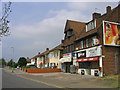
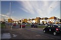
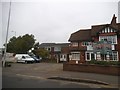
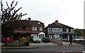
Your daily life in RM11 3TS includes convenient access to a range of retail and transport options within practical reach. Local retail options include M&S Hornchurch BP, Tesco Hornchurch, and the Co-op Harold, giving you access to major supermarkets and convenience stores. For rail travel, Harold Wood Station, Gidea Park Station, and Emerson Park Station serve as nearby transport hubs for your commutes. These five named stations provide multiple departures per day for travel across London and beyond. Furthermore, Upminster Bridge, Hornchurch, and Elm Park Station are identified as nearby metro connections, offering tube access to central London. This density of transport links means you can choose the station that best fits your schedule or budget. Residents can walk or take short drives to reach these amenities without significant travel time. The presence of Tesco Hornchurch and M&S Hornchurch BP ensures you have ready access to food and general household needs.
Amenities
Schools
Families living in RM11 3TS benefit from a selection of nearby educational institutions with strong reputations. Harold Wood Primary School serves as a nearby primary school with a good Ofsted rating. Nelmes Primary School operates as another option for younger children and holds an outstanding Ofsted rating. Redden Court School functions as a primary school in the vicinity for those seeking education options. The Campion School appears twice in the local education data; it serves as a primary school but also operates as an academy with a good Ofsted rating. This mixture of primary schools and an academy ensures you have multiple pathways for your child's education if they reside in RM11 3TS. The presence of an academy alongside traditional primary schools provides variety in the educational approach available to you. Schools near RM11 3TS offer a range of ratings, from good to outstanding, indicating high standards in the area. You have access to multiple choices without needing to travel far from your home.
| Rank | School | Type | Entry gender | Ages |
|---|
Explore more schools in this area
Go to Schools tabDemographics
The community living in RM11 3TS displays a mature demographic profile with a median age of 47 years. Adults aged between 30 and 64 years form the most common age range, suggesting a community dominated by established families or professionals in their prime working years. Home ownership is the dominant housing status, with 83% of residents owning their properties outright or with a mortgage. This high level of ownership indicates financial stability within the neighbourhood and a long-term commitment to the area. Houses constitute the primary accommodation type, meaning there are few, if any, apartment blocks in this specific cluster. The predominant ethnic group is White, reflecting the historical development of the estate over time. You are looking at a stable, established community rather than a transient rental market. The combination of a median age of 47 and an 83% ownership rate creates a quiet, settled atmosphere where neighbours know each other well.
Household Size
Accommodation Type
Tenure
Ethnic Group
Religion
Household Composition
Age
Household Deprivation
NS-SEC
Explore more demographic insights in this area
Go to Demographics tabPlanning
Planning Constraints
- Flood RiskPremium
- Ramsar Wetland SitesPremium
- Area of Outstanding Natural BeautyPremium
- Protected Nature ReservePremium
- Protected WoodlandPremium