Area Overview for RM11 3LU
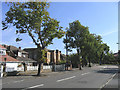
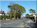
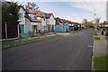
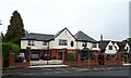
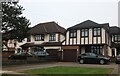
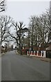
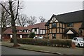
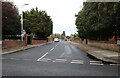
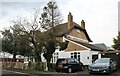
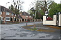
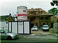
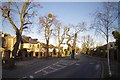
Photos of RM11 3LU
Area Information
RM11 3LU represents a specific residential cluster in east London, covering only 1.6 hectares. This compact postcode area houses a population of 1,739 people, creating a tightly knit environment where residents are likely to know their neighbours. The area's density reaches 107,375 people per square kilometre, which is exceptionally high for residential England. This concentration suggests an urban residential zone where property is in high demand and space is at a premium. Living in RM11 3LU means experiencing a community defined by its small size and dense living pattern. You will find a high concentration of homes within a very limited geographic footprint. The area functions as a distinct pocket within the wider RM11 postcode sector. Its small scale means that local developments directly impact the character of the immediate surroundings. Prospective buyers should view this postcode as a micro-community rather than a broad neighbourhood. The physical boundaries are tight, which often fosters a strong sense of locality among the residents. Daily life here is characterised by close proximity to facilities and other households.
- Area Type
- Postcode
- Area Size
- 1.6 hectares
- Population
- 1739
- Population Density
- 2564 people/km²
The property market in RM11 3LU is defined by its physical layout and tenure structure. Houses make up the majority of the accommodation type, offering traditional British housing stock suitable for families. The area maintains a robust 77% home ownership level, indicating that this postcode serves primarily existing owners rather than private landlords seeking rental inventory. This high ownership percentage suggests that when properties come onto the market, they are often undergoing owner-led refurbishments. For buyers looking at homes in RM11 3LU, this creates a scenario where price stability is common due to the lack of speculative rental turnover. The total area size of 1.6 hectares limits the volume of new development, which protects the character of existing streetscapes. You will likely encounter a mix of vintage and updated family homes within this small footprint. The density of 107,375 people per square kilometre implies that land value is significant. Investors or first-time buyers should note that inventory levels may remain low due to the small geographic scope. The market here rewards those who understand the value of proximity to established amenities without seeking large sprawling estates.
House Prices in RM11 3LU
Showing 13 properties
| Address | Type | Beds | Baths | Last Sale Price | Last Sale Date | |
|---|---|---|---|---|---|---|
| 12 Parkstone Avenue, Hornchurch, RM11 3LU | Detached | 6 | 5 | £1,650,000 | Mar 2021 | |
| 24 Parkstone Avenue, Hornchurch, RM11 3LU | Detached | 5 | 3 | £1,350,000 | Jul 2019 | |
| 28 Parkstone Avenue, Hornchurch, RM11 3LU | Detached | 4 | 1 | £820,000 | Apr 2017 | |
| 16 Parkstone Avenue, Hornchurch, RM11 3LU | Detached | 5 | - | £985,000 | Jul 2015 | |
| 22 Parkstone Avenue, Hornchurch, RM11 3LU | house | 4 | - | £680,000 | Mar 2013 | |
| 2 Parkstone Avenue, Hornchurch, RM11 3LU | house | - | - | £900,000 | Mar 2011 | |
| 18 Parkstone Avenue, Hornchurch, RM11 3LU | Detached | 5 | - | £890,000 | Jul 2008 | |
| 14 Parkstone Avenue, Hornchurch, RM11 3LU | Detached | - | - | £590,000 | Oct 2003 | |
| 8 Parkstone Avenue, Hornchurch, RM11 3LU | Detached | - | - | £187,500 | Nov 1996 | |
| 26 Parkstone Avenue, Hornchurch, RM11 3LU | Detached | - | - | £200,000 | Sep 1995 |
Energy Efficiency in RM11 3LU
Residents of RM11 3LU benefit from a wide array of amenities located within practical reach of the small postcode area. Rail access is strong, with options including Emerson Park Station, Gidea Park Station, and Upminster Station. The nearest 5 rail stations are positioned to facilitate access to central London and other parts of Essex. For daily shopping, there are 5 notable retail venues, including Tesco Butts, Asda Hornchurch, and Iceland Hornchurch. These supermarkets provide comprehensive grocery options for the 1,739 residents living in the area. Transport infrastructure also includes 5 distinct metro stations, specifically Upminster Bridge, Hornchurch, and Elm Park Station. These hubs allow for rapid transit connections without requiring a car for most daily journeys. The convenience of these 15 total transport and retail nodes means you can manage your week without leaving the immediate vicinity of your home. Dining, pubs, and local services are clustered within a short distance of the main streets. This density of amenities supports the lifestyle of the predominantly house-owning community. You will find that running errands requires little travel time from your doorstep.
Amenities
Schools
| Rank | School | Type | Entry gender | Ages |
|---|
Explore more schools in this area
Go to Schools tabDemographics
The community within RM11 3LU is mature, with a median age of 47 years. Most residents fall into the adult age range of 30 to 64 years, indicating a population in the prime working and retirement years. This age profile suggests stability and a focus on established family life or downsizing rather than new arrivals. Housing tenure reflects this stability, with 77% of residents owning their homes outright or with a mortgage. This high ownership rate points to a settled community rather than a transient rental market. The accommodation type is predominantly houses, meaning you will find detached and semi-detached properties rather than apartment blocks. Demographically, the predominant ethnic group is White, which aligns with the broader east London demographic profile. There are no data points regarding deprivation levels or income statistics in the provided records. Consequently, the quality of life picture relies on the high homeownership rate and stable age groups. This demographic structure often correlates with lower crime rates and a desire for quiet, family-friendly environments. The residents are likely to be involved in local schools and community groups given the age concentration.
Household Size
Accommodation Type
Tenure
Ethnic Group
Religion
Household Composition
Age
Household Deprivation
NS-SEC
Explore more demographic insights in this area
Go to Demographics tabPlanning
Planning Constraints
- Flood RiskPremium
- Ramsar Wetland SitesPremium
- Area of Outstanding Natural BeautyPremium
- Protected Nature ReservePremium
- Protected WoodlandPremium