Area Overview for RM11 3LH
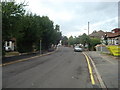
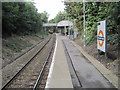
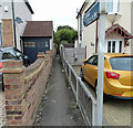
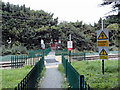
Photos of RM11 3LH
Area Information
Living in RM11 3LH means residing within a precisely defined postcode area that covers just two hectares of land in England. This small residential cluster houses 1,318 people, creating an environment with an extremely high population density of 66,866 people per square kilometre. The area operates as a tight-knit neighbourhood where residents share immediate proximity to one another. Daily life here is characterised by a settled rhythm, supported by the presence of established homes rather than temporary or transient accommodation. You will find that the locality is dominated by houses, reflecting a community built for long-term living. The sheer concentration of residents in such a compact space suggests a neighbourhood where footpaths are well-used and local interactions are frequent. This specific cluster offers a concentrated living experience without the sprawl of larger towns. Prospective buyers looking for a focused residential zone will appreciate the defined boundaries of this postcode. The area provides a clear snapshot of suburban life where residents know their neighbours and the constraints of the geography shape the community's daily routines.
- Area Type
- Postcode
- Area Size
- 2.0 hectares
- Population
- 1318
- Population Density
- 3062 people/km²
The property landscape in RM11 3LH is defined by a strong presence of owner-occupied homes. With 93 percent of residents owning their properties, the market here moves quite differently from areas where rental stocks dominate. This heavy ownership rate implies that the houses in this postcode are primarily sought after by buyers looking to settle permanently. The accommodation type is almost exclusively houses, meaning you will not find a high concentration of purpose-built rental blocks or flats typical of urban regeneration zones. Instead, the stock consists of established residential properties suitable for families or retirees. This structure creates a stable environment where property values likely benefit from long-term investment rather than short-term lease agreements. For anyone considering purchase, knowing that the area is overwhelmingly owned offers reassurance about the stability of the neighbourhood. Buyers coming from areas with high rental dependency may find the culture of this postcode distinct and perhaps more predictable. The market reflects a community of people who have bought in and stayed, rather than those constantly moving between temporary accommodations.
House Prices in RM11 3LH
Showing 12 properties
| Address | Type | Beds | Baths | Last Sale Price | Last Sale Date | |
|---|---|---|---|---|---|---|
| 37 Herbert Road, Hornchurch, RM11 3LH | Detached | 4 | - | £830,000 | Mar 2015 | |
| 33 Herbert Road, Hornchurch, RM11 3LH | house | - | - | £1,025,000 | Jun 2007 | |
| 35 Herbert Road, Hornchurch, RM11 3LH | Detached | 5 | 4 | £865,000 | Jun 2004 | |
| 23 Herbert Road, Hornchurch, RM11 3LH | Detached | - | - | £465,000 | Apr 2000 | |
| 29 Herbert Road, Hornchurch, RM11 3LH | Detached | - | - | £320,000 | Aug 1999 | |
| 31 Herbert Road, Hornchurch, RM11 3LH | Detached | - | - | £186,000 | Jul 1995 | |
| 27 Herbert Road, Hornchurch, RM11 3LH | Detached | 6 | 5 | - | - | |
| 25 Herbert Road, Hornchurch, RM11 3LH | house | - | - | - | - | |
| 25B Herbert Road, Hornchurch, RM11 3LH | Detached | - | - | - | - | |
| 25A Herbert Road, Hornchurch, RM11 3LH | Detached | - | - | - | - |
Energy Efficiency in RM11 3LH
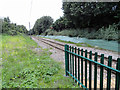
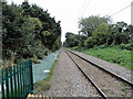
Residents of RM11 3LH benefit from excellent access to key transport and shopping hubs within practical reach. You can walk or take a short journey to Emerson Park Station, Upminster Station, and Gidea Park Station for rail travel. The area is also close to Upminster Bridge and Elm Park Station for metro connections, giving you multiple options for commuting into central London or other locations. For daily shopping, Asda Hornchurch and Tesco Butts are nearby, ensuring you can pick up groceries without a long drive. Iceland Hornchurch provides additional retail convenience for frozen goods and essentials. This mix of rail, metro, and major supermarkets means your daily errands require minimal travel time. The presence of these specific named venues within the local network supports a self-sufficient lifestyle. You do not need to travel far to access essential services. The proximity of these five rail stations, five retail outlets, and five metro-related locations creates a well-serviced environment for any household.
Amenities
Schools
| Rank | School | Type | Entry gender | Ages |
|---|
Explore more schools in this area
Go to Schools tabDemographics
The community within RM11 3LH is dominated by established residents with an average age of 47 years. Most of the population falls into the adult bracket between 30 and 64 years old, indicating a neighbourhood populated by working-age families and individuals in their mid-career stages. Home ownership stands at an impressive 93 percent, meaning the vast majority of households have already purchased their properties. This high rate of ownership suggests that families have made significant long-term commitments to this postcode. The dominant housing type is houses, which aligns with the demographic profile of adults seeking stability and space. The predominant ethnic group in the area is White, reflecting the traditional composition of many residential clusters in this part of the country. With such a high level of home ownership and an adult-focused age range, the area likely prioritises stability over rapid turnover. You are entering a community where people have put down roots. The demographic picture paints a scene of maturity and consistency rather than a transient student population or young professional hubs.
Household Size
Accommodation Type
Tenure
Ethnic Group
Religion
Household Composition
Age
Household Deprivation
NS-SEC
Explore more demographic insights in this area
Go to Demographics tabPlanning
Planning Constraints
- Flood RiskPremium
- Ramsar Wetland SitesPremium
- Area of Outstanding Natural BeautyPremium
- Protected Nature ReservePremium
- Protected WoodlandPremium