Area Overview for RM11 3LE
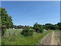
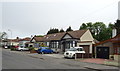
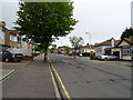
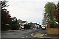
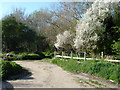
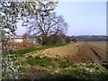
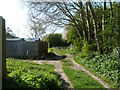
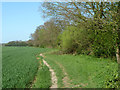
Photos of RM11 3LE
Area Information
RM11 3LE represents a highly compact residential zone within Greater London, covering just 2.2 hectares. This small postcode cluster hosts a population of 1,341 residents, creating an intimate neighbourhood environment where local features are immediately accessible. The area is defined by its density, with approximately 62,300 people per square kilometre, indicating a tightly knit community structure rather than sprawling development. Living in RM11 3LE means you reside in a specific residential cluster characterised by limited land area and a stabilised population. The high density suggests that facilities shared by the wider area are in close proximity, reducing travel time for daily errands. This locality attracts those who prefer a contained environment where the boundaries of their immediate surroundings are clearly defined. The demographic profile further reinforces this stability, as the area consists almost entirely of households where owners occupy the homes. Daily life here revolves around the practicalities of a small footprint, where walking distances to main stations or shops are short. You are part of a group where 92% of homes are owner-occupied, pointing towards established residents who have put down roots in this small section of Hornchurch. The lack of large-scale commercial or industrial intrusion keeps the focus on housing and local amenity access.
- Area Type
- Postcode
- Area Size
- 2.2 hectares
- Population
- 1341
- Population Density
- 1608 people/km²
The property market in RM11 3LE is exclusively owner-occupied, with 92% of homes held by owners rather than investors or short-term renters. This statistic confirms that the 1,341 residents live in properties they have purchased, creating a Market of established homeowners rather than a transient rental sector. The accommodation type data confirms that Houses make up 100% of the housing stock within this postcode. You will not find flats or apartments in RM11 3LE; the building regulations and land layout support only standalone dwelling units. This focus on houses aligns with the small area size of 2.2 hectares, which physically constrains high-density apartment blocks. The primary homes in this cluster are likely to be semi-detached or detached properties typical of the Hornchurch neighbourhood. This market structure means that utilities, maintenance, and local investment are driven by resident stability rather than developer intervention. Buyers considering homes in this area are entering a community where the seller pool consists of individuals who have lived there for years. The high ownership rate often correlates with higher property values and greater resistance to rapid price fluctuations. For those looking to buy, the lack of rental stock indicates a market dominated by those seeking to settle permanently. The immediate surroundings reflect this stability, with no indication of large-scale re-development plans in the short term.
House Prices in RM11 3LE
Showing 18 properties
| Address | Type | Beds | Baths | Last Sale Price | Last Sale Date | |
|---|---|---|---|---|---|---|
| 21 Fordyce Close, Hornchurch, RM11 3LE | Detached | 5 | 3 | £1,270,000 | May 2025 | |
| 12 Fordyce Close, Hornchurch, RM11 3LE | house | - | - | £1,345,000 | Aug 2022 | |
| 4 Fordyce Close, Hornchurch, RM11 3LE | house | - | - | £1,030,000 | Aug 2015 | |
| 9 Fordyce Close, Hornchurch, RM11 3LE | Detached | 5 | 3 | £899,995 | May 2015 | |
| 6 Fordyce Close, Hornchurch, RM11 3LE | house | 5 | - | £800,000 | May 2012 | |
| 2 Fordyce Close, Hornchurch, RM11 3LE | Bungalow | 3 | 2 | £800,000 | Oct 2011 | |
| 3 Fordyce Close, Hornchurch, RM11 3LE | house | 3 | 2 | £860,000 | Oct 2010 | |
| 7 Fordyce Close, Hornchurch, RM11 3LE | house | - | - | £855,000 | May 2008 | |
| 8 Fordyce Close, Hornchurch, RM11 3LE | Detached | - | - | £895,000 | Sep 2007 | |
| 17 Fordyce Close, Hornchurch, RM11 3LE | Detached | - | - | £350,000 | Apr 1999 |
Energy Efficiency in RM11 3LE
Your daily life in RM11 3LE benefits from a wide range of nearby amenities clustered within a short driving distance. Retail options include Asda Hornchurch, Tesco Butts, and M&S Hornchurch BP, which provide daily groceries and household essentials. You do not need to travel far for shopping, as these retailers are located nearby and serve the local cluster. Transport links are equally accessible, with five rail stations and five metro stations offering convenient travel. Emerson Park Station, Upminster Station, Gidea Park Station, Upminster Bridge, and Elm Park Station are all within practical reach. The area is further supported by five notable metro connections that integrate with the wider train network. Living in RM11 3LE means you can access amenities like Hoxne Road in upminster if needed, though the immediate postcode relies on the larger Hornchurch network for major services. The small size of the area, at just 2.2 hectares, ensures you are always within view of these broader amenities. You can walk to.local shops or take a quick train ride to access larger centres. The visible landmarks and frequent station stops reinforce the convenience of the location. This setup supports the 92% homeownership rate by providing the stability and convenience that families require.
Amenities
Schools
Two schools are located near RM11 3LE, providing educational options for the local families. Emerson Park School operates as a primary school and serves young students in the neighbourhood. For secondary education, Emerson Park Academy is the designated institution and holds a good Ofsted rating. This rating signifies that the academy meets expected standards for education and inspection requirements. The presence of an academy rather than a traditional comprehensive school indicates a modernised management structure for older students. Living in RM11 3LE gives you access to these two specific institutions without the need for long commutes. The mix of primary and academy provision covers the full schooling cycle for children growing up in the area. Families with young children will typically start at Emerson Park School before transferring to Emerson Park Academy. The data does not provide further breakdowns of performance metrics or pupil-to-teacher ratios, but the Good rating for the academy is a verified fact. This educational setup supports the demographic reality where the majority of residents are adults aged 30 to 64, many of whom are raising families. The proximity of schools enhances the appeal of the 2.2-hectare zone as a family-oriented environment.
| Rank | School | Type | Entry gender | Ages |
|---|
Explore more schools in this area
Go to Schools tabDemographics
The community in RM11 3LE is defined by a mature population profile with a median age of 47 years. Most residents fall into the adult category, with the 30 to 64 age range representing the most common demographic bracket. This age distribution suggests the area appeals to established families or professionals nearing retirement. Accommodation choices are uniform, as the data indicates Houses are the predominant accommodation type chosen by the population. This contrasts sharply with many London suburbs where flats and terraces dominate, highlighting a preference for detached or semi-detached living within this specific cluster. Overwhelmingly, the area is characterised by homeownership, with 92% of residents owning their properties. This figure implies a stable, long-term community with low tenant turnover. The predominant ethnic group is White, reflecting the traditional settlement patterns of the wider Hornchurch region. There is no significant data available to suggest rapid demographic shifts or high levels of cultural diversity within this specific 2.2-hectare zone. The homogeneity of the housing stock and ownership status creates a predictable neighbourhood atmosphere. You are likely to see repeat owners and residents who have lived in the same houses for decades. The age profile means you will engage with neighbours who have experience in local governance, community planning, and established social networks.
Household Size
Accommodation Type
Tenure
Ethnic Group
Religion
Household Composition
Age
Household Deprivation
NS-SEC
Explore more demographic insights in this area
Go to Demographics tabPlanning
Planning Constraints
- Flood RiskPremium
- Ramsar Wetland SitesPremium
- Area of Outstanding Natural BeautyPremium
- Protected Nature ReservePremium
- Protected WoodlandPremium