Area Overview for RM11 3JB
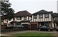
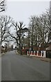
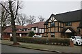
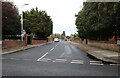
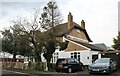
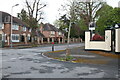
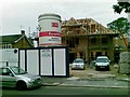
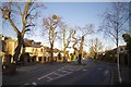
Photos of RM11 3JB
Area Information
RM11 3JB represents a specific postcode area covering a small residential cluster characterised by high-density housing within just 1.8 hectares. Despite this compact footprint, the district supports a population of 1739 residents, resulting in a density of 95207 people per square kilometre. This concentration suggests a close-knit community environment where neighbours are likely familiar with one another. The area functions as a defined pocket of the broader Hornchurch and Upminster corridor in East London, offering a concentrated living experience rather than expansive suburban sprawl. Daily life here revolves around efficient access to established transport nodes and nearby retail hubs. You will find yourself living in a setting where space is at a premium, yet便利ities remain within practical reach. The distinct lack of green belt or large open spaces within this specific postcode limits outdoor land for private gardens, making the design of individual properties central to the local character. For those considering homes in RM11 3JB, expect a neighbourhood focused on vertical living solutions and communal proximity rather than acreage. The area attracts buyers who value proximity to London while maintaining a distinct, local identity. Living in this postcode offers a straightforward trade-off: higher density in exchange for a vibrant, established community feel with immediate access to major travel arteries.
- Area Type
- Postcode
- Area Size
- 1.8 hectares
- Population
- 1739
- Population Density
- 2564 people/km²
RM11 3JB operates as a distinct housing market defined almost entirely by private residence. With a home ownership percentage of 77%, the area lacks the rental volatility often seen in central London or student-heavy suburbs. The accommodation type is listed as houses, meaning you will not find apartments or flats within this specific postcode cluster. This is a critical detail for buyers specifying their housing requirements, as the search here targets traditional residential structures. The high density of 95207 people per square kilometre within 1.8 hectares indicates that these houses are situated close together, likely forming terraced rows or small semi-detached clusters typical of post-war development. This layout maximises land use in a constrained area, which influences both property prices and garden sizes. Buyers looking at homes in RM11 3JB should prepare for a market driven by existing owners rather than institutional landlords or short-term lets. The market is further insulated from fluctuations that affect high-rise rental zones. As you look at properties in this area, expect a stock of family homes that have remained in private hands for generations. This contrasts with areas where developers frequently redevelop land for new tenures. The dominance of owner-occupation creates a slower, more deliberate market where price reductions are less common and sales can take longer to conclude.
House Prices in RM11 3JB
Showing 13 properties
| Address | Type | Beds | Baths | Last Sale Price | Last Sale Date | |
|---|---|---|---|---|---|---|
| 10 Burntwood Avenue, Hornchurch, RM11 3JB | Detached | 5 | 4 | £3,220,000 | Jun 2021 | |
| 4 Burntwood Avenue, Hornchurch, RM11 3JB | Detached | 5 | 5 | £892,500 | Apr 2017 | |
| 22 Burntwood Avenue, Hornchurch, RM11 3JB | Detached | 5 | 4 | £1,515,000 | Dec 2015 | |
| 6 Burntwood Avenue, Hornchurch, RM11 3JB | Detached | 4 | - | £1,400,000 | Oct 2015 | |
| 8 Burntwood Avenue, Hornchurch, RM11 3JB | Detached | 4 | 3 | £1,585,000 | Jul 2015 | |
| 2A Burntwood Avenue, Hornchurch, RM11 3JB | Detached | 7 | 4 | £544,000 | Mar 2009 | |
| 24 Burntwood Avenue, Hornchurch, RM11 3JB | Detached | 6 | 1 | £315,000 | Apr 2002 | |
| 6A Burntwood Avenue, Hornchurch, RM11 3JB | Detached | - | - | £375,000 | Oct 1999 | |
| 16 Burntwood Avenue, Hornchurch, RM11 3JB | Detached | - | - | £300,000 | Jan 1997 | |
| 14 Burntwood Avenue, Hornchurch, RM11 3JB | Detached | 4 | 3 | - | - |
Energy Efficiency in RM11 3JB
Your daily convenience in RM11 3JB relies heavily on the amenities located within a short practical reach. Retail options are well represented, with five major outlets close by. Notable supermarkets include Tesco Butts, Asda Hornchurch, and Iceland Hornchurch, ensuring you have immediate access to groceries and household essentials. For rail connectivity, there are five stations available, including Emerson Park Station, Gidea Park Station, and Harold Wood Station. These provide efficient links to central London and other key destinations. Additionally, the area boasts five metro stations, notably Upminster Bridge, Hornchurch, and Elm Park Station. This dual rail network offers flexibility, allowing you to choose between the DLR and Overground lines depending on your destination. While parks within the specific 1.8-hectare cluster may be limited due to density, the proximity to major stations gives you quick access to larger green spaces elsewhere in the borough. The location places you within walking or short driving distance to established high streets and transport interchanges. You will find that your lifestyle in RM11 3JB is defined by this tight logistical web of transport and retail. The presence of both Tesco Butts and Asda Hornchurch ensures you never need to travel far for basic shopping. Commuters benefit from the choice between Emerson Park and Harold Wood for their daily train journey. This blend of local conveniences and major transport hubs creates a functional, no-frills but highly capable living environment.
Amenities
Schools
| Rank | School | Type | Entry gender | Ages |
|---|
Explore more schools in this area
Go to Schools tabDemographics
The community in RM11 3JB is predominantly defined by an older demographic profile, with a median age of 47 years. The vast majority of residents fall into the adult age range of 30 to 64 years, indicating a stable population with likely established careers and families. This age distribution contrasts sharply with younger, university-age neighbourhoods, suggesting a focus on long-term settlement rather than transient living. Home ownership stands at 77%, which is significantly higher than the national average for many parts of England. Such a high rate implies that most households have secured their properties over time, fostering a sense of permanence and investment in local improvements. The accommodation type in RM11 3JB is exclusively houses, though the high density suggests these are likely terrace or semi-detached units rather than isolated mansions. Ethnically, the population is predominantly White, reflecting the established nature of many East London postcodes from this era. These figures paint a picture of a settled, middle-aged household where residents have put down deep roots. The high ownership rate combined with the age profile means you are likely to encounter a community that is resistant to student housing developments or rapid, speculative building. This stability often translates into reliable local tenancy neighbours and consistent support for local services and schools.
Household Size
Accommodation Type
Tenure
Ethnic Group
Religion
Household Composition
Age
Household Deprivation
NS-SEC
Explore more demographic insights in this area
Go to Demographics tabPlanning
Planning Constraints
- Flood RiskPremium
- Ramsar Wetland SitesPremium
- Area of Outstanding Natural BeautyPremium
- Protected Nature ReservePremium
- Protected WoodlandPremium