Area Overview for RM11 3EL
Photos of RM11 3EL
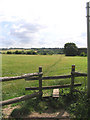
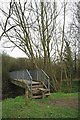
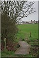
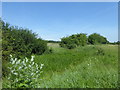
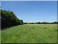
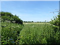
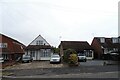
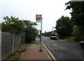
19 photos from this area
Area Information
Key information about the RM11 3EL including its size, population, and administrative classification.
- Area Type
- Postcode
- Area Size
- 6470 m²
- Population
- 1857
- Population Density
- 2416 people/km²
House Prices in RM11 3EL
19
Properties
£396,477
Average Sold Price
£135,000
Lowest Price
£605,000
Highest Price
Showing 19 properties
| Address | Type | Beds | Baths | Last Sale Price | Last Sale Date | |
|---|---|---|---|---|---|---|
| 42 Essex Gardens, Hornchurch, RM11 3EL | Semi-detached | 4 | 2 | £605,000 | Feb 2025 | |
| 58 Essex Gardens, Hornchurch, RM11 3EL | house | 3 | 2 | £453,000 | Jul 2022 | |
| 44 Essex Gardens, Hornchurch, RM11 3EL | Detached | 3 | 1 | £415,000 | Apr 2021 | |
| 49 Essex Gardens, Hornchurch, RM11 3EL | Semi-detached | 3 | 2 | £450,000 | Apr 2021 | |
| 54 Essex Gardens, Hornchurch, RM11 3EL | house | - | - | £375,000 | Apr 2021 | |
| 51 Essex Gardens, Hornchurch, RM11 3EL | Semi-detached | 3 | 2 | £350,000 | Dec 2020 | |
| 45 Essex Gardens, Hornchurch, RM11 3EL | Semi-detached | 4 | 2 | £475,000 | May 2019 | |
| 47 Essex Gardens, Hornchurch, RM11 3EL | Semi-detached | 4 | - | £505,000 | Nov 2017 | |
| 62 Essex Gardens, Hornchurch, RM11 3EL | Terraced | 4 | - | £450,000 | Aug 2016 | |
| 46 Essex Gardens, Hornchurch, RM11 3EL | Terraced | 4 | - | £377,000 | Sep 2015 |
Page 1 of 2
Energy Efficiency in RM11 3EL
Amenities
Schools
| Rank | School | Type | Entry gender | Ages |
|---|
Explore more schools in this area
Go to Schools tabDemographics
Household Size
Family (3-5 people)
most common
Accommodation Type
Houses
most common
Tenure
86
majority
Ethnic Group
White
most common
Religion
N/A
most common
Household Composition
N/A
most common
Age
47
median
Adults (30-64 years)
most common
Household Deprivation
N/A
with no deprivation
NS-SEC
33
in Lower managerial occupations
Explore more demographic insights in this area
Go to Demographics tabPlanning
Planning Constraints
- Flood RiskPremium
- Ramsar Wetland SitesPremium
- Area of Outstanding Natural BeautyPremium
- Protected Nature ReservePremium
- Protected WoodlandPremium