Area Overview for RM11 3BA
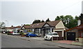
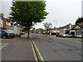
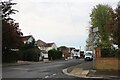
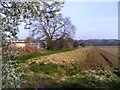
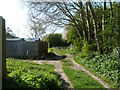
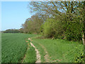
Photos of RM11 3BA

Area Information
RM11 3BA represents a specific residential cluster within the RM11 postcode, covering a land area of 5,156 square metres. This small footprint supports a population of 1,543 people, creating a neighbourhood with high density that nonetheless maintains a residential character. The area is concentrated in England, serving as a compact community where daily life revolves around close proximity to essential services and transport links. Living in RM11 3BA means residing in an environment where居民的 interactions are immediate due to the small physical size of the locality. The demographic profile indicates that adults between the ages of 30 and 64 form the most common age group, suggesting a family-oriented or young professional population. High home ownership levels reflect a community that has established long-term roots rather than a transient rental market. The area does not suffer from planning constraints related to flood risk, protected woodlands, or Ramsar wetland sites, ensuring that future developments can proceed without significant ecological restrictions. This clean environmental profile makes the location straightforward for buyers seeking a property without complex heritage or conservation overlays.
- Area Type
- Postcode
- Area Size
- 5156 m²
- Population
- 1543
- Population Density
- 2614 people/km²
The property market in RM11 3BA is overwhelmingly owner-occupied, with home ownership standing at 85 per cent. This high percentage indicates that the housing stock consists mainly of owner-occupied families rather than a bustling private rental sector. Houses form the predominant accommodation type, meaning you will primarily encounter detached or semi-detached properties rather than flats or apartment blocks. For buyers looking at homes in this postcode, the market is likely characterised by stability and established tenure rather than high vacancy rates. The small total area of 5,156 square metres limits the broader diversity of property styles often found in larger towns, focusing the available stock on residential clusters. The 1,543 residents living here are mostly likely buying into the property market rather than renting short-term. This environment suits buyers seeking a permanent base rather than a temporary stopover. The lack of rental-heavy pressure often means more secure neighbourhoods where long-term residents know one another. Prospective buyers should expect a market driven by local knowledge and sustained property values rather than speculative investment trends common in high-density rental hubs.
House Prices in RM11 3BA
Showing 11 properties
| Address | Type | Beds | Baths | Last Sale Price | Last Sale Date | |
|---|---|---|---|---|---|---|
| 20 Lee Gardens Avenue, Hornchurch, RM11 3BA | Terraced | 2 | 1 | £362,000 | May 2024 | |
| 16 Lee Gardens Avenue, Hornchurch, RM11 3BA | house | 4 | 2 | £685,000 | Nov 2023 | |
| 8 Lee Gardens Avenue, Hornchurch, RM11 3BA | Detached | 3 | 1 | £470,000 | Jun 2019 | |
| 6 Lee Gardens Avenue, Hornchurch, RM11 3BA | Bungalow | 3 | - | £380,000 | Mar 2015 | |
| 22 Lee Gardens Avenue, Hornchurch, RM11 3BA | house | 2 | - | £180,000 | Jan 2011 | |
| 24 Lee Gardens Avenue, Hornchurch, RM11 3BA | Detached | - | - | £132,000 | Jul 1997 | |
| 4 Lee Gardens Avenue, Hornchurch, RM11 3BA | Detached | 4 | 2 | - | - | |
| 14 Lee Gardens Avenue, Hornchurch, RM11 3BA | Detached | 5 | 3 | - | - | |
| 10 Lee Gardens Avenue, Hornchurch, RM11 3BA | Bungalow | 3 | 1 | - | - | |
| 18 Lee Gardens Avenue, Hornchurch, RM11 3BA | house | - | - | - | - |
Energy Efficiency in RM11 3BA
Residents of RM11 3BA have access to a comprehensive range of amenities within practical reach. Five metro options are available, including Upminster Bridge, Hornchurch, and Elm Park Station, providing significant transport connectivity. For shopping needs, five retail outlets are nearby, such as Co-op Upminster, Iceland Hornchurch, and M&S Upminster SF. These specific venues offer daily necessities from fresh groceries to major household brands. Three rail stations serve the immediate vicinity, highlighting the area's strong link to broader travel networks. Upminster Station, Emerson Park Station, and Gidea Park Station are all within convenient distance, allowing quick commutes into central London or surrounding towns. This concentration of facilities means you can handle most errands without travelling far. The proximity of major retailers like M&S and Iceland ensures that quality goods are accessible quickly. Living in this area grants you the convenience of city-sized amenities within a residential setting. Daily life is streamlined by the absence of long journeys for groceries or social activities.
Amenities
Schools
| Rank | School | Type | Entry gender | Ages |
|---|
Explore more schools in this area
Go to Schools tabDemographics
The community in RM11 3BA is defined by a mature demographic structure where adults aged 30 to 64 years represent the most common age range. The median age for residents stands at 47 years, indicating a settled population rather than a hub for students or young singles. Home ownership is exceptionally high, with 85 per cent of households owning their property outright or with a mortgage. This figure compares to national averages and suggests a stable, invested community where most residents have long-term ties to their local homes. Houses constitute the primary accommodation type, providing a single consistent style of dwelling for the 1,543 people living within this postcode area. The predominant ethnic group is White, which accounts for the majority of the population. This demographic homogeneity often correlates with stable neighbours and lower turnover rates. The high density of 299,269 people per square kilometre is a result of the small 5,156 square metre area size containing the entire population cluster. Such a high density figure is a mathematical consequence of the limited land area and does not imply overcrowding in every individual street but rather reflects intense concentration within the defined postcode boundary.
Household Size
Accommodation Type
Tenure
Ethnic Group
Religion
Household Composition
Age
Household Deprivation
NS-SEC
Explore more demographic insights in this area
Go to Demographics tabPlanning
Planning Constraints
- Flood RiskPremium
- Ramsar Wetland SitesPremium
- Area of Outstanding Natural BeautyPremium
- Protected Nature ReservePremium
- Protected WoodlandPremium