Area Overview for RM11 2PT
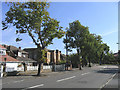
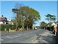
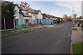
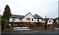
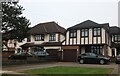
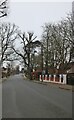
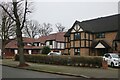
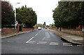
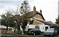
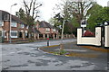
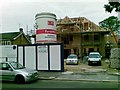
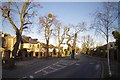
Photos of RM11 2PT
Area Information
Living in RM11 2PT offers a settled residential experience defined by its ownership demographics and limited footprint. This specific postcode covers a small cluster measuring just 8922 square metres, yet it houses a population of 1591 residents. The high population density of 178322 people per square kilometre indicates closely grouped housing, typical of established suburban developments on the edge of London. You are buying into an environment where houses dominate the streetscape, creating a neighbourhood feel that is distinct from larger, mixed-use towns. The area functions as a quiet residential zone rather than a commercial hub, prioritising domestic convenience. Residents enjoy direct access to major transport links, including Emerson Park, Harold Wood, and Gidea Park stations, alongside retail options like M&S and Tesco. The community reflects a clear social dotage, with the majority of people living in their own homes. This stability forms the character of daily life here, where planning issues like flood risk or protected land constraints are non-factors, allowing for straightforward homeownership without significant environmental barriers.
- Area Type
- Postcode
- Area Size
- 8922 m²
- Population
- 1591
- Population Density
- 2900 people/km²
The property market in RM11 2PT is overwhelmingly defined by owner-occupancy. With 95% of households owned outright or with a mortgage, this postcode area is not a rental hotspot but a stable community of homeowners. The accommodation type is exclusively houses, which dictates the type of streets and boundaries you will encounter. This contrasts sharply with areas where flats dominate, offering different entry prices and living arrangements. When you look at homes in RM11 2PT, you are viewing properties bought and sold through the standard owner-occupier channel. The small footprint of 8922 square metres means the market is tight and local. There are no large-scale developments planned due to the absence of planning constraints like protected woodlands or wetlands. This stability benefits sellers of existing properties and buyers looking for a solid investment without the volatility of the private renter market. The high ownership rate also correlates with the area's safe status and low crime risk, making it a preferred choice for those building long-term equity.
House Prices in RM11 2PT
Showing 16 properties
| Address | Type | Beds | Baths | Last Sale Price | Last Sale Date | |
|---|---|---|---|---|---|---|
| 24 Great Nelmes Chase, Hornchurch, RM11 2PT | Chalet | 3 | 3 | £970,000 | Oct 2024 | |
| 30 Great Nelmes Chase, Hornchurch, RM11 2PT | Detached | 3 | 1 | £820,000 | Aug 2024 | |
| 34 Great Nelmes Chase, Hornchurch, RM11 2PT | Detached | 4 | 2 | £860,000 | Oct 2022 | |
| 40 Great Nelmes Chase, Hornchurch, RM11 2PT | house | - | - | £606,000 | Jun 2022 | |
| 20 Great Nelmes Chase, Hornchurch, RM11 2PT | Detached | 5 | 5 | £995,000 | Jan 2021 | |
| 32 Great Nelmes Chase, Hornchurch, RM11 2PT | house | - | - | £545,000 | Sep 2014 | |
| 38 Great Nelmes Chase, Hornchurch, RM11 2PT | house | - | - | £650,000 | Nov 2008 | |
| 28 Great Nelmes Chase, Hornchurch, RM11 2PT | Detached | - | - | £440,000 | Nov 2006 | |
| 42 Great Nelmes Chase, Hornchurch, RM11 2PT | Detached | - | - | £355,000 | Oct 2004 | |
| 26 Great Nelmes Chase, Hornchurch, RM11 2PT | Detached | - | - | £290,500 | May 2002 |
Energy Efficiency in RM11 2PT
Daily life in RM11 2PT benefits from a cluster of amenities within walking or driving distance. You have access to five retail venues, including M&S Hornchurch BP, Tesco Hornchurch, and Tesco Butts, ensuring your grocery and household shopping needs are met locally. Transport connectivity is further strengthened by five nearby rail stations and five metro stations, including Upminster Bridge, Hornchurch, and Elm Park Station. These locations provide the backbone for a lifestyle that balances local convenience with city access. While this is a residential postcode, the scale of 8922 square metres means you are not in a vast open space, but rather a defined, accessible cluster. The lack of planning constraints such as AONBs or protected reserves means the immediate environment is maintained for residential use rather than conservation concerns. Neighbourhood character is shaped by proximity to these services, creating a routine where essential tasks require minimal travel. The area feels self-contained regarding shopping and travel access, fitting the needs of those who prefer a car-independent life for daily errands while using trains for longer commutes.
Amenities
Schools
| Rank | School | Type | Entry gender | Ages |
|---|
Explore more schools in this area
Go to Schools tabDemographics
The community within RM11 2PT is characterised by a mature and established household structure. The median age stands at 47 years, placing the most common age range squarely between 30 and 64 years. This suggests a neighbourhood likely populated by families with children or empty nesters who have remained in one property for a considerable time. Homeownership is exceptionally high at 95%, meaning you are far more likely to find long-term owner-occupiers than landlords renting to tenants. The accommodation consists almost entirely of houses, supporting the council tax bands and lifestyle choices of family life. The predominant ethnic group is White, reflecting the traditional demographic makeup of this part of Hornchurch and the surrounding Essex borough. There is no indication of recent large-scale demographic shifts in the available data. This profile offers clarity for buyers seeking a stable, owner-led community where neighbours have likely lived there for decades. The social fabric is built on permanent residency rather than transient renting.
Household Size
Accommodation Type
Tenure
Ethnic Group
Religion
Household Composition
Age
Household Deprivation
NS-SEC
Explore more demographic insights in this area
Go to Demographics tabPlanning
Planning Constraints
- Flood RiskPremium
- Ramsar Wetland SitesPremium
- Area of Outstanding Natural BeautyPremium
- Protected Nature ReservePremium
- Protected WoodlandPremium